
Robinhood Pool (Hazel Grove)
| Locality | |
|---|---|
| Coordinate | 53.368, -2.0942 |
| Adm. div. | Cheshire |
| Vicinity | On the north side of Buxton Road, immediately west of Norbury Hollow Road |
| Type | Natural feature |
| Interest | Robin Hood name |
| Status | Defunct |
| First Record | 1970 |
| A.k.a. | Robin Hood Pool |

By Henrik Thiil Nielsen, 2017-01-19. Revised by Henrik Thiil Nielsen, 2021-06-21.
The Robinhood Pool was located immediately west of the Robin Hood Inn in what was then known as Norbury but is now part of Hazel Grove, While the inn is first recorded in an 1849 tithe award, the earliest source I know of for the pool is from 1970.[1]
This is not the only pool located close to a Robin Hood pub. In Cherry Hinton, Cambridgeshire, across the street from a public house named the Robin Hood we find Robin Hood Dip, which contains a small island, the Giant's Grave.
Gazetteers
- Not included in Dobson, R. B., ed.; Taylor, J., ed. Rymes of Robyn Hood: an Introduction to the English Outlaw (London, 1976), pp. 293-311.
Sources
Maps
- 25" map Cheshire XX.9 (c. 1877; surveyed c. 1876). No copy in NLS.
- 25" O.S. map Cheshire XX.9 (1898; rev. 1896) (georeferenced)
- 25" O.S. map Cheshire XX.9 (1898; rev. 1896–97)
- 25" O.S. map Cheshire XX.9 (1938; rev. 1936)
- 25" O.S. map Cheshire XX.9 (1934; rev. 1907)
- 6" O.S. map Cheshire XX (1881; surveyed 1871–72)
- 6" O.S. map Cheshire XX.SW (1899; rev. 1896-97) (georeferenced)
- 6" O.S. map Cheshire XX.SW (1899; rev. 1896-97)
- 6" O.S. map Cheshire XX.SW (1912; rev. 1907)
- 6" O.S. map Cheshire XX.SW (c. 1946; rev. 1938).
Also see
Notes
Image gallery
Click any image to display it in the lightbox, where you can navigate between images by clicking in the right or left side of the current image.
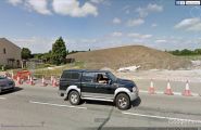
The site of Robinhood Pool / Google Earth Street View.

Yellow marker bottom centre indicates site of Robinhood Pool; seen from the air before construction work seen in preceding photo began / Google Earth Street View.
