
Robin Hood Court (St Clement Danes)
| Locality | |
|---|---|
| Coordinate | Near 51.513741, -0.113456 |
| Adm. div. | Middlesex, now Greater London |
| Vicinity | Southern end of the Royal Courts of Justice |
| Type | Thoroughfare |
| Interest | Robin Hood name |
| Status | Defunct |
| First Record | 1763 |


By Henrik Thiil Nielsen, 2018-06-23. Revised by Henrik Thiil Nielsen, 2021-01-07.
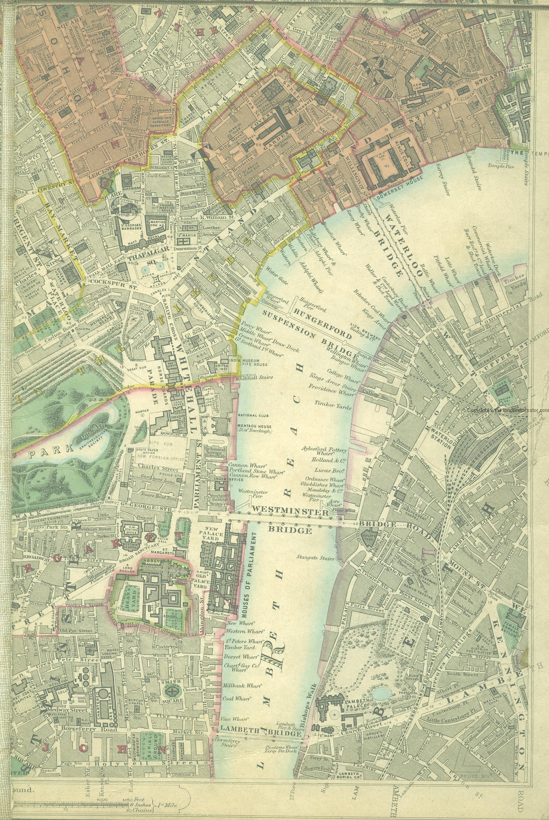
Robin Hood Court, named after a public house that once existed there, was located a little north-east of the church of St Clement Danes in an area now occupied by the Royal Courts of Justice. It is noted in mid-18th to early 19th century topographical reference works on London.
Robin Hood Court is included in a list of localities in the Compleat Compting House Companion (1763).[1] Lockie in his Topography of London (editions of 1810 and 1813) notes a 'Robinhood-Court, Newcastle-Court, Strand,—the first on the L., a few yards from Picket-st. or the Strand, near Temple-bar' (see Gazetteers below). 'Picket Street' was then the name of the Strand on the north side of the church of St Clement Danes.[2] The stretch of the Strand where the main entrance to the Royal Courts of Justice now is was then known as Butcher Row. On John Rocque's Map of London (1746), Newcastle Court court can bee seen running NNW from Butcher Row.[3] Lockie's directions seem to indicate that Robin Hood Court was on the left side of Newcastle court, coming from Butcher Row (The Strand). Based on this, I believe the yard indicated on the detail of Horwood's map below is the one he referred to.
In or adjacent to Robin Hood Court was found the Robin Hood and Little John (St Clement Danes), a pub which achieved some fame as the meeting place of the Robin Hood Society. There was another Robin Hood Court on the north side of the Strand, for this see Robin Hood Court (St Martin-in-the-Fields).
Gazetteers
- Not included in Dobson, R. B., ed.; Taylor, J., ed. Rymes of Robyn Hood: an Introduction to the English Outlaw (London, 1976), pp. 293-311.
Sources
- Anonymous. The Compleat Compting-House Companion: or, Young Merchant, or Tradesman's Sure Guide (London, 1763), p. 417, s.n. Robin Hood court [6]
- Anonymous, compil. The New Complete Guide to all Persons who have any Trade or Concern with the City of London, and Parts adjacent ([s.l], 1783), p. 59 s.n. Robin Hood's court [6]
- Elmes, James, compil. A Topographical Dictionary of London and Its Environs (London, 1831), p. 354, s.n. Robinhood-Ct.
- Lockie, John, compil. Lockie's Topography of London, Giving a Concise Local Description of and Accurate Direction to Every Square, Street, Lane, Court, Dock, Wharf, Inn, Public Office, &c. in the Metropolis and its Environs (London, 1810), s.n. Robinhood-Court [2]
Maps
- Locating London's Past (John Rocque's 1746 Map of London)
- Edward Stanford's Library Map of London (1862-71), Westminster section
- 25" O.S. map London (1915- Numbered sheets) V.10 (1936; rev. 1914)
- 25" O.S. map London (1915- Numbered sheets) V.10 (1936; rev. 1914) (georeferenced)
- 6" O.S. map Middlesex XVII (1880-82; surveyed 1868-73)
- 6" O.S. map Surrey III (1880; surveyed 1868-73)
- 6" O.S. map London VII.SW (1894-96; rev. 1893-95)
- 6" O.S. map Surrey III.NW (1898; rev. 1893-95)
- 6" O.S. map Surrey III.NW (1898; rev. 1893-95) (georeferenced)
- 6" O.S. map London Sheet K (1920; rev. 1913-14)
- 6" O.S. map London Sheet K (c. 1946; rev. 1938).
Background
Also see
- St Clement Danes place-name cluster
- Robinhood place-names
- Robin Hood Court (St Martin-in-the-Fields).
Notes
Image gallery
Click any image to display it in the lightbox, where you can navigate between images by clicking in the right or left side of the current image.
The Robin Hood Court was probably located somewhere within the area now occupied by the Royal Courts of Justice / Google Earth Street View.
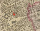
Robin Hood Court was probably the area indicated by the red arrow / Adapted from Richard Horwood's Plan of the Cities of London and Westminster (1792-99) at Romantic London.