From International Robin Hood Bibliography
| Locality |
|---|
| Coordinate |
54.113522, -3.224669 |
|---|
| Adm. div. |
Lancashire |
|---|
| Vicinity |
4-6 Crellin Street, Barrow-in-Furness |
|---|
| Type |
Public house |
|---|
| Interest |
Robin Hood name |
|---|
| Status |
Extant |
|---|
| First Record |
|
|---|
| A.k.a. |
Robin Hood |
|---|
Loading map...
{"minzoom":false,"maxzoom":false,"mappingservice":"leaflet","width":"34%","height":"400px","centre":false,"title":"","label":"","icon":"","lines":[],"polygons":[],"circles":[],"rectangles":[],"copycoords":false,"static":false,"zoom":false,"defzoom":9,"layers":["OpenStreetMap","NLS","Stamen.Terrain"],"image layers":[],"overlays":[],"resizable":false,"fullscreen":true,"scrollwheelzoom":true,"cluster":false,"clustermaxzoom":20,"clusterzoomonclick":true,"clustermaxradius":80,"clusterspiderfy":true,"geojson":"","clicktarget":"","imageLayers":[],"locations":[{"text":"\u003Cdiv class=\"mw-parser-output\"\u003E\u003Cp\u003ERobin Hood Inn (Barrow-in-Furness)\n\u003C/p\u003E\u003C/div\u003E","title":"Robin Hood Inn (Barrow-in-Furness)\n","link":"","lat":54.113522,"lon":-3.224669,"icon":""}],"imageoverlays":null}
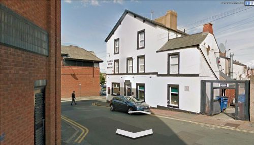
The Robin Hood Inn.

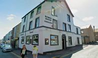
The Robin Hood, 4-6 Crellin Street, Barrow-in-Furness / Google Earth Street View (click or tap to enlarge).
By Henrik Thiil Nielsen, 2013-08-07. Revised by Henrik Thiil Nielsen, 2022-02-06.
The Robin Hood in Barrow-in-Furness is located at 4-6 Crellin Street.
Can anybody tell us how old the pub is?
Gazetteers
Web sources
Image gallery
Click any image to display it in the lightbox, where you can navigate between images by clicking in the right or left side of the current image.
The Robin Hood, 4-6 Crellin Street, Barrow-in-Furness / Google Earth Street View
The Robin Hood, 4-6 Crellin Street, Barrow-in-Furness / Google Earth Street View


