
Robin Hood Yard (Holborn): Difference between revisions
m (Text replacement - "{{#ask:[[Category:Records ({{#ifeq:{{#pos:{{PAGENAME}}|(|}}||{{PAGENAME}}|{{#sub:{{PAGENAME}}|0| {{#expr:{{#pos:{{PAGENAME}}|(|}}-1}} }},{{#sub:{{PAGENAME}}|{{#expr:{{#pos:{{PAGENAME}}|(|}}-1}}|1}}{{#sub:{{PAGENAME}}|{{#expr:{{#pos:...) |
m (Text replacement - "{{#ask:[[Category:Records ({{#ifeq:{{#pos:{{PAGENAME}}|(|}}||{{PAGENAME}}|{{#sub:{{PAGENAME}}|0| {{#expr:{{#pos:{{PAGENAME}}|(|}}-1}} }},{{#sub:{{PAGENAME}}|{{#expr:{{#pos:{{PAGENAME}}|(|}}-1}}|1}}{{#sub:{{PAGENAME}}|{{#expr:{{#pos:...) |
||
| Line 6: | Line 6: | ||
Robin Hood Yard was a narrow oblong yard or cul-de-sac lane reached from a side entrance on the east side of Leather Lane. Lockie in his ''Topography of London'' (editions of 1810 and 1813) lists it as "Robinhood-Yard, Leather-Lane, Holborn,—8 doors on the R. from 128, Holborn-hill".<ref>{{:Lockie, John 1810a}}, ''s.n.'' Robinhood-Yard; {{:Lockie, John 1813a}}, ''s.n.'' Robinhood-Yard.</ref> The earliest certain record of the place-name known to IRHB is John Rocque's 1746 ''Plan of London and Westminster''.<ref>{{:Rocque, John 1746a}}. Shown on this page.</ref> However, it is not impossible that the "Robin hood's yard ''in'' shoe lane" listed in a register entitled ''A New Review of London'' (1728) is really this yard in Leather Lane. Robin Hood Court in Shoe Lane would seem more likely to be meant, but this is already included in the list under the usual form of its name.<ref>{{:Anonymous 1728a}}, p. 30 ''s.nn.'' 'Robin hood's court' and 'Robin hood's yard'. Italics as in source. IRHB's brackets</ref> Robin Hood Yard in Leather Lane is also included in the list of London street and place-names in the ''Compleat Compting-House Companion'' (1763),<ref>{{:Anonymous 1763a}}, p. 417.</ref> and figures occasionally in reports of cases at the Old Bailey (see Records below). It no doubt owed its name to the circumstance that it was adjacent to one of Holborn's at least three inns named the [[Robin Hood (Leather Lane, Holborn)|Robin Hood.]] | Robin Hood Yard was a narrow oblong yard or cul-de-sac lane reached from a side entrance on the east side of Leather Lane. Lockie in his ''Topography of London'' (editions of 1810 and 1813) lists it as "Robinhood-Yard, Leather-Lane, Holborn,—8 doors on the R. from 128, Holborn-hill".<ref>{{:Lockie, John 1810a}}, ''s.n.'' Robinhood-Yard; {{:Lockie, John 1813a}}, ''s.n.'' Robinhood-Yard.</ref> The earliest certain record of the place-name known to IRHB is John Rocque's 1746 ''Plan of London and Westminster''.<ref>{{:Rocque, John 1746a}}. Shown on this page.</ref> However, it is not impossible that the "Robin hood's yard ''in'' shoe lane" listed in a register entitled ''A New Review of London'' (1728) is really this yard in Leather Lane. Robin Hood Court in Shoe Lane would seem more likely to be meant, but this is already included in the list under the usual form of its name.<ref>{{:Anonymous 1728a}}, p. 30 ''s.nn.'' 'Robin hood's court' and 'Robin hood's yard'. Italics as in source. IRHB's brackets</ref> Robin Hood Yard in Leather Lane is also included in the list of London street and place-names in the ''Compleat Compting-House Companion'' (1763),<ref>{{:Anonymous 1763a}}, p. 417.</ref> and figures occasionally in reports of cases at the Old Bailey (see Records below). It no doubt owed its name to the circumstance that it was adjacent to one of Holborn's at least three inns named the [[Robin Hood (Leather Lane, Holborn)|Robin Hood.]] | ||
Included on the 1968 edition of ''Bartholomew's Reference Atlas of Greater London'',<ref>{{:Bartholomew, John 1968a}}, 8B.</ref> the yard has since disappeared from the maps. There is still a (now quite irregularly shaped) yard in the area between the building that houses the Sir Christopher Hatton restaurant on the eastern side of Leather Lane and the London Diamond Bourse and Barclay's Bank on the west side of Hatton Garden, but this can hardly be open to the public. I doubt very much if the man in the street is allowed to get so close to the diamonds.{{ | Included on the 1968 edition of ''Bartholomew's Reference Atlas of Greater London'',<ref>{{:Bartholomew, John 1968a}}, 8B.</ref> the yard has since disappeared from the maps. There is still a (now quite irregularly shaped) yard in the area between the building that houses the Sir Christopher Hatton restaurant on the eastern side of Leather Lane and the London Diamond Bourse and Barclay's Bank on the west side of Hatton Garden, but this can hardly be open to the public. I doubt very much if the man in the street is allowed to get so close to the diamonds.{{PnItemQry}} | ||
== Gazetteers == | == Gazetteers == | ||
* {{:Anonymous 1728a}}, p. 30, ''s.nn.'' 'Robin hood's court' and 'Robin hood's yard' | * {{:Anonymous 1728a}}, p. 30, ''s.nn.'' 'Robin hood's court' and 'Robin hood's yard' | ||
Revision as of 03:06, 17 July 2018
[[File:|thumb|right|500px|Around here was the entrance to Robin Hood Yard / Google Earth Street View.]]

By Henrik Thiil Nielsen, 2018-06-16. Revised by Henrik Thiil Nielsen, 2018-07-17.
Robin Hood Yard was a narrow oblong yard or cul-de-sac lane reached from a side entrance on the east side of Leather Lane. Lockie in his Topography of London (editions of 1810 and 1813) lists it as "Robinhood-Yard, Leather-Lane, Holborn,—8 doors on the R. from 128, Holborn-hill".[1] The earliest certain record of the place-name known to IRHB is John Rocque's 1746 Plan of London and Westminster.[2] However, it is not impossible that the "Robin hood's yard in shoe lane" listed in a register entitled A New Review of London (1728) is really this yard in Leather Lane. Robin Hood Court in Shoe Lane would seem more likely to be meant, but this is already included in the list under the usual form of its name.[3] Robin Hood Yard in Leather Lane is also included in the list of London street and place-names in the Compleat Compting-House Companion (1763),[4] and figures occasionally in reports of cases at the Old Bailey (see Records below). It no doubt owed its name to the circumstance that it was adjacent to one of Holborn's at least three inns named the Robin Hood.
Included on the 1968 edition of Bartholomew's Reference Atlas of Greater London,[5] the yard has since disappeared from the maps. There is still a (now quite irregularly shaped) yard in the area between the building that houses the Sir Christopher Hatton restaurant on the eastern side of Leather Lane and the London Diamond Bourse and Barclay's Bank on the west side of Hatton Garden, but this can hardly be open to the public. I doubt very much if the man in the street is allowed to get so close to the diamonds.Template:PnItemQry
Gazetteers
- Anonymous. A New Review of London: being an Exact Survey, lately taken, of every Street, Lane, Court, Alley, Square, Close, Green, Wharf, Row, Garden, Field, and aLl Places, by what Name soever call'd, within the Cities, Liberties, or Suburbs of London, Westminster, and the Borough of Southwark. 3rd ed. (London, 1728), p. 30, s.nn. 'Robin hood's court' and 'Robin hood's yard'
- Anonymous, compil. The New Complete Guide to all Persons who have any Trade or Concern with the City of London, and Parts adjacent ([s.l], 1783), p. 59 s.n. Robin Hood yard [2]
- Dobson, R. B., ed.; Taylor, J., ed. Rymes of Robyn Hood: an Introduction to the English Outlaw (London, 1976), p. 299, s.n. Robin Hood Yard
- Elmes, James, compil. A Topographical Dictionary of London and Its Environs (London, 1831), p. 354, s.n. Robinhood-Yard
- Lockie, John, compil. Lockie's Topography of London, Giving a Concise Local Description of and Accurate Direction to Every Square, Street, Lane, Court, Dock, Wharf, Inn, Public Office, &c. in the Metropolis and its Environs (London, 1810), s.n. Robinhood-Yard
Maps
- Rocque, John, cartog.; Pine, John, engr. A Plan of the Cities of London and Westminster, and Borough of Southwark (London, 1746)
- John Bartholomew & Son Ltd. Bartholomew's Reference Atlas of Greater London, Covering the Whole Metropolitan Police Area, with Larger Scale Maps For Central London and Index For Quick Location of Over 62,000 Names (Edinburgh, 1968), 8B
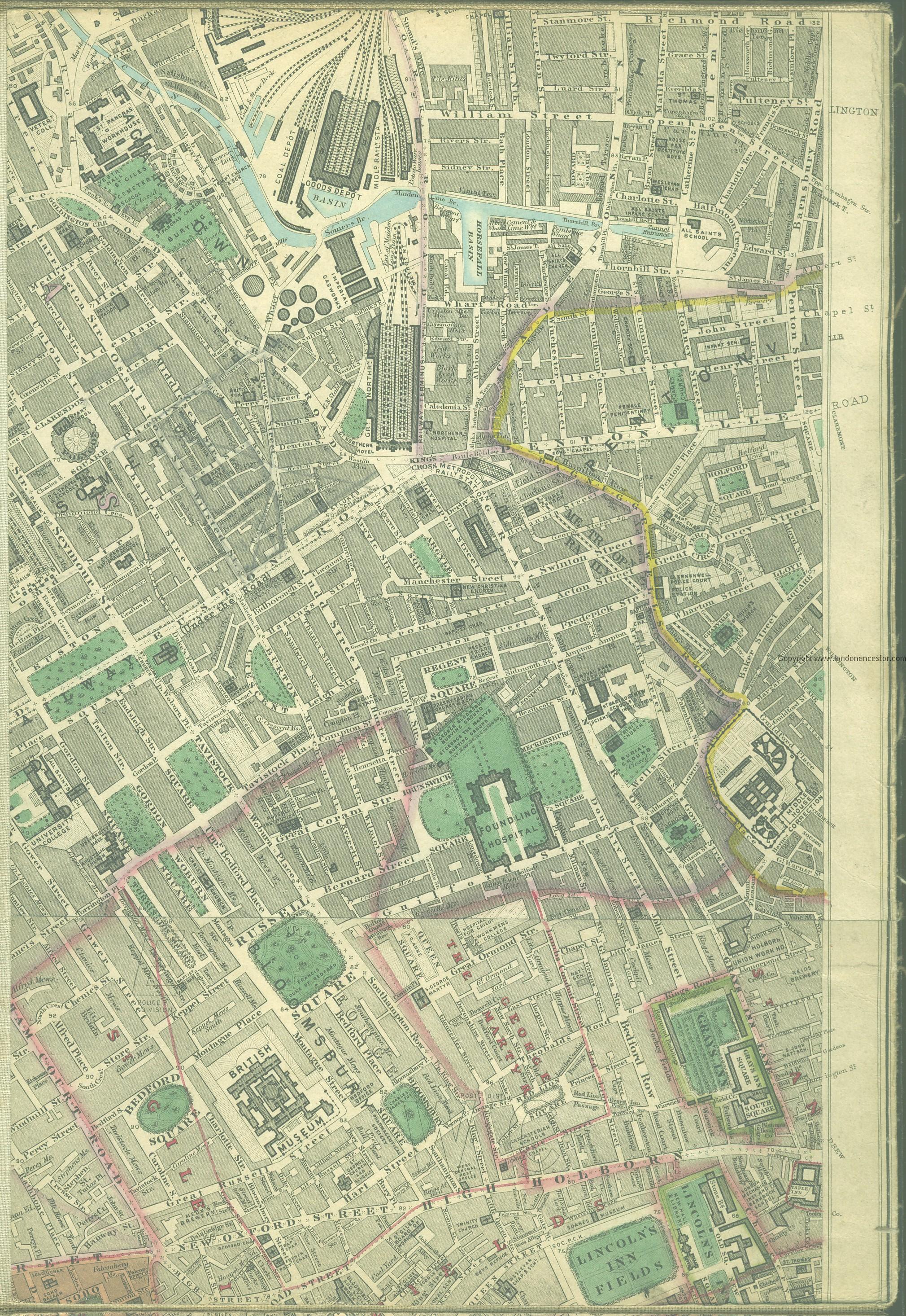
- Edward Stanford's Library Map of London (1862-71), Bloomsbury section
- 25" O.S. map London XXVI (1936; rev. 1914)
- 25" O.S. map London (1915- Numbered sheets) V.10 (1936; rev. 1914) (georeferenced)]
- 6" O.S. map Middlesex XVII (1880-82; surveyed 1868-73)
- 6" O.S. map Surrey III (1880; surveyed 1868-73)
- 6" O.S. map London VII.SW (1894-96; rev. 1893-95)
- 6" O.S. map Surrey III.NW (1898; rev. 1893-95)
- 6" O.S. map Surrey III.NW (1898; rev. 1893-95) (georeferenced).
- 6" O.S. map London sheet K (1920; rev. 1913-14)
- 6" O.S. map London sheet K (c. 1946; rev. 1938).
Notes
- ↑ Lockie, John, compil. Lockie's Topography of London, Giving a Concise Local Description of and Accurate Direction to Every Square, Street, Lane, Court, Dock, Wharf, Inn, Public Office, &c. in the Metropolis and its Environs (London, 1810), s.n. Robinhood-Yard; Lockie, John, compil. Lockie's Topography of London, Giving a Concise Local Description of, and Accurate Direction to, Every Square, Street, Lane, Court, Dock, Wharf, Inn, Public Office, &c. in the Metropolis and its Environs. Second Edition (London, 1813), s.n. Robinhood-Yard.
- ↑ Rocque, John, cartog.; Pine, John, engr. A Plan of the Cities of London and Westminster, and Borough of Southwark (London, 1746). Shown on this page.
- ↑ Anonymous. A New Review of London: being an Exact Survey, lately taken, of every Street, Lane, Court, Alley, Square, Close, Green, Wharf, Row, Garden, Field, and aLl Places, by what Name soever call'd, within the Cities, Liberties, or Suburbs of London, Westminster, and the Borough of Southwark. 3rd ed. (London, 1728), p. 30 s.nn. 'Robin hood's court' and 'Robin hood's yard'. Italics as in source. IRHB's brackets
- ↑ Anonymous. The Compleat Compting-House Companion: or, Young Merchant, or Tradesman's Sure Guide (London, 1763), p. 417.
- ↑ John Bartholomew & Son Ltd. Bartholomew's Reference Atlas of Greater London, Covering the Whole Metropolitan Police Area, with Larger Scale Maps For Central London and Index For Quick Location of Over 62,000 Names (Edinburgh, 1968), 8B.

Around here was the entrance to Robin Hood Yard / Google Earth Street View.
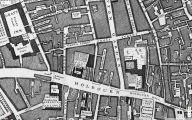
Robin Hood Yard, on Rocque's 1746 Plan of the Cities of London and Westminster / Locating London's Past.
