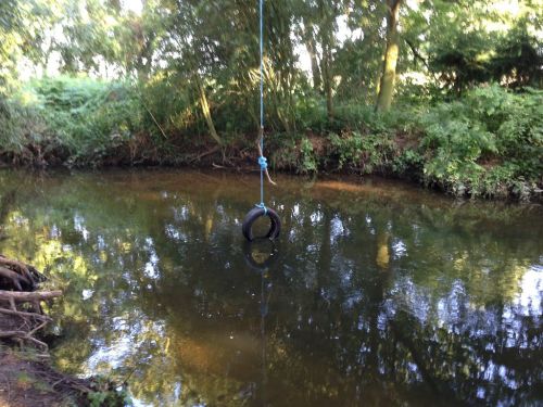
Robin Hood Bank (Edwinstowe)
From International Robin Hood Bibliography
| Locality | |
|---|---|
| Coordinate | 53.1865, -1.0842 |
| Adm. div. | Nottinghamshire |
| Vicinity | Nottinghamshire |
| Type | Area |
| Interest | Robin Hood name |
| Status | Defunct? |
| First Record | 1841 |
Robin Hood Bank.
By Henrik Thiil Nielsen, 2016-10-08. Revised by Henrik Thiil Nielsen, 2022-04-22.
Robin Hood Bank was (is?) the name of a short stretch, c. 170 m, of the north bank of River Maune. Gover, Mawer and Stenton in the English Place-Name Society's volume on Nottinghamshire list the name without indicating the situation of the locality to which it was applied, referring to a "c. 1840" tithe award.[1] In fact the tithe award is dated 1841. The land was then owned by an Elizabeth Webster, the occupier being a Miles Webster. The land was characterized as wood, with an area of 1 acre, 1 rood and 39 perches (6019.7 m2).[2]
Gazetteers
- Dobson, R. B., ed.; Taylor, J., ed. Rymes of Robyn Hood: an Introduction to the English Outlaw (London, 1976), p. 302, s.n. 'Robin Hood Farm'
- Field, John; compil. English Field Names: a Dictionary (Newton Abbot, ©1972), p. 183, s.n. 'Robin Hood Bank'.
MS sources
- Tithe award schedule for Edwinstowe (1841) (Piece 26, sub-piece 043, Image 048 – The Genealogist; £)
- Tithe award map for Edwinstowe (1841) (Piece 26, sub-piece 043, sub-piece 001 – The Genealogist; £).
Printed sources
- Gover, J.E.B.; Mawer, Allen; Stenton, F.M. The Place-Names of Nottinghamshire (English Place-Name Society, vol. XVII) (Cambridge, 1940), p. 78, and see p. 302.
Maps
- 25" O.S. map Nottinghamshire XXIII.4 (c. 1885; surveyed c. 1884). No copy in NLS
- 25" O.S. map Nottinghamshire XXIII.4 (1898; rev. 1897) (georeferenced)
- 25" O.S. map Nottinghamshire XXIII.4 (1898; rev. 1897)
- 25" O.S. map Nottinghamshire XXIII.4 (1917; rev. 1914)
- 25" O.S. map Nottinghamshire XXIII.4 (1946; rev. 1938)
- 6" O.S. map Nottinghamshire XXIII.NE (1884; surveyed 1883-84)
- 6" O.S. map Nottinghamshire XXIII.NE (1900; rev. 1897)
- 6" O.S. map Nottinghamshire XXIII.NE (1900; rev. 1897) (georeferenced)
- 6" O.S. map Nottinghamshire XXIII.NE (1920; rev. 1914)
- 6" O.S. map Nottinghamshire XXIII.NE (c. 1948; rev. 1938).
Background
Also see
Notes
- ↑ Gover, J.E.B.; Mawer, Allen; Stenton, F.M. The Place-Names of Nottinghamshire (English Place-Name Society, vol. XVII) (Cambridge, 1940), p. 78, and see p. 302.
- ↑ Tithe award schedule for Edwinstowe (1841) (Piece 26, sub-piece 043, Image 048 – Genealogist.co,; subscription required); Tithe award map for Edwinstowe (1841) (Piece 26, sub-piece 043, sub-piece 001 – Genealogist.co.uk; subscription required).

