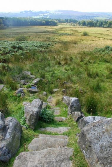
Little John's Well (Outseats, Hathersage)
From International Robin Hood Bibliography
| Locality | |
|---|---|
| Coordinate | 53.3113, -1.6022 |
| Adm. div. | Derbyshire |
| Vicinity | c. 475 m. SSE of Longshaw Lodge; c. 3 km ESE of Hathersage |
| Type | Natural feature |
| Interest | Robin Hood name |
| Status | Extant |
| First Record | 1882 |
Little John's Well.

Little John's Well. Steps lead down to a water trough fed by a natural spring / Roger Temple, 5 Sep. 2007, Creative Commons, via Geograph.
By Henrik Thiil Nielsen, 2016-08-31. Revised by Henrik Thiil Nielsen, 2021-01-06.
Little John's Well in Hathersage parish is located c. 475 m SSE of Longshaw Lodge and c. 500 m SSW of Robin Hood's Well. Dobson & Taylor are no doubt correct in noting that the two wells are "closely related".[1] So far the first source I known to mention this Little John's Well is the 6" O.S. map of the area published in 1882 (see Maps section below).[2]
Gazetteers
- Dobson, R. B., ed.; Taylor, J., ed. Rymes of Robyn Hood: an Introduction to the English Outlaw (London, 1976), p. 296, s.n. 'Little John's Well'.
Sources
Background
Maps
- 6" O.S. map Derbyshire XVII.NW (1883; surveyed 1876-80)
- 6" O.S. map Derbyshire XVII.NW (1898; surveyed 1897)
- 6" O.S. map Derbyshire XVII.NW (1923; rev. 1919)
- 6" O.S. map Derbyshire XVII (1924; rev. 1919)
- 6" O.S. map Derbyshire XVII (c. 1933; rev. 1919)
- 1" O.S. map Sheet 100 (1909).
Also see
- Outseats place-name cluster
- Hathersage place-name cluster
- Places named Little John's Well
- Places named after Little John.
Notes
- ↑ Dobson, R. B., ed.; Taylor, J., ed. Rymes of Robyn Hood: an Introduction to the English Outlaw (London, 1976), p. 296, s.n. 'Little John's Well'.
- ↑ This place-name is not included in Cameron, Kenneth. The Place-Names of Derbyshire (English Place-Name Society, vols. XXVII-XXIX) (Cambridge, 1959).
