Robinhood Pool (Hazel Grove): Difference between revisions
From International Robin Hood Bibliography
m (Text replacement - "VicinitySuffix=|" to "") |
m (Text replacement - "<!-- {{ImgGalleryIntro}} <gallery widths="195px"> FOR EACH IMAGE: File:_FILENAME.jpg|_LEGEND / [_URL _PHOTOGRAPHER, _DAY _MON. _YEAR, Creative Commons.] </gallery>-->" to "") |
||
| Line 27: | Line 27: | ||
</div | </div> | ||
{{PnItemNav}} | {{PnItemNav}} | ||
Revision as of 02:58, 18 December 2017
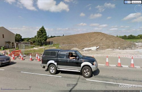
The site of Robin Hood Pool.
By Henrik Thiil Nielsen, 2017-01-19. Revised by Henrik Thiil Nielsen, 2017-12-18.
The Robinhood Pool was located immediately west of the Robin Hood Inn in what was then known as Norbury but is now part of Hazel Grove, While the inn is first recorded in an 1849 tithe award, the earliest source I know of for the pool is from 1970.[1]
By a remarkable coincidence, in Cherry Hinton, Cambridgeshire, across the street from a public house named the Robin Hood we find Robin Hood Dip , which also contains a small island, the Giant's Grave.
Gazetteers
- Not included in Dobson, R. B., ed.; Taylor, J., ed. Rymes of Robyn Hood: an Introduction to the English Outlaw (London, 1976), pp. 293-311.
Sources
Maps
- 6" O.S. map Cheshire XX.SW (1882; surveyed 1871-72)
- 6" O.S. map Cheshire XX.SW (1899; rev. 1896-97)
- 6" O.S. map Cheshire XX.SW (1899; rev. 1896-97) (georeferenced)
- 6" O.S. map Cheshire XX.SW (1912; rev. 1907)
- 6" O.S. map Cheshire XX.SW (c. 1946; rev. 1938).
Notes


