Robin Hood Close (Eastwood): Difference between revisions
From International Robin Hood Bibliography
m (Text replacement - "PnItemAlsoSee" to "PlaceNamesItemAlsoSee") |
m (Text replacement - "PlaceNamesItemQuery" to "PlaceNamesItemAllusionsAndRecords") |
||
| Line 3: | Line 3: | ||
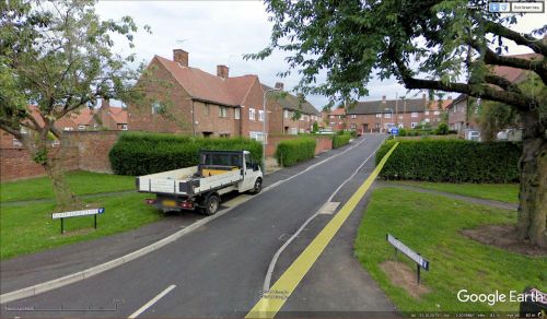
[[File:{{#var:Image}}|thumb|right|500px|Robin Hood Close, Eastwood / Google Earth Street View.]]<div class="no-img"> | [[File:{{#var:Image}}|thumb|right|500px|Robin Hood Close, Eastwood / Google Earth Street View.]]<div class="no-img"> | ||
<p id="byline">By Henrik Thiil Nielsen, 2018-05-26. Revised by {{#realname:{{REVISIONUSER}}}}, {{REVISIONYEAR}}-{{REVISIONMONTH}}-{{REVISIONDAY2}}.</p> | <p id="byline">By Henrik Thiil Nielsen, 2018-05-26. Revised by {{#realname:{{REVISIONUSER}}}}, {{REVISIONYEAR}}-{{REVISIONMONTH}}-{{REVISIONDAY2}}.</p> | ||
Robin Hood Close is a short residential cul-de-sac on the SE side of Priory Road in Eastwood. As it is not included on earlier O.S. maps, it probably dates from the last half of the 20th century.{{ | Robin Hood Close is a short residential cul-de-sac on the SE side of Priory Road in Eastwood. As it is not included on earlier O.S. maps, it probably dates from the last half of the 20th century.{{PlaceNamesItemAllusionsAndRecords}} | ||
<!--== Gazetteers == | <!--== Gazetteers == | ||
== Sources ==--> | == Sources ==--> | ||
Revision as of 00:55, 6 January 2021
| Locality | |
|---|---|
| Coordinate | 53.011933, -1.303989 |
| Adm. div. | Nottinghamshire |
| Vicinity | SE from Priory Road in Eastwood |
| Type | Thoroughfare |
| Interest | Robin Hood name |
| Status | Extant |
| First Record | |
Robin Hood Close, Eastwood
By Henrik Thiil Nielsen, 2018-05-26. Revised by Henrik Thiil Nielsen, 2021-01-06.
Robin Hood Close is a short residential cul-de-sac on the SE side of Priory Road in Eastwood. As it is not included on earlier O.S. maps, it probably dates from the last half of the 20th century.
Maps
- 25" O.S. map Nottinghamshire XXXVII.2 (1880; surveyed 1878)
- 25" O.S. map Nottinghamshire XXXVII.2 (1900; rev. 1899)
- 25" O.S. map Nottinghamshire XXXVII.2 (1900; rev. 1899) (georeferenced)
- 25" O.S. map Nottinghamshire XXXVII.2 (1915; rev. 1913)
- 25" O.S. map Nottinghamshire XXXVII.2 (1947; rev. 1938)
- 6" O.S. map Nottinghamshire XXXVII.NW (1885; surveyed 1879-80)
- 6" O.S. map Derbyshire XLVI.NW (1901; rev. 1899)
- 6" O.S. map Derbyshire XLVI.NW (1901; rev. 1899) (georeferenced)
- 6" O.S. map Derbyshire XLVI (1921; rev. 1913-14)
- 6" O.S. map Derbyshire XLVI.NW (1921; rev. 1913)
- 6" O.S. map Derbyshire XLVI.NW (c. 1947; rev. 1938).
Also see

