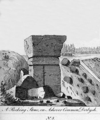
Robin Hood's Mark (Ashover): Difference between revisions
From International Robin Hood Bibliography
(Created page with "__NOTOC__{{PlaceNamesItemTop|Lat=53.15366|Lon=-1.487028|AdministrativeDivision=Derbyshire|Vicinity=|Type=Natural feature|Interest=Robin Hood name| Status=Extant|Demonym=|Ridin...") |
mNo edit summary |
||
| Line 1: | Line 1: | ||
__NOTOC__{{PlaceNamesItemTop|Lat=53.15366|Lon=-1.487028|AdministrativeDivision=Derbyshire|Vicinity=|Type=Natural feature|Interest=Robin Hood name| | __NOTOC__{{PlaceNamesItemTop|Lat=53.15366|Lon=-1.487028|AdministrativeDivision=Derbyshire|Vicinity=''c.'' 2 km SW of Ashover; ''c.'' 200 m S of the Turning Stone; north of Cocking Tor|Type=Natural feature|Interest=Robin Hood name| | ||
Status=Extant|Demonym=|Riding=|GreaterLondon=|Year=1794|Aka=Robin Hoods Mark|Century=|Cluster1=Ashover|Cluster2=|Cluster3=|Image=rooke-hayman-1796a-plate-facing-p43.jpg|Postcards=|ExtraCat1=Places connected by bowshot|ExtraCat2=|ExtraCat3=|ExtraCat4=|ExtraCat5=|ExtraLink1=|ExtraLink2=|ExtraLink3=|ExtraLink4=|ExtraLink5=|ExtraLinkName1=|ExtraLinkName2=|ExtraLinkName3=|ExtraLinkName4=|ExtraLinkName5=|GeopointPrefix=Near |GeopointSuffix= ?|VicinitySuffix=|StatusSuffix=|DatePrefix=|DateSuffix=}} | Status=Extant|Demonym=|Riding=|GreaterLondon=|Year=1794|Aka=Robin Hoods Mark|Century=|Cluster1=Ashover|Cluster2=|Cluster3=|Image=rooke-hayman-1796a-plate-facing-p43.jpg|Postcards=|ExtraCat1=Places connected by bowshot|ExtraCat2=|ExtraCat3=|ExtraCat4=|ExtraCat5=|ExtraLink1=|ExtraLink2=|ExtraLink3=|ExtraLink4=|ExtraLink5=|ExtraLinkName1=|ExtraLinkName2=|ExtraLinkName3=|ExtraLinkName4=|ExtraLinkName5=|GeopointPrefix=Near |GeopointSuffix= ?|VicinitySuffix=|StatusSuffix=|DatePrefix=|DateSuffix=}} | ||
{{#display_map:{{#var:Coords}}~{{#replace:{{PAGENAME}}|'|'}}|width=34%|fullscreen=yes}}<div class="pnMapLegend">{{PAGENAME}}.</div> | {{#display_map:{{#var:Coords}}~{{#replace:{{PAGENAME}}|'|'}}|width=34%|fullscreen=yes}}<div class="pnMapLegend">{{PAGENAME}}.</div> | ||
[[File:{{#var:Image}}|thumb|right| | [[File:{{#var:Image}}|thumb|right|350px|_LEGEND / [_URL _PHOTOGRAPHER_, _DAY_ _MON_. _YEAR_, Creative Commons.]]] | ||
<div class="no-img"><p id="byline">By | <div class="no-img"><p id="byline">By Henrik Thiil Nielsen, 2021-06-16. Revised by {{#realname:{{REVISIONUSER}}}}, {{REVISIONYEAR}}-{{REVISIONMONTH}}-{{REVISIONDAY2}}.</p> | ||
{{PlaceNamesItemAllusionsAndRecords}} | {{PlaceNamesItemAllusionsAndRecords}} | ||
Revision as of 17:03, 16 June 2021
| Locality | |
|---|---|
| Coordinate | Near 53.15366, -1.487028 ? |
| Adm. div. | Derbyshire |
| Vicinity | c. 2 km SW of Ashover; c. 200 m S of the Turning Stone; north of Cocking Tor |
| Type | Natural feature |
| Interest | Robin Hood name |
| Status | Extant |
| First Record | 1794 |
| A.k.a. | Robin Hoods Mark |
Robin Hood's Mark (Ashover).
By Henrik Thiil Nielsen, 2021-06-16. Revised by Henrik Thiil Nielsen, 2021-06-16.
Gazetteers
- Not included in Dobson, R. B., ed.; Taylor, J., ed. Rymes of Robyn Hood: an Introduction to the English Outlaw (London, 1976), pp. 293-311.
Sources
Maps
- 25" map Derbyshire XXIX.16 (c. 1880; surveyed c. 1875). No copy in NLS]
- 25" O.S. map Derbyshire XXIX.16 (1899; rev. 1897)
- 25" O.S. map Derbyshire XXIX.16 (1922; rev. 1919)
- 25" O.S. map Ashover parish, Derbyshire (1950s) (georeferenced)
- 6" O.S. map Derbyshire XXIX.SE (1884; surveyed 1879)
- 6" O.S. map Derbyshire XXIX.SE (1899; rev. 1897–98) (georeferenced)
- 6" O.S. map Derbyshire XXIX.SE (1899; rev. 1897–98)
- 6" O.S. map Derbyshire XXIX (1923; rev. 1919–20)
- 6" O.S. map Derbyshire XXIX.SE (1923; rev. 1919)
- 6" O.S. map Derbyshire XXIX.SE (c. 1948; rev. 1938).
Also see
Notes

