From International Robin Hood Bibliography
The printable version is no longer supported and may have rendering errors. Please update your browser bookmarks and please use the default browser print function instead.
| Locality |
|---|
| Coordinate |
52.986054, -0.031228 |
|---|
| Adm. div. |
Lincolnshire |
|---|
| Vicinity |
Boston |
|---|
| Type |
Thoroughfare |
|---|
| Interest |
Robin Hood name |
|---|
| Status |
Extant |
|---|
| First Record |
|
|---|
Loading map...
{"minzoom":false,"maxzoom":false,"mappingservice":"leaflet","width":"34%","height":"400px","centre":false,"title":"","label":"","icon":"","lines":[],"polygons":[],"circles":[],"rectangles":[],"copycoords":false,"static":false,"zoom":false,"defzoom":9,"layers":["OpenStreetMap","NLS","Stamen.Terrain"],"image layers":[],"overlays":[],"resizable":false,"fullscreen":true,"scrollwheelzoom":true,"cluster":false,"clustermaxzoom":20,"clusterzoomonclick":true,"clustermaxradius":80,"clusterspiderfy":true,"geojson":"","clicktarget":"","imageLayers":[],"locations":[{"text":"\u003Cdiv class=\"mw-parser-output\"\u003E\u003Cp\u003ELocksley Close (Boston)\n\u003C/p\u003E\u003C/div\u003E","title":"Locksley Close (Boston)\n","link":"","lat":52.986054,"lon":-0.031228,"icon":""}],"imageoverlays":null}
Locksley Close.
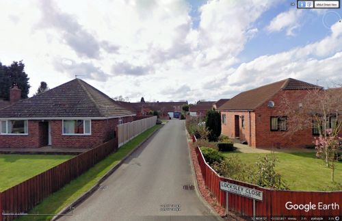
Looking west down Locksley Close from Robin Hood's Walk / Google Earth Street View.
By Henrik Thiil Nielsen, 2013-08-07. Revised by Henrik Thiil Nielsen, 2021-01-06.
Friar Way, Greenwood Drive, Locksley Close, Marian Road, Sheriff Way and Sherwood Avenue were all obviously inspired by the presence in this immediate are of a residential street named Robin Hood's Walk, which itself goes back at least as far as 1640.
Gazetteers
Also see

