Little John Birch Coppice (Bagot's Wood): Difference between revisions
m (Text replacement - "Google Earth's StreetView" to "Google Earth Street View") |
mNo edit summary |
||
| Line 1: | Line 1: | ||
__NOTOC__ | __NOTOC__{{PnItemTop|Lat=52.856|Lon=-1.8934|AdmDiv=Staffordshire|Vicinity=N. end of Bagot's wood; 20 m or less E. of the B5013; 4.45 km SSW of Uttoxeter|Type=Natural feature|Interest=Robin Hood name|Status=Defunct|Demonym=|Riding=|GreaterLondon=|Year=1823|Aka=|Century=|Cluster1=Bagot's Wood|Cluster2=|Cluster3=|Image=google_earth_streetview_near_little_john_birch_staffordshire.jpg|Postcards=|ExtraCat1=Places named Robin Hood's Wood|ExtraCat2=Places named after Little John|ExtraCat3=|ExtraCat4=|ExtraCat5=|GeopointPrefix=|GeopointSuffix=|VicinitySuffix=|StatusSuffix=|DatePrefix=|DateSuffix=}} | ||
{{ | {{#display_map:{{#var:Coords}}|width=34%}}<div class="pnMapLegend">Approximate indication of the site of Little John Birch and Little John Birch Coppice.</div> | ||
| | |||
| | |||
| | |||
| | |||
| | |||
| | |||
| | |||
| | |||
| | |||
}} | |||
{{#display_map: | |||
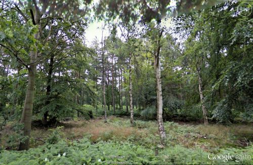
[[File:google_earth_streetview_near_little_john_birch_staffordshire.jpg|thumb|right|500px|There are still birches in the vicinity of Little John Birch/Little John Birch Coppice (photo from Google Earth Street View).]] | [[File:google_earth_streetview_near_little_john_birch_staffordshire.jpg|thumb|right|500px|There are still birches in the vicinity of Little John Birch/Little John Birch Coppice (photo from Google Earth Street View).]] | ||
<p id="byline">By Henrik Thiil Nielsen, 2016-09-25. Revised by {{#realname:{{REVISIONUSER}}}}, {{REVISIONYEAR}}-{{REVISIONMONTH}}-{{REVISIONDAY2}}.</p><div class="no-img"> | <p id="byline">By Henrik Thiil Nielsen, 2016-09-25. Revised by {{#realname:{{REVISIONUSER}}}}, {{REVISIONYEAR}}-{{REVISIONMONTH}}-{{REVISIONDAY2}}.</p><div class="no-img"> | ||
| Line 45: | Line 28: | ||
</div> | </div><!-- | ||
< | {{ImgGalleryIntro}} | ||
<gallery widths="195px"> | |||
FOR EACH IMAGE: File:_FILENAME.jpg|_LEGEND / [_URL _PHOTOGRAPHER, _DAY _MON. _YEAR, Creative Commons.] | |||
</gallery>--> | |||
{{PnItemNav}} | |||
{{ | |||
Revision as of 05:35, 6 December 2017
By Henrik Thiil Nielsen, 2016-09-25. Revised by Henrik Thiil Nielsen, 2017-12-06.
Located at the north end of Bagot's Wood, 4.55 km SSW of Uttoxeter, Little John's Birch Coppice is first mentioned in 1823 (see Records below). While the coppice is not included on any of the 6" O.S. maps of the area online at NLS, the maps, published 1884 to c. 1849, all include Little John Birch tout court. Presumably this was a birch tree that gave its name to a coppice in which it stood. Also included on the maps is Big John Birch (see allusion below), which stood c. 300 m ESE of Little John Birch (Coppice). A Google search on 25 Sep. 2016 yielded no relevant results except a PDF of the printed source of the allusion, so this entry is to all intents and purposes the World Wide Web debut of Little John Birch and its coppice.
The coordinates I have indicated for the coppice differ very slightly from those I cite for the birch itself. This difference is not significant; it serves simply two separate the markers indicating the to place-name entries on the Staffordshire overview map. It is not possible to establish the exact site of the birch from the O.S. 6" maps.
Records
1823 - Little John Birch Coppice in Bagot's Wood
A particular of Woods and Plantations belonging to the Right Honorable William Lord Bagot, in the Parishes Abbot's Bromley and Hanbury, lying together and surrounding Bagot's Park, exclusive of Woods and Lands planted within the ancient boundary of the Park, and also of detached Plantations in the said Parishes. [...] Big John Birch [...] Little John Birch Coppice [...][1]
Gazetteers
- Not included in Dobson, R. B., ed.; Taylor, J., ed. Rymes of Robyn Hood: an Introduction to the English Outlaw (London, 1976), pp. 293-311.
Sources
- [Bagot, William]. Memorials of the Bagot Family (Blithfield, 1824), pp. xxix, xxxi.
Maps
- 6" O.S. map Staffordshire XXXII.SW (1884; surveyed 1881-82)
- 6" O.S. map Staffordshire XXXII.SW (1901; rev. 1899-1900)
- 6" O.S. map Derbyshire LII (1924; rev. 1920)
- 6" O.S. map Derbyshire LII (c. 1949; rev. 1938)
Also see
Notes

