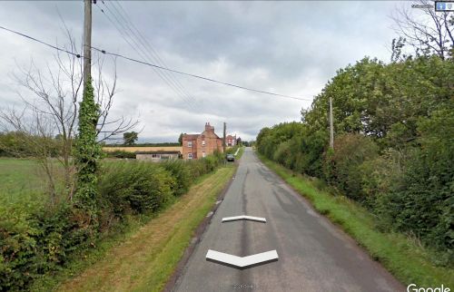
White Gate (Stubwood)
From International Robin Hood Bibliography
| Locality | |
|---|---|
| Coordinate | 52.957007, -1.857836 |
| Adm. div. | Staffordshire |
| Vicinity | Somewhere in Stubwood, c. 5.6 km NNE of Uttoxeter |
| Type | Miscellaneous |
| Interest | Local tradition |
| Status | Defunct |
| First Record | 1865 |
White Gate (Stubwood).
By Henrik Thiil Nielsen, 2020-10-16. Revised by Henrik Thiil Nielsen, 2021-01-06.
According to a 19th century local tradition, Robin Hood was standing at White Gate in Stubwood when he shot several arrows that landed at Robin Hood's Butts, c. 2.5 km SSW. It has not been possible to determine where in Stubwood the White Gate was located.
See further the page on Robin Hood's Butts (Combridge). Template:PlaceNamesItemQuery
Gazetteers
- Not included in Dobson, R. B., ed.; Taylor, J., ed. Rymes of Robyn Hood: an Introduction to the English Outlaw (London, 1976), pp. 293-311.
Maps
- 25" O.S. map Staffordshire XXVI.2 (1881; surveyed 1880)
- 25" O.S. map Staffordshire XXVI.2 (1901; rev. 1898-99) (georeferenced)
- 25" O.S. map Staffordshire XXVI.2 (1901; rev. 1898–99)
- 25" O.S. map Staffordshire XXVI.2 (1922; rev. 1920)
- 6" O.S. map Derbyshire XLVII (1924; rev. 1920)
- 6" O.S. map Derbyshire XLVII.NW (1901; rev. 1899) (georeferenced)
- 6" O.S. map Derbyshire XLVII.NW (1901; rev. 1899)
- 6" O.S. map Staffordshire XXVI.NW (1886; surveyed 1880–81)
- 6" O.S. map Derbyshire XLVII.NW (1924; rev. 1920)
- 6" O.S. map Derbyshire XLVII.NW (1901; rev. 1899) (georeferenced).
Also see
Notes

