
Sherwood Street (Reading)
| Locality | |
|---|---|
| Coordinates | 51.459293, -1.002943 |
| Adm. div. | Berkshire |
| Vicinity | c. 80 mN of and parallel with Oxford Street in Reading |
| Type | Thoroughfare |
| Interest | Miscellaneous |
| Status | Extant |
| First Record | 1900 |

By Henrik Thiil Nielsen, 2017-11-17. Revised by Henrik Thiil Nielsen, 2017-11-17.
Sherwood Street in Reading most likely owes its name to the presence in the neighbourhood of several localities named after Little John.
Gazetteers
- Not included in Dobson, R. B., ed.; Taylor, J., ed. Rymes of Robyn Hood: an Introduction to the English Outlaw (London, 1976), pp. 293-311.
- Not included in Gelling Margaret 1973a.
Maps
For ease of reference map evidence for the southern Little John's Lane are included here, though it has its own page.
North section
- 25" O.S. map Oxfordshire LVI.14 (1899; rev. 1897) (lane shown, not labelled)
- 25" O.S. map Berkshire XXXVII.2 (1911; rev. 1910) (lane shown, only S. sect. labelled)
- 25" O.S. map Oxfordshire LVI.14 (1913; rev. 1910) (lane labelled)
- 25" O.S. map Oxfordshire LVI.14 (1934; rev. 1932) (lane labelled)
- 25" O.S. map Berkshire XXXVII.2 (1934; rev. 1932) (n. and s. sects. of lane separately labelled)
- 25" O.S. map Oxfordshire LVI.14 (1938; rev. 1936) (lane labelled)
South section
- 25" O.S. map Berkshire XXXVII.2 (1911; rev. 1910) (lane labelled)
- 25" O.S. map Berkshire XXXVII.2 (1934; rev. 1932) (n. and s. sects. of lane separately labelled)
- 6" O.S. map Berkshire XXXVII (1883; surveyed 1872-77) (lane shown, not labelled)
- 6" O.S. map Berkshire XXXVII.NW (1900; rev. 1898) (lane labelled)
- 6" O.S. map Berkshire XXXVII.NW (1900; rev. 1898) (georeferenced) (lane labelled)
- 6" O.S. map Berkshire XXXVII.NW (1914; rev. 1910) (lane shown, not labelled)
- 6" O.S. map Berkshire XXXVII.NW (c. 1935; rev. 1932) (lane shown, not labelled)
- 6" O.S. map Berkshire XXXVII.NW (c. 1944; rev. 1938) (lane shown, not labelled)
Background
Also see
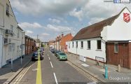
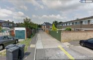
Little John's Lane, looking north from Oxford Road / Google Earth Street View.
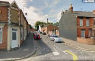
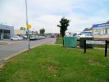
Little John's Lane, looking south from Sherwood Street / Google Earth Street View.
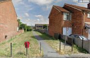
Looking north from Sherwood Street. Here Little John's Lane is an unnamed tarmac path / Google Earth Street View.
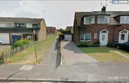
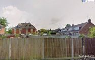
Fulmead Road and Thornton Mews together form a "[". Looking south from Fulmead Road, on the bottom "arm" of the bracket, Little John's Lane is still an unnamed tarmac path
Fulmead Road and Thornton Mews together form a "[". Looking north from Fulmead Road, on the bottom "arm" of the bracket, Little John's Lane is still a tarmac path. I cannot read the white sign on the green fence. Does it read "Little John's Lane"?
Looking south from Thornton Mews. Only a determined trespasser could follow this stretch of Little John's Lane
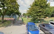
Looking north from Thornton Mews. This tarmac path between a football field and a playground can legitimately regard itself as the heir of Little John's Lane
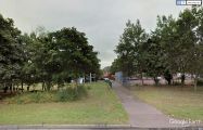
Looking south from Portman Road. The tarmac follows the course of Little John's Lane
Looking north on Little Johns Lane from corner of Portman Road / 'Shazz', 7 Aug. 2013, Creative Commons, via Geograph.


"th" can not be assigned to a declared number type with value 19.