Sherwood Road (Hall Green): Difference between revisions
From International Robin Hood Bibliography
m (Text replacement - "PnItemAlsoSee" to "PlaceNamesItemAlsoSee") |
m (Text replacement - "PlaceNamesItemQuery" to "PlaceNamesItemAllusionsAndRecords") |
||
| Line 4: | Line 4: | ||
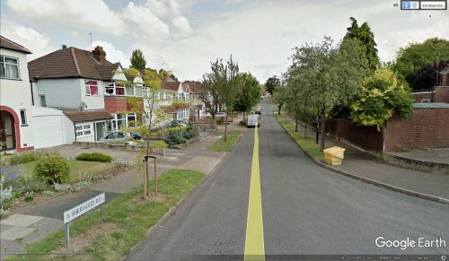
[[File:{{#var:Image}}|thumb|right|500px|Sherwood Road / Google Earth Street View.]]<div class="no-img"> | [[File:{{#var:Image}}|thumb|right|500px|Sherwood Road / Google Earth Street View.]]<div class="no-img"> | ||
<p id="byline">By Henrik Thiil Nielsen, 2018-01-12. Revised by {{#realname:{{REVISIONUSER}}}}, {{REVISIONYEAR}}-{{REVISIONMONTH}}-{{REVISIONDAY2}}.</p> | <p id="byline">By Henrik Thiil Nielsen, 2018-01-12. Revised by {{#realname:{{REVISIONUSER}}}}, {{REVISIONYEAR}}-{{REVISIONMONTH}}-{{REVISIONDAY2}}.</p> | ||
Sherwood Road is a roughly L-shaped road that connects [[Robin Hood Lane (Hall Green)|Robin Hood Lane]] and Highfield Road in Hall Green.{{ | Sherwood Road is a roughly L-shaped road that connects [[Robin Hood Lane (Hall Green)|Robin Hood Lane]] and Highfield Road in Hall Green.{{PlaceNamesItemAllusionsAndRecords}} | ||
== Gazetteers == | == Gazetteers == | ||
* Not included in {{:Dobson, Richard Barrie 1976a}}, pp. 293-311. | * Not included in {{:Dobson, Richard Barrie 1976a}}, pp. 293-311. | ||
Latest revision as of 00:59, 6 January 2021
| Locality | |
|---|---|
| Coordinate | 52.428545, -1.849729 |
| Adm. div. | Worcestershire |
| Vicinity | Connects Robin Hood Lane and Highfield Road in Hall Green |
| Type | Thoroughfare |
| Interest | Miscellaneous |
| Status | Extant |
| First Record | |
Sherwood Road (Hall Green).
By Henrik Thiil Nielsen, 2018-01-12. Revised by Henrik Thiil Nielsen, 2021-01-06.
Sherwood Road is a roughly L-shaped road that connects Robin Hood Lane and Highfield Road in Hall Green.
Gazetteers
- Not included in Dobson, R. B., ed.; Taylor, J., ed. Rymes of Robyn Hood: an Introduction to the English Outlaw (London, 1976), pp. 293-311.
Also see

