From International Robin Hood Bibliography
| Locality |
|---|
| Coordinate |
52.418884, -1.834154 |
|---|
| Adm. div. |
Worcestershire |
|---|
| Vicinity |
29 Brockhurst Drive, SW of Stratford Road, Hall Green |
|---|
| Type |
Association |
|---|
| Interest |
Miscellaneous |
|---|
| Status |
Extant |
|---|
| First Record |
|
|---|
Loading map...
{"minzoom":false,"maxzoom":false,"mappingservice":"leaflet","width":"34%","height":"400px","centre":false,"title":"","label":"","icon":"","lines":[],"polygons":[],"circles":[],"rectangles":[],"copycoords":false,"static":false,"zoom":false,"defzoom":9,"layers":["OpenStreetMap","NLS","Stamen.Terrain"],"image layers":[],"overlays":[],"resizable":false,"fullscreen":true,"scrollwheelzoom":true,"cluster":false,"clustermaxzoom":20,"clusterzoomonclick":true,"clustermaxradius":80,"clusterspiderfy":true,"geojson":"","clicktarget":"","imageLayers":[],"locations":[{"text":"\u003Cdiv class=\"mw-parser-output\"\u003E\u003Cp\u003ESherwood Park Bowls Club (Hall Green)\n\u003C/p\u003E\u003C/div\u003E","title":"Sherwood Park Bowls Club (Hall Green)\n","link":"","lat":52.418884,"lon":-1.834154,"icon":""}],"imageoverlays":null}
Sherwood Park Bowls Club (Hall Green).
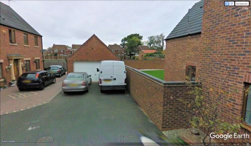
The grounds of Sherwood Park Bowls Club are behind the fence and wall / Google Earth Street View.
By Henrik Thiil Nielsen, 2018-01-12. Revised by Henrik Thiil Nielsen, 2021-01-06.
Sherwood Park Bowls Club is one of about a dozen associations, businesses, thoroughfares etc. in the Hall Green area with Robin Hood-themed names.
Gazetteers
Background
Also see

