
Robin Hood Roundabout (Newbury): Difference between revisions
(Created page with "__NOTOC__{{PnItemTop|Lat=51.406760|Lon=-1.317364|AdmDiv=Berkshire|Vicinity=At intersection of A339, London Road, A4, and Shaw Road, in Newbury|Type=Thoroughfare|Interest=Robin...") |
mNo edit summary |
||
| Line 5: | Line 5: | ||
The Robin Hood Roundabout at the intersection of the A339 (formerly A34), London Road, the A4, and Shaw Road, in Newbury, was built in 1966.<ref>[http://www.newburyhistory.co.uk/newbury-timeline Newbury History: Timeline of Newbury.]</ref> | The Robin Hood Roundabout at the intersection of the A339 (formerly A34), London Road, the A4, and Shaw Road, in Newbury, was built in 1966.<ref>[http://www.newburyhistory.co.uk/newbury-timeline Newbury History: Timeline of Newbury.]</ref> | ||
The roundabout was altered in 1977, but apparently further alterations were required already in the 1980s.<ref>[http://www.newburyhistory.co.uk/newbury-timeline Newbury History: Timeline of Newbury;] [https://www.sabre-roads.org.uk/wiki/index.php?title=Robin_Hood_Roundabout_(Newbury) Sabre: Robin Hood Roundabout (Newbury).]</ref> No doubt the roundabout was named after its neighbour, the [[Robin Hood (Newbury | The roundabout was altered in 1977, but apparently further alterations were required already in the 1980s.<ref>[http://www.newburyhistory.co.uk/newbury-timeline Newbury History: Timeline of Newbury;] [https://www.sabre-roads.org.uk/wiki/index.php?title=Robin_Hood_Roundabout_(Newbury) Sabre: Robin Hood Roundabout (Newbury).]</ref> No doubt the roundabout was named after its neighbour, the [[Robin Hood (Newbury)|Robin Hood]].{{PnItemQry}} | ||
== Gazetteers == | == Gazetteers == | ||
* Not included in {{:Dobson, Richard Barrie 1976a}}, pp. 293-311. | * Not included in {{:Dobson, Richard Barrie 1976a}}, pp. 293-311. | ||
| Line 41: | Line 41: | ||
robin-hood-roundabout.jpg|Robin Hood Roundabout / [https://www.geograph.org.uk/photo/3105302 Colin Pyle, 10 Aug. 2012; Creative Commons via Geograph.] | robin-hood-roundabout.jpg|Robin Hood Roundabout / [https://www.geograph.org.uk/photo/3105302 Colin Pyle, 10 Aug. 2012; Creative Commons via Geograph.] | ||
geograph-4151134-by-David-Dixon.jpg|Robin Hood Roundabout / [https://www.geograph.org.uk/photo/4151134 David Dixon, 17 July 2014; Creative Commons via Geograph.] | geograph-4151134-by-David-Dixon.jpg|Robin Hood Roundabout / [https://www.geograph.org.uk/photo/4151134 David Dixon, 17 July 2014; Creative Commons via Geograph.] | ||
geograph-4863322-by-N-Chadwick.jpg|Robin Hood Roundabout / [https://www.geograph.org.uk/photo/4863322 N. Chadwick, 1 Oct. 2015; Creative Commons via Geograph.] | geograph-4863322-by-N-Chadwick.jpg|Robin Hood Roundabout / [https://www.geograph.org.uk/photo/4863322 N. Chadwick, 1 Oct. 2015; Creative Commons via Geograph.] | ||
geograph-4923910-by-David-Howard.jpg|Robin Hood Roundabout / [https://www.geograph.org.uk/photo/4923910 David Howard, 24 Apr. 2016; Creative Commons via Geograph.] | geograph-4923910-by-David-Howard.jpg|Robin Hood Roundabout / [https://www.geograph.org.uk/photo/4923910 David Howard, 24 Apr. 2016; Creative Commons via Geograph.] | ||
Revision as of 00:24, 2 May 2020
[[File:|thumb|right|500px|Robin Hood Roundabout / Colin Pyle, Creative Commons via Geograph.]]
By Henrik Thiil Nielsen, 2020-04-30. Revised by Henrik Thiil Nielsen, 2020-05-02.
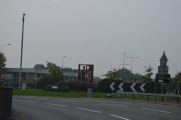
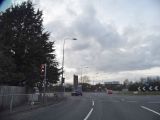
The Robin Hood Roundabout at the intersection of the A339 (formerly A34), London Road, the A4, and Shaw Road, in Newbury, was built in 1966.[1]
The roundabout was altered in 1977, but apparently further alterations were required already in the 1980s.[2] No doubt the roundabout was named after its neighbour, the Robin Hood.Template:PnItemQry
Gazetteers
- Not included in Dobson, R. B., ed.; Taylor, J., ed. Rymes of Robyn Hood: an Introduction to the English Outlaw (London, 1976), pp. 293-311.
Sources
Maps
Maps of the area, all older than the roundabout.
- 25" O.S. map Berkshire XXXV.13 (c. 1880, surveyed 1878). No Copy in NLS
- 25" O.S. map Berkshire XXXV.13 (1900, rev. 1898) (georeferenced)
- 25" O.S. map Berkshire XXXV.13 (1900; rev. 1898)
- 25" O.S. map Berkshire XXXV.13 (1911; rev. 1910)
- 25" O.S. map Berkshire XXXV.13 (1933; rev. 1932)
- 6" O.S. map Berkshire XXXV (1883; surveyed 1877-1878)
- 6" O.S. map Berkshire XXXV.SW (1900, rev. 1898) (georeferenced)
- 6" O.S. map Berkshire XXXV.SW (1900; rev. 1898)
- 6" O.S. map Berkshire XXXV.SW (1913; rev. 1910)
- 6" O.S. map Berkshire XXXV.SW (c. 1933; rev. 1932)
- 6" O.S. map Berkshire XXXV.SW (c. 1944; rev. 1938).
Notes
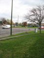
Robin Hood Roundabout / Julian Tubb, 7 Nov. 2007; Creative Commons via Geograph.
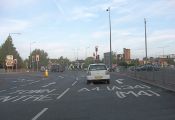
The notorious Robin Hood Roundabout / Stuart Logan, 23 Sep. 2011; Creative Commons via Geograph.
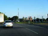
Robin Hood Roundabout / Colin Pyle, 10 Aug. 2012; Creative Commons via Geograph.
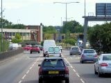
Robin Hood Roundabout / David Dixon, 17 July 2014; Creative Commons via Geograph.
Robin Hood Roundabout / N. Chadwick, 1 Oct. 2015; Creative Commons via Geograph.
Robin Hood Roundabout / David Howard, 24 Apr. 2016; Creative Commons via Geograph.


