Robin Hood Road (Willenhall, Coventry): Difference between revisions
From International Robin Hood Bibliography
m (Text replacement - "VicinitySuffix=|" to "") |
m (Text replacement - "PlaceNamesItemQuery" to "PlaceNamesItemAllusionsAndRecords") |
||
| (26 intermediate revisions by the same user not shown) | |||
| Line 1: | Line 1: | ||
__NOTOC__{{ | __NOTOC__{{PlaceNamesItemTop|Lat=52.388598|Lon=-1.466184|AdministrativeDivision=Warwickshire|Vicinity=Willenhall, Coventry|Type=Thoroughfare|Interest=Robin Hood name|Status=Extant|Demonym=|Riding=|GreaterLondon=|Year=|Aka=|Century=|Cluster1=|Cluster2=|Cluster3=|Image=Robin Hood Road (Willenhall, Coventry, Warwickshire).png|Postcards=|ExtraCat1=|ExtraCat2=|ExtraCat3=|ExtraCat4=|ExtraCat5=|ExtraLink1=|ExtraLink2=|ExtraLink3=|ExtraLink4=|ExtraLink5=|ExtraLinkName1=|ExtraLinkName2=|ExtraLinkName3=|ExtraLinkName4=|ExtraLinkName5=|GeopointPrefix=|GeopointSuffix=|StatusSuffix=|DatePrefix=|DateSuffix=}} | ||
{{#display_map:{{#var:Coords}}|width=34%}}<div class="pnMapLegend"> | {{#display_map:{{#var:Coords}}~{{#replace:{{PAGENAME}}|'|'}}|width=34%|enablefullscreen=yes}}<div class="pnMapLegend">Robin Hood Road.</div> | ||
[[File:Robin Hood Road (Willenhall, Coventry, Warwickshire).png|thumb|right|500px|Robin Hood Road | [[File:Robin Hood Road (Willenhall, Coventry, Warwickshire).png|thumb|right|500px|Robin Hood Road / [http://commons.wikimedia.org/wiki/User:Snowmanradio Snowmanradio, Wikimedia Commons.]]]<div class="no-img"> | ||
<p id="byline">By Henrik Thiil Nielsen, 2013-08-07. Revised by {{#realname:{{REVISIONUSER}}}}, {{REVISIONYEAR}}-{{REVISIONMONTH}}-{{REVISIONDAY2}}.</p | <p id="byline">By Henrik Thiil Nielsen, 2013-08-07. Revised by {{#realname:{{REVISIONUSER}}}}, {{REVISIONYEAR}}-{{REVISIONMONTH}}-{{REVISIONDAY2}}.</p> | ||
Robin Hood Road is located in the south-east Coventry suburb of Willenhall. | |||
{{PlaceNamesItemAllusionsAndRecords}} | |||
== Gazetteers == | |||
* Not included in {{:Dobson, Richard Barrie 1976a}}, pp. 293-311. | |||
{{PlaceNamesItemAlsoSee}}<!-- | |||
== Notes == | |||
<references/>--> | |||
</div | </div> | ||
{{ | |||
{{PlaceNamesItemNavigation}} | |||
Latest revision as of 00:56, 6 January 2021
| Locality | |
|---|---|
| Coordinate | 52.388598, -1.466184 |
| Adm. div. | Warwickshire |
| Vicinity | Willenhall, Coventry |
| Type | Thoroughfare |
| Interest | Robin Hood name |
| Status | Extant |
| First Record | |
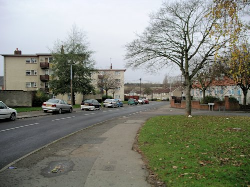
Robin Hood Road.

Robin Hood Road / Snowmanradio, Wikimedia Commons.
By Henrik Thiil Nielsen, 2013-08-07. Revised by Henrik Thiil Nielsen, 2021-01-06.
Robin Hood Road is located in the south-east Coventry suburb of Willenhall.
Gazetteers
- Not included in Dobson, R. B., ed.; Taylor, J., ed. Rymes of Robyn Hood: an Introduction to the English Outlaw (London, 1976), pp. 293-311.
