Robin Hood Road (Wimbledon)
From International Robin Hood Bibliography
| Locality | |
|---|---|
| Coordinate | 51.427994, -0.245627 |
| Adm. div. | Surrey, now Greater London |
| Vicinity | On Wimbledon Common |
| Type | Thoroughfare |
| Interest | Robin Hood name |
| Status | Extant |
| First Record | 1874 |
| A.k.a. | Robin Hood Ride |
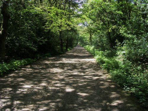
Robin Hood Road (Wimbledon).

Robin Hood Road / Shaun Ferguson, 25 Jun. 2008, Creative Commons, via Geograph
By Henrik Thiil Nielsen, 2018-01-13. Revised by Henrik Thiil Nielsen, 2021-01-06.
Robin Hood Road is a footpath and riding path across Wimbledon Common. It formerly lead to Robin Hood Farm. The earliest record I have at present is the 6" O.S. map published in 1874 (see Maps section below).
Gazetteers
- Not included in Dobson, R. B., ed.; Taylor, J., ed. Rymes of Robyn Hood: an Introduction to the English Outlaw (London, 1976), pp. 293-311.
Maps
- 6" O.S. map Surrey VII (1874; surveyed 1865)
- 6" O.S. map Surrey VII.SW (1899; rev. 1893-95) (georeferenced)
- 6" O.S. map Surrey VII.SW (1899; rev. 1893-95)
- 6" O.S. map Surrey VII.SW (1920; rev. 1911)
- 6" O.S. map Surrey VII.SW (c. 1933; rev. 1911)
- 6" O.S. map Surrey VII.SW (1936; rev. 1932-33)
- 6" O.S. map Surrey VII.SW (c. 1944; rev. 1938)
- 6" O.S. map Surrey VII.SW (c. 1946; rev. 1938).
Also see
