
Robin Hood Road (Knaphill, Woking): Difference between revisions
m (Text replacement - "PlaceNamesItemQuery" to "PlaceNamesItemAllusionsAndRecords") |
m (Text replacement - "ImgGalleryIntro" to "ImageGalleryIntroduction") |
||
| Line 31: | Line 31: | ||
<div id="gallery"> | <div id="gallery"> | ||
{{ | {{ImageGalleryIntroduction}} | ||
<gallery widths="195px"> | <gallery widths="195px"> | ||
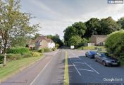
robin-hood-road-knaphill-google-earth-street-view.jpg|Robin Hood Road / Google Earth Street View. | robin-hood-road-knaphill-google-earth-street-view.jpg|Robin Hood Road / Google Earth Street View. | ||
Latest revision as of 13:53, 7 January 2021
| Locality | |
|---|---|
| Coordinate | 51.318478, -0.601667 |
| Adm. div. | Surrey |
| Vicinity | Knaphill, Woking |
| Type | Thoroughfare |
| Interest | Robin Hood name |
| Status | Extant |
| First Record | c. 1900 |

By Henrik Thiil Nielsen, 2013-08-17. Revised by Henrik Thiil Nielsen, 2021-01-07.
Robin Hood Road between Knaphill and St John's, Woking, connects a small cluster of localities with Robin Hood-related names, for which see Knaphill place-name cluster.
The earliest dated reference I have found for this road name is a 25" O.S. map of the area published in 1936 and based on surveying done in 1934. (see Maps below). However, there is no doubt that the postcard shown in the gallery below dates from a time much closer to 1900.
Gazetteers
- Not included in Dobson, R. B., ed.; Taylor, J., ed. Rymes of Robyn Hood: an Introduction to the English Outlaw (London, 1976), pp. 293-311.
Maps
Road shown, not labelled, unless otherwise stated.
- 25" O.S. map Surrey XVI.11 (1916; rev. 1913)
- 25" O.S. map Surrey XVI.11 (1936; rev. 1934)
- 25" O.S. map Surrey XVI.11 (1916; rev. 1913)
- 6" O.S. map Surrey XVI (1873; surveyed 1870-71)
- 6" O.S. map Surrey XVI.SE (1897; rev. 1894-95)
- 6" O.S. map Surrey XVI.SE (1897; rev. 1894-95) (georeferenced)
- 6" O.S. map Surrey XVI.SE (1920; rev. 1913)
- 6" O.S. map Surrey XVI.SE (1937; rev. 1934-35) (road shown and labelled)
- 6" O.S. map Surrey XVI.SE (c. 1944; rev. 1938) (road shown and labelled)
- 6" O.S. map Surrey XVI.SE (c. 1946; rev. 1938) (road shown and labelled).
Background
Also see
Image gallery
Click any image to display it in the lightbox, where you can navigate between images by clicking in the right or left side of the current image.
Robin Hood Road / Google Earth Street View.
