Robin Hood Junction (Robin Hood, Wakefield)
From International Robin Hood Bibliography
| Locality | |
|---|---|
| Coordinate | 53.7428, -1.5038 |
| Adm. div. | West Riding of Yorkshire |
| Vicinity | Leeds Road, Wakefield |
| Type | Transport |
| Interest | Robin Hood name |
| Status | Extant |
| First Record | 1908 |
Approximate site of Robin Hood Junction.
By Henrik Thiil Nielsen, 2016-12-31. Revised by Henrik Thiil Nielsen, 2021-01-06.
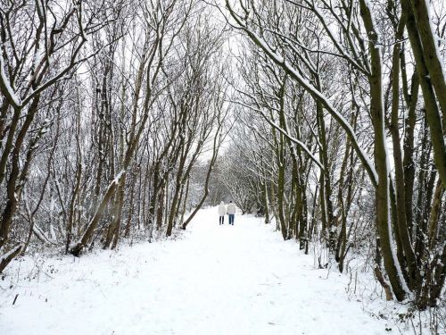
Robin Hood Junction in the village of Robin Hood, Wakefield, on the East and West Yorkshire Union Railway, is first recorded, as far as I know, on the 6" O.S. map of the area published in 1908. The railway was established in 1891 and extended a few years later. It closed in 1966.[1] As seen in the photo below, the tracks have now been replaced by a nice footpath.
Gazetteers
- Not included in Dobson, R. B., ed.; Taylor, J., ed. Rymes of Robyn Hood: an Introduction to the English Outlaw (London, 1976), pp. 293-311.
Maps
- 6" O.S. map Yorkshire 233 (1854; rev. 1848-51)
- 6" O.S. map Yorkshire CCXXXIII.NE (1894; rev. 1892)
- 6" O.S. map Yorkshire CCXXXIII.NE 1908; rev. 1905)
- 6" O.S. map Yorkshire CCXXXIII.NE (1908; rev. 1905) (georeferenced)
- 6" O.S. map Yorkshire CCXXXIII.NE (1931; rev. 1931-32) [sic]
- 6" O.S. map Yorkshire CCXXXIII.NE (1947; rev. 1938)
- 6" O.S. map Yorkshire CCXXXIII.NE (1949; rev. 1948).
Background
Also see
Notes

