Robin Hood Cottage (Whatstandwell): Difference between revisions
From International Robin Hood Bibliography
m (Text replacement - "PnItemNav" to "PlaceNamesItemNavigation") |
m (Text replacement - "PnItemAlsoSee" to "PlaceNamesItemAlsoSee") |
||
| Line 12: | Line 12: | ||
* [http://maps.nls.uk/view/102341358#zoom=6&lat=3100&lon=13591&layers=BT 6" O.S. map ''Derbyshire'' XXXIV (1924; rev. 1920)] | * [http://maps.nls.uk/view/102341358#zoom=6&lat=3100&lon=13591&layers=BT 6" O.S. map ''Derbyshire'' XXXIV (1924; rev. 1920)] | ||
* [http://maps.nls.uk/view/101601060#zoom=6&lat=3185&lon=6429&layers=BT 6" O.S. map ''Derbyshire'' XXXIV (''c.'' 1949; rev. 1938).] | * [http://maps.nls.uk/view/101601060#zoom=6&lat=3185&lon=6429&layers=BT 6" O.S. map ''Derbyshire'' XXXIV (''c.'' 1949; rev. 1938).] | ||
{{ | {{PlaceNamesItemAlsoSee}}<!-- | ||
== Notes == | == Notes == | ||
Revision as of 00:41, 6 January 2021
| Locality | |
|---|---|
| Coordinate | 53.0919, -1.5051 |
| Adm. div. | Derbyshire |
| Vicinity | c. 6 km SE of Matlock |
| Type | Building |
| Interest | Robin Hood name |
| Status | Extant |
| First Record | 1884 |
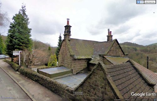
Robin Hood Cottage.
By Henrik Thiil Nielsen, 2016-12-30. Revised by Henrik Thiil Nielsen, 2021-01-06.
Robin Hood Cottage is located in the hamlet of Robin Hood on Leashaw Road in Whatstandwell, Derbyshire. The earliest record I have found of the cottage is a 6" O.S. map of the area published in 1884 (see Maps section below).Template:PlaceNamesItemQuery
Gazetteers
- Not included in Dobson, R. B., ed.; Taylor, J., ed. Rymes of Robyn Hood: an Introduction to the English Outlaw (London, 1976), pp. 293-311.
Maps
- 6" O.S. map Derbyshire XXXIV.SE (1884; surveyed 1879)
- 6" O.S. map Derbyshire XXXIV.SE (1900; rev. 1898) (georeferenced)
- 6" O.S. map Derbyshire XXXIV (1924; rev. 1920)
- 6" O.S. map Derbyshire XXXIV (c. 1949; rev. 1938).
Also see

