Robin Hood's Well (Birtley): Difference between revisions
From International Robin Hood Bibliography
m (Text replacement - "ImgGalleryIntro" to "ImageGalleryIntroduction") |
m (Text replacement - "No Copy in NLS" to "No copy in NLS") |
||
| Line 10: | Line 10: | ||
== Maps == | == Maps == | ||
Labelled "Robin Hood's Well" unless otherwise noted. | Labelled "Robin Hood's Well" unless otherwise noted. | ||
* 25" O.S. map ''Northumberland'' (''Old Series'') LXXVI.3 (''c.'' 1866; surveyed ''c.'' 1861-62). No | * 25" O.S. map ''Northumberland'' (''Old Series'') LXXVI.3 (''c.'' 1866; surveyed ''c.'' 1861-62). No copy in NLS | ||
* [http://maps.nls.uk/view/132267692#zoom=4&lat=4341&lon=12043&layers=BT 25" O.S. map ''Northumberland'' (''Old Series'') LXXVI.3 (1896; rev. 1895)] | * [http://maps.nls.uk/view/132267692#zoom=4&lat=4341&lon=12043&layers=BT 25" O.S. map ''Northumberland'' (''Old Series'') LXXVI.3 (1896; rev. 1895)] | ||
* [http://maps.nls.uk/geo/explore/#zoom=18&lat=55.0977&lon=-2.2184&layers=168&b=1 25" O.S. map ''Northumberland'' (''Old Series'') LXXVI.3 (1896; rev. 1895)] (georeferenced) | * [http://maps.nls.uk/geo/explore/#zoom=18&lat=55.0977&lon=-2.2184&layers=168&b=1 25" O.S. map ''Northumberland'' (''Old Series'') LXXVI.3 (1896; rev. 1895)] (georeferenced) | ||
Latest revision as of 01:04, 13 February 2021
| Locality | |
|---|---|
| Coordinate | 55.097643, -2.218037 |
| Adm. div. | Northumberland |
| Vicinity | c. 1.6 km W of Birtley; c. 850 m W of Wark; near E brink of River North Tyne |
| Type | Natural feature |
| Interest | Robin Hood name |
| Status | Defunct? |
| First Record | 1866 |
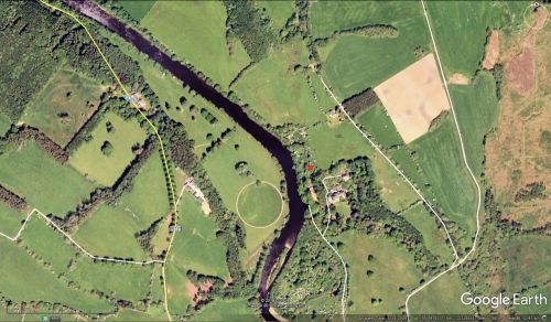
Robin Hood's Well, Birtley.
By Henrik Thiil Nielsen, 2018-03-05. Revised by Henrik Thiil Nielsen, 2021-02-13.
Robin Hood's Well c. 1.6 km west of Birtley, Northumberland, is recorded on a 6" O.S. map of the area published in 1868.
Gazetteers
- Not included in Dobson, R. B., ed.; Taylor, J., ed. Rymes of Robyn Hood: an Introduction to the English Outlaw (London, 1976), pp. 293-311.
Maps
Labelled "Robin Hood's Well" unless otherwise noted.
- 25" O.S. map Northumberland (Old Series) LXXVI.3 (c. 1866; surveyed c. 1861-62). No copy in NLS
- 25" O.S. map Northumberland (Old Series) LXXVI.3 (1896; rev. 1895)
- 25" O.S. map Northumberland (Old Series) LXXVI.3 (1896; rev. 1895) (georeferenced)
- 6" O.S. map Northumberland LXXVI (1866; surveyed 1862)
- 6" O.S. map Northumberland LXXVI.NE (1897; rev. 1895)
- 6" O.S. map Northumberland LXXVI.NE (1897; rev. 1895) (georeferenced)
- 6" O.S. map Northumberland nLXXIII.SE (1925; rev. 1920)
- 6" O.S. map Northumberland nLXXIII.SE (1952; rev. 1946)
- 1:25,000 O.S. map NY87 (1959; surveyed 1952) (georeferenced). Label: "Wells"
- 1:1 million–1-10K (1900s) (georeferenced).
Background
Also see

