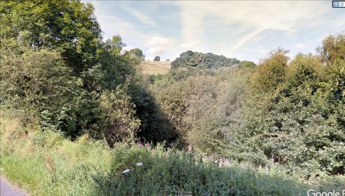
Plumpton Park (Stannington)
| Locality | |
|---|---|
| Coordinate | 53.400553, -1.551387 |
| Adm. div. | West Riding of Yorkshire |
| Vicinity | Area bounded by Spout Lane (SW), Storrs Lane (W) and a footpath (E and N), on Storrs/Stannington boundary |
| Type | Area |
| Interest | Literary locale |
| Status | Defunct |
| First Record | c. 1500 |
By Henrik Thiil Nielsen, 2020-04-27. Revised by Henrik Thiil Nielsen, 2022-05-17.
An area in Stannington, bordering Storrs, near Sheffield, was known as Plumpton Park in the mid-19th century. It is one of a surprisingly large number of plots of land in the North and North Midlands recorded under that name in tithe awards. As Robin Hood experts will know, it was also the name in the Gest of Robyn Hode of an area – probably near the home of the knight Sir Richard at the Lee – where King Edward discovered to his chagrin that Robin Hood had severely depleted the stock of deer. Though that Plumpton Park is most probably to be thought of as the locality in Lancashire, this is not certain, and it seems best, therefore, to record all occurrences of the name.
The field name occurs in the 1846 tithe award for Stannington, Storrs and Dungworth with James Stanley as landowner, Jonathan Revitt as occupier, an area of 1 acre, 3 roods and 24 perches (531.15 m2), and 'Rough Grass & Plantation' listed under 'State of Cultivation'.[1]
Gazetteers
- Not included in Dobson, R. B., ed.; Taylor, J., ed. Rymes of Robyn Hood: an Introduction to the English Outlaw (London, 1976), pp. 293-311.
Sources
- 1846 tithe award for Stannington, Storrs and Dungworth, online at the Genealogist, Piece 43, sub-piece 375, Image 112, item 514 (£)
- accompanying map, online at the Genealogist, Piece 43, sub-piece 375, Sub-Image 001, item 514 (£).
Maps
- 25" O.S. map Yorkshire CCXCIV.1 (1893; surveyed 1890)
- 25" O.S. map Yorkshire CCXCIV.1 (1905; rev. 1901) (georeferenced)
- 25" O.S. map Yorkshire CCXCIV.1 (1905; rev. 1901)
- 25" O.S. map Yorkshire CCXCIV.1 (1923; rev. 1920)
- 25" O.S. map Yorkshire CCXCIV.1 (1936; rev. 1934-35)
- 6" O.S. map Yorkshire 294 (1855; surveyed 1850-1851)
- 6" O.S. map Yorkshire CCXCIV.NW (1894; surveyed 1890)
- 6" O.S. map Yorkshire CCXCIV.NW (1906, rev. 1901 to 1903) (georeferenced)
- 6" O.S. map Yorkshire CCXCIV.NW (1906; rev. 1901-1903)
- 6" O.S. map Yorkshire CCXCIV (1924; rev. 1920-1921)
- 6" O.S. map Yorkshire CCXCIV.NW (1924; rev. 1920)
- 6" O.S. map Yorkshire CCXCIV.NW (1939; rev. 1934-1935)
- 6" O.S. map Yorkshire CCXCIV.NW (1947; rev. 1938)
- 6" O.S. map Yorkshire CCXCIV.NW (1949; rev. 1948).
Also see
- Stannington place-name cluster
- Loxley place-name cluster
- Sheffield place-name cluster
- Places named Plumpton Park
- Place-names in Gest of Robyn Hode
- Gest of Robyn Hode.
Notes
- ↑ 1846 tithe award for Stannington, Storrs and Dungworth, online at the Genealogist, Piece 43, sub-piece 375, Image 112, item 514; accompanying map, online at the Genealogist, Piece 43, sub-piece 375, Sub-Image 001, item 514 (£).

