1535 - Leland, John - Itinerary (2): Difference between revisions
From International Robin Hood Bibliography
m (Text replacement - "{{#display_map: " to "{{#display_map:") |
m (Text replacement - ".</p><div class="no-img">" to ".</p> <div class="no-img">") |
||
| Line 14: | Line 14: | ||
|lines=54.2796504009454,-0.40817642002366483:54.4356987001048,-0.5338325479533523|width=34%}}<div class="pnMapLegend">Scarborough to Robin Hood's Bay.</div> | |lines=54.2796504009454,-0.40817642002366483:54.4356987001048,-0.5338325479533523|width=34%}}<div class="pnMapLegend">Scarborough to Robin Hood's Bay.</div> | ||
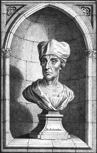
[[File:John_Leland.jpg|thumb|320px|Bust of John Leland (from {{:Leland, John 1906a}}, vol. I, plate facing p. 36).]] | [[File:John_Leland.jpg|thumb|320px|Bust of John Leland (from {{:Leland, John 1906a}}, vol. I, plate facing p. 36).]] | ||
<p id="byline">By Henrik Thiil Nielsen, 2013-07-17. Revised by {{#realname:{{REVISIONUSER}}}}, {{REVISIONYEAR}}-{{REVISIONMONTH}}-{{REVISIONDAY2}}.</p><div class="no-img"> | <p id="byline">By Henrik Thiil Nielsen, 2013-07-17. Revised by {{#realname:{{REVISIONUSER}}}}, {{REVISIONYEAR}}-{{REVISIONMONTH}}-{{REVISIONDAY2}}.</p> | ||
<div class="no-img"> | |||
=== Allusion === | === Allusion === | ||
<onlyinclude> | <onlyinclude> | ||
Revision as of 11:12, 18 December 2017
| Allusion | |
|---|---|
| Date | c.1535-43 |
| Author | Leland, John |
| Title | Itinerary |
| Mentions | Robin Hood's Bay (North Riding of Yorkshire) |
Scarborough to Robin Hood's Bay.

Bust of John Leland (from Leland, John; Smith, Lucy Toulmin, ed. The Itinerary of John Leland in or about the Years 1535-1543 (London, 1906-10), vol. I, plate facing p. 36).
By Henrik Thiil Nielsen, 2013-07-17. Revised by Henrik Thiil Nielsen, 2017-12-18.
Allusion
Thens [i.e. from Scarborough] an 8. miles to a fischer tounlet of 20. bootes caullid Robyn Huddes Bay, a dok or bosom of a mile yn lenghth; and thens 4. miles to Whiteby [...][1]
IRHB comments
This entry in John Leland's Itinerary was written sometime in the years c. 1535-43.
Notes
Editions
- Leland, John; Smith, Lucy Toulmin, ed. The Itinerary of John Leland in or about the Years 1535-1543 (London, 1906-10). Allusion: vol. I, p. 51.
Lists
- Not included in Dobson, R. B., ed.; Taylor, J., ed. Rymes of Robyn Hood: an Introduction to the English Outlaw (London, 1976), pp. 315-19.
- Not included in Sussex, Lucy, compil. 'References to Robin Hood up to 1600', in: Knight, Stephen. Robin Hood: A Complete Study of the English Outlaw (Oxford, UK; Cambridge, Massachusetts: Blackwell, 1994), pp. 262-88.
Also see
- 1535 - Leland, John - Itinerary (1)
- 1535 - Leland, John - Itinerary (3)
- 1540 - Leland, John - Collectanea
