Robin Hoods (Winnersh) (2)
| Locality | |
|---|---|
| Coordinate | 51.4326, -0.8741 |
| Adm. div. | Berkshire |
| Vicinity | E side of Robinhood Lane, S of Priory Court or Robin Hood Way , N of Danywern Drive, extending perhaps a little farther east than Annesley Gardens or Deerhurst Drive |
| Type | Area |
| Interest | Robin Hood name |
| Status | Defunct? |
| First Record | 1841 |
By Henrik Thiil Nielsen, 2018-09-21. Revised by Henrik Thiil Nielsen, 2022-04-22.
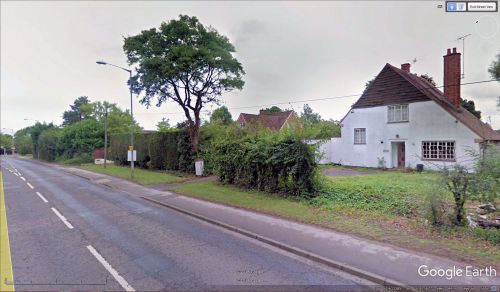
Two plots of land, one – see Robin Hoods (Winnersh) (1) – on the west, the other one the east side of Robinhood Lane in Winnersh were known locally as the Robin Hoods in the mid-19th century.The easternmost of these was a roughly rectangular area on the east side of Robinhood Lane, south of Priory Court or Robin Hood Way, north of Danywern Drive, extending perhaps a little farther east than Annesley Gardens or Deerhurst Drive. The tithe award for Hurst (1841) lists it as "Robin Hoods", the owner Robert Palmer, Esq., occupier William Peaple, state of cultivation "Arable", area 6 acres, 2 roods and 36 perches (27215.11 m2).[1] Since both areas are listed as "Robin Hoods" in the tithe award, we must assume that this was their collective name.
The plot immediately north of this easternmost "Robin Hood" was known as "May Piddle".[2] It is hardly possible to say whether the element "May" refers to the month or the plant, so any attempt to connect the "Robin Hoods" with May festivities in the area must remain pure speculation. For another speculative attempt to account for the Robin Hood place-names in this vicinity, see the page on Robinhood Lane (Winnersh).
Gazetteers
- Not included in Dobson, R. B., ed.; Taylor, J., ed. Rymes of Robyn Hood: an Introduction to the English Outlaw (London, 1976), pp. 293-311.
MS sources
- 1840 tithe map for Hurst parish, online at the Genealogist.co.uk, Piece 02, sub-piece 076, Sub-Image 001 (£)
- 1841 tithe award for Hurst parish, online at the Genealogist.co.uk, Piece 02, sub-piece 076, Image 048, Plot No. 1226 (£).
Printed sources
- Gelling, Margaret. The Place-Names of Berkshire (English Place-Name Society, vols. XLIX-LI) (Cambridge, 1973; [s.l.], 1974-76), pt. I, p. 138 (parish cf. p. 136).
Maps
These maps include the area in which the two Robin Hoods were located. The contours of the westernmost "Robin Hood", as shown on the MS tithe map, are clearly recognizable on them, those of the easternmost one less clearly so. Neither is labelled on the maps.
- 25" O.S. map Berkshire XXXVIII.6 (c. 1875; surveyed 1871). No copy in NLS
- 25" O.S. map Berkshire XXXVIII.6 (1899; rev. 1898)
- 25" O.S. map Berkshire XXXVIII.10 (1899; rev. 1898)
- 25" O.S. map Berkshire XXXVIII.6 (1899; rev. 1898) (georeferenced)
- 25" O.S. map Berkshire XXXVIII.10 (1911; rev. 1909)
- 25" O.S. map Berkshire XXXVIII.6 (1912; rev. 1910)
- 25" O.S. map Berkshire XXXVIII.10 (1933; rev. 1931)
- 25" O.S. map Berkshire XXXVIII.6 (1933; rev. 1932)
- 6" O.S. map Berkshire XXXVIII (1883; surveyed 1871-72)
- 6" O.S. map Berkshire XXXVIII.NW (1900; rev. 1898)
- 6" O.S. map Berkshire XXXVIII.SW (1900; rev. 1898)
- 6" O.S. map Berkshire XXXVIII.NW (1900; rev. 1898) (georeferenced)
- 6" O.S. map Berkshire XXXVIII.SW (1912; rev. 1909)
- 6" O.S. map Berkshire XXXVIII.NW (1913; rev. 1910)
- 6" O.S. map Berkshire XXXVIII.SW (c. 1933; rev. 1931-32)
- 6" O.S. map Berkshire XXXVIII.NW (c. 1934; rev. 1932)
- 6" O.S. map Berkshire XXXVIII.SW (c. 1944; rev. 1931-32)
- 6" O.S. map Berkshire XXXVIII.NW (c. 1944; rev. 1938).
Background
- 1841 tithe award for Hurst parish, online at the Genealogist.co.uk, Piece 02, sub-piece 076, Image 048, Plot No. 1227 (£).
- Wikipedia: Winnersh.
Also see
Notes
- ↑ 1841 tithe award for Hurst parish, online at the Genealogist.co.uk, Piece 02, sub-piece 076, Image 048, Plot No. 1226; 1840 tithe map for Hurst parish, online at the Genealogist.co.uk, Piece 02, sub-piece 076, Sub-Image 001 (£). Gelling, Margaret. The Place-Names of Berkshire (English Place-Name Society, vols. XLIX-LI) (Cambridge, 1973; [s.l.], 1974-76), pt. I, p. 138.
- ↑ 1841 tithe award for Hurst parish, online at the Genealogist.co.uk, Piece 02, sub-piece 076, Image 048, Plot No. 1227.

