Robin Hood (Cotehill)
| Locality | |
|---|---|
| Coordinate | 54.856527, -2.804671 |
| Adm. div. | Cumberland |
| Vicinity | Stretching c. 200 m north-northwest along the part of the road to Brackenbank that follows a course roughly parallel to River Eden, bordering towards the east on Brackenbank Wood; south of this, extending from c. 250 m ENE of Duncowfold Farm to c. 60 m WSW of River Eden, S. of road to Brackenbank |
| Type | Area |
| Interest | Robin Hood name |
| Status | Defunct? |
| First Record | 1840 |
By Henrik Thiil Nielsen, 2022-02-05. Revised by Henrik Thiil Nielsen, 2022-04-22.
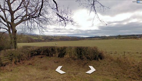
In the mid-19th century, an area of arable with a few patches of wood, east and southeast of the road to Brackenbank, west of River Eden, was known locally as 'Robin Hood'.
The northernmost part of this area, situated in the township of Wetheral, stretched c. 200 m north-northwest along a stretch of the road to Brackenbank where it follows a course roughly parallel to River Eden. Along the eastern edge of this field were two patches of wood, both evidently now part of Brackenbank Wood. The land now belongs to Christmas tree grower Mapa Trees Carlisle. Accordign to teh 1840 tithe award, the landowner was then Thomas Wannop, Jr., the occupier John Watson. The area of arable is cited as 6 acres and 33 perches (25115.8 m2), that of wood 1 acre and 3 perches (4122.73 m2), totalling some 29238 m2.[1]
The southernmost part, adjacent to the former, covered an area from c. 250 m east-northeast of Duncowfold Farm to c. 60 m west-soutwest of River Eden, southeast of the point where the road to Brackenbank turns north-northwest. It figures in the 1840 tithe award for the township of Cumwhinton and Coathill in the Parish of Wetheral, where it is listed as two separate plots, one with state of cultivation listed as 'Arable', the other as 'Wood'. The landowner was a John Armstrong, the occupier a George Nelson. The area of the piece of arable was 11 acres, 1 rood and 18 perches (45982.41 m2), that of the wood 1 acre, and 15 perches (4426.25 m2), totalling some 50,408 m2. The plots are listed under the "Hamlet of Coathill". Immediately south-southeast of 'Robin Hood', was a plot listed in the tithe award as Robin Hood Well.[2]
The combined area of the two fields and adjacent patches of wood was 'c.' 79,646 m2. Since all four plots listed in the tithe awards were contiguous, no doubt the name of Robin Hood was applied to the combined area. The coordinate in the info box is near the centrepoint of the combined area of the Wetheral and Cotehill Robin Hoods. The coordinates indicated on the interactive map are those of the centrepoints of, respectively, the Wetheral plots named 'Robin Hood' and those in Cotehill so named.
Gazetteers
- Not included in Dobson, R. B., ed.; Taylor, J., ed. Rymes of Robyn Hood: an Introduction to the English Outlaw (London, 1976), pp. 293-311.
MS sources
- 1840 tithe award for the township of Cumwhinton and Coathill in the Parish of Wetheral, online at the Genealogist, Piece 07, sub-Piece 056, Image 396, #219-20 (£)
- accompanying map, online at the Genealogist, Piece 07, sub-Piece 056, sub-Image 001, #219-20 (£)
- 1840 tithe award for the township of Wetheral in the Parish of Wetheral, online at the Genealogist, Piece 07, sub-Piece 180, Image 371, #563 and 563a (£)
- accompanying map, online at the Genealogist, Piece 07, Sub-Piece 180, Sub-Image 001, #563 and 563a (£).
Maps
- 25" O.S. map Cumberland XXIV.15 (c. 1861; surveyed 1860)
- 6" O.S. map Cumberland XXIV.SE (1901; rev. 1899) (georeferenced)
- 25" O.S. map Cumberland XXIV.15 (1900; rev. 1899) (georeferenced)
- 25" O.S. map Cumberland XXIV.15 (1900; rev. 1899)
- 25" O.S. map Cumberland XXIV.15 (1925; rev. 1923)
- 6" O.S. map Cumberland XXIV (1868; surveyed 1861)
- 6" O.S. map Cumberland XXIV.SE (1901; rev. 1899)
- 6" O.S. map Cumberland XXIV.SE (1926; rev. 1923–24)
- 6" O.S. map Cumberland XXIV.SE (1951; rev. 1946–48).
Also see
Notes
- ↑ 1840 tithe award for the township of Wetheral in the Parish of Wetheral, online at the Genealogist, Piece 07, sub-Piece 180, Image 371, #563 and 563a (£); accompanying map, online at the Genealogist, Piece 07, Sub-Piece 180, Sub-Image 001, #563 and 563a (£).
- ↑ 1840 tithe award for the township of Cumwhinton and Coathill in the Parish of Wetheral, online at the Genealogist, Piece 07, sub-Piece 056, Image 396, #219-20 (£); accompanying map, online at the Genealogist, Piece 07, sub-Piece 056, sub-Image 001, #219-20 (£).
Image gallery
Click any image to display it in the lightbox, where you can navigate between images by clicking in the right or left side of the current image.
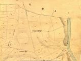
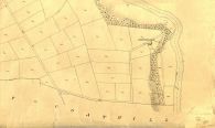
Detail of MS tithe award; plots 219 and 220 (in Cotehill) were known as 'Robin Hood' / © Crown Copyright Images reproduced by courtesy of The National Archives, London, England. www.NationalArchives.gov.uk & www.TheGenealogist.co.uk.
Detail of MS tithe award; plots 563 and 563a (in Wetheral) were known as 'Robin Hood' / © Crown Copyright Images reproduced by courtesy of The National Archives, London, England. www.NationalArchives.gov.uk & www.TheGenealogist.co.uk.

