Robin's Tump (Cardington)
| Locality | |
|---|---|
| Coordinate | 52.555, -2.7631 |
| Adm. div. | Shropshire |
| Vicinity | 750 m WNW of Willstone |
| Type | Prehistoric site |
| Interest | Robin Hood name |
| Status | Extant |
| First Record | 1883 |
By Henrik Thiil Nielsen, 2017-06-06. Revised by Henrik Thiil Nielsen, 2021-01-06.
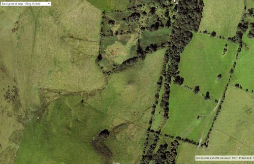
Robin's Tump is a small bowl barrow in the parish of Cardington (Shropshire), c. 750 m WNW of the hamlet of Willstone. Margaret Gelling, in the English Place-Name Society's first volume on Shropshire, explains the name as "probably an allusion to Robin Hood, who appears fairly frequently in Sa[lop] minor names".[1]
The Tump is "situated on the top of a west to east spur below the summit of Caer Caradoc Hill",[2]. This small, relatively well-preserved Bronze Age barrow is circular in plan, has a diameter of c. 9 m and a maximum height of c. 80 cm.[2]
The earliest references I have found for this place-name so far are the 25" and 6" O.S. maps of the area published in 1883 (see Maps section below).
Gazetteers
- Not included in Dobson, R. B., ed.; Taylor, J., ed. Rymes of Robyn Hood: an Introduction to the English Outlaw (London, 1976), pp. 293-311.
Sources
- Gelling, Margaret; Foxall, H.D.G.; Champion, W.; Cavill, Paul, introd.; Coates, Richard, gen. ed. & introd. The Place-Names of Shropshire (English Place-Name Society, vols. LXII/LXIII, LXX, LXXVI, LXXX, LXXXII, LXXXIX) ([s.l.], 1990; Nottingham, 1995-2012), pt. I, p. 127
- Historic England: Bowl barrow on Robin's Tump, 600m south west of Hill House.
Maps
- 25" O.S. map Shropshire LVI.2(1883; surveyed 1882)
- 25" O.S. map Shropshire LVI.2(1903; rev. 1901)
- 25" O.S. map Shropshire LVI.2(1927; rev. 1925)
- 6" O.S. map Shropshire LVI.NW (1883; surveyed 1882)
- 6" O.S. map Shropshire LVI.NW (1903; rev. 1901)
- 6" O.S. map Shropshire LVI.NW (1903; rev. 1901) (georeferenced)
- 6" O.S. map Shropshire LVI.NW (1928; rev. 1925)
- 6" O.S. map Shropshire LVI.NW (c. 1953; rev. 1949).
Also see
Notes
- ↑ Gelling, Margaret; Foxall, H.D.G.; Champion, W.; Cavill, Paul, introd.; Coates, Richard, gen. ed. & introd. The Place-Names of Shropshire (English Place-Name Society, vols. LXII/LXIII, LXX, LXXVI, LXXX, LXXXII, LXXXIX) ([s.l.], 1990; Nottingham, 1995-2012), pt. I, p. 127. IRHB's brackets.
- ↑ 2.0 2.1 Historic England: Bowl barrow on Robin's Tump, 600m south west of Hill House.

