
Sherwood Place (Wolston Close, Solihull): Difference between revisions
From International Robin Hood Bibliography
mNo edit summary |
mNo edit summary |
||
| Line 3: | Line 3: | ||
[[File:{{#var:Pnimage}}|thumb|right|500px|Sherwood Place / Google Earth Street View.]] | [[File:{{#var:Pnimage}}|thumb|right|500px|Sherwood Place / Google Earth Street View.]] | ||
<p id="byline">By Henrik Thiil Nielsen, 2018-05-25. Revised by {{#realname:{{REVISIONUSER}}}}, {{REVISIONYEAR}}-{{REVISIONMONTH}}-{{REVISIONDAY2}}.</p><div class="no-img"> | <p id="byline">By Henrik Thiil Nielsen, 2018-05-25. Revised by {{#realname:{{REVISIONUSER}}}}, {{REVISIONYEAR}}-{{REVISIONMONTH}}-{{REVISIONDAY2}}.</p><div class="no-img"> | ||
A housing complex on Pailton Road/Wolston Close, Solihull, built ''c.'' 2013, is named Sherwood Place, a name perhaps inspired by the presence of several localities with Robin Hood-related names in the area.{{#ask:[[Category:Records ({{#ifeq:{{#pos:{{PAGENAME}}|(|}}||{{PAGENAME}}|{{#sub:{{PAGENAME}}|0| {{#expr:{{#pos:{{PAGENAME}}|(|}}-1}} }},{{#sub:{{PAGENAME}}|{{#expr:{{#pos:{{PAGENAME}}|(|}}-1}}|1}}{{#sub:{{PAGENAME}}|{{#expr:{{#pos:{{PAGENAME}}|(|}}+1}}}}}}]]| format=embedded|embedformat=h4|columns=1|limit=1000|sort=Utitle|intro=<h3>Records</h3>}}{{#ask:[[Category:Allusions ({{#ifeq:{{#pos:{{PAGENAME}}|(|}}||{{PAGENAME}}|{{#sub:{{PAGENAME}}|0| {{#expr:{{#pos:{{PAGENAME}}|(|}}-1}} }},{{#sub:{{PAGENAME}}|{{#expr:{{#pos:{{PAGENAME}}|(|}}-1}}|1}}{{#sub:{{PAGENAME}}|{{#expr:{{#pos:{{PAGENAME}}|(|}}+1}}}}}}]]| format=embedded|embedformat=h4|columns=1|limit=1000|sort=Utitle|intro=<h3>Allusions</h3>}} | A housing complex on Pailton Road/Wolston Close, Solihull, built ''c.'' 2013, is named Sherwood Place, a name perhaps inspired by the presence of several localities with Robin Hood-related names in the area. It seems to have been built ''c.'' 2013.<ref>The flats had sold out by 16 Jul. 2014, see [http://www.geograph.org.uk/photo/4075159 Geograph: SP1180 : Sherwood Place, development.]</ref>{{#ask:[[Category:Records ({{#ifeq:{{#pos:{{PAGENAME}}|(|}}||{{PAGENAME}}|{{#sub:{{PAGENAME}}|0| {{#expr:{{#pos:{{PAGENAME}}|(|}}-1}} }},{{#sub:{{PAGENAME}}|{{#expr:{{#pos:{{PAGENAME}}|(|}}-1}}|1}}{{#sub:{{PAGENAME}}|{{#expr:{{#pos:{{PAGENAME}}|(|}}+1}}}}}}]]| format=embedded|embedformat=h4|columns=1|limit=1000|sort=Utitle|intro=<h3>Records</h3>}}{{#ask:[[Category:Allusions ({{#ifeq:{{#pos:{{PAGENAME}}|(|}}||{{PAGENAME}}|{{#sub:{{PAGENAME}}|0| {{#expr:{{#pos:{{PAGENAME}}|(|}}-1}} }},{{#sub:{{PAGENAME}}|{{#expr:{{#pos:{{PAGENAME}}|(|}}-1}}|1}}{{#sub:{{PAGENAME}}|{{#expr:{{#pos:{{PAGENAME}}|(|}}+1}}}}}}]]| format=embedded|embedformat=h4|columns=1|limit=1000|sort=Utitle|intro=<h3>Allusions</h3>}} | ||
<!--=== Gazetteers === | <!--=== Gazetteers === | ||
=== Sources ===--> | === Sources ===--> | ||
| Line 17: | Line 17: | ||
* [https://maps.nls.uk/view/101584864#zoom=4&lat=2004&lon=2598&layers=BT 6" O.S. map ''Warwickshire'' XIX.NE (1920; rev. 1913-14)] | * [https://maps.nls.uk/view/101584864#zoom=4&lat=2004&lon=2598&layers=BT 6" O.S. map ''Warwickshire'' XIX.NE (1920; rev. 1913-14)] | ||
* [https://maps.nls.uk/view/101584861#zoom=4&lat=1860&lon=2846&layers=BT 6" O.S. map ''Warwickshire'' XIX.NE (''c.'' 1946; rev. 1938).] | * [https://maps.nls.uk/view/101584861#zoom=4&lat=1860&lon=2846&layers=BT 6" O.S. map ''Warwickshire'' XIX.NE (''c.'' 1946; rev. 1938).] | ||
<!--=== Discussion === | <!--=== Discussion ===--> | ||
=== Background === | === Background === | ||
* [http://www.geograph.org.uk/photo/4075159 Geograph: SP1180 : Sherwood Place, development.]<!-- | |||
=== Brief mention ===--> | === Brief mention ===--> | ||
{{PnItemAlsoSee}} | {{PnItemAlsoSee}} | ||
=== Notes === | |||
<references/ | <references/> | ||
</div> | </div> | ||
{{ImgGalleryIntro}} | {{ImgGalleryIntro}} | ||
<gallery widths="195px"> | <gallery widths="195px"> | ||
File:sherwood-place-wolston-close-solihull-google-earth-street-view.jpg|Sherwood Place / Google Earth Street View. | |||
</gallery | File:geograph-4075159-by-Alex-McGregor.jpg|Sherwood Place / [geograph-4075159-by-Alex-McGregor Alex McGregor, 16 Jul. 2014, Creative Commons, via Geograph.] | ||
</gallery> | |||
{{PnItemNav}} | {{PnItemNav}} | ||
Revision as of 03:01, 25 May 2018
Sherwood Place
[[File:|thumb|right|500px|Sherwood Place / Google Earth Street View.]]
By Henrik Thiil Nielsen, 2018-05-25. Revised by Henrik Thiil Nielsen, 2018-05-25.
A housing complex on Pailton Road/Wolston Close, Solihull, built c. 2013, is named Sherwood Place, a name perhaps inspired by the presence of several localities with Robin Hood-related names in the area. It seems to have been built c. 2013.[1]
Maps
- 25" O.S. map Warwickshire XIX.7 (1888; surveyed 1886)
- 25" O.S. map Warwickshire XIX.7 (1904; rev. 1903)
- 25" O.S. map Warwickshire XIX.7 (1904; rev. 1903) (georeferenced)
- 25" O.S. map Warwickshire XIX.7 (1917; rev. 1913-14)
- 25" O.S. map Warwickshire XIX.7 (1939; rev. 1937)
- 6" O.S. map Warwickshire XIX.NE (1886; surveyed 1886)
- 6" O.S. map Warwickshire XIX.NE (1905; rev. 1902-1903)
- 6" O.S. map Warwickshire XIX.NE (1905; rev. 1902-1903) (georeferenced)
- 6" O.S. map Warwickshire XIX.NE (1920; rev. 1913-14)
- 6" O.S. map Warwickshire XIX.NE (c. 1946; rev. 1938).
Background
Notes
- ↑ The flats had sold out by 16 Jul. 2014, see Geograph: SP1180 : Sherwood Place, development.
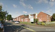
Sherwood Place / Google Earth Street View.

Sherwood Place / [geograph-4075159-by-Alex-McGregor Alex McGregor, 16 Jul. 2014, Creative Commons, via Geograph.]

