
Robin Hood Wood (Bassenthwaite)
From International Robin Hood Bibliography
Robin Hood Wood.

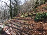
Path in Robin Hood Wood / David Brown; Geograph; Creative Commons.
By Henrik Thiil Nielsen, 2017-08-30. Revised by Henrik Thiil Nielsen, 2020-05-17.
Robin Hood Wood is situated immediately north of Bassenthwaite. About 200 m NNW are Robin Hood farm and Robin Hood Cottage. Robin Hood Holiday Park is located c. 300 m northwest. Robin Hood Wood is included on the 6" O.S. map of the area published in 1867 as well as subsequent revisions (see Maps section below). Template:PnItemQry
Gazetteers
- Not included in Dobson, R. B., ed.; Taylor, J., ed. Rymes of Robyn Hood: an Introduction to the English Outlaw (London, 1976), pp. 293-311.
Maps
- 6" O.S. map Cumberland XLVI (1867; surveyed 1864-65)
- 6" O.S. map Cumberland XLVI.SE (1900; rev. 1898)
- 6" O.S. map Cumberland XLVI.SE (1900; rev. 1898) (georeferenced)
- 6" O.S. map Cumberland XLVI.SE (19230; rev. 1926).
Background
Path in Robin Hood Wood / David Brown; Geograph; Creative Commons.
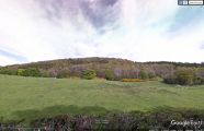
Robin Hood Wood seen from the southwest / Google Earth Street View.
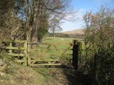
Bridleway in Robin Hood Wood / Adrian Taylor; Geograph; Creative Commons.
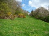
On the bridleway in Robin Hood Wood / Christine Johnstone; Geograph; Creative Commons.


