From International Robin Hood Bibliography
The printable version is no longer supported and may have rendering errors. Please update your browser bookmarks and please use the default browser print function instead.
| Locality |
|---|
| Coordinate |
53.614458, -1.789045 |
|---|
| Adm. div. |
West Riding of Yorkshire |
|---|
| Vicinity |
S of Berry Brow, 3.5 km S of Huddersfield |
|---|
| Type |
Building |
|---|
| Interest |
Robin Hood name |
|---|
| Status |
Extant |
|---|
| First Record |
|
|---|
Loading map...
{"minzoom":false,"maxzoom":false,"mappingservice":"leaflet","width":"34%","height":"400px","centre":false,"title":"","label":"","icon":"","lines":[],"polygons":[],"circles":[],"rectangles":[],"copycoords":false,"static":false,"zoom":false,"defzoom":9,"layers":["OpenStreetMap","NLS","Stamen.Terrain"],"image layers":[],"overlays":[],"resizable":false,"fullscreen":true,"scrollwheelzoom":true,"cluster":false,"clustermaxzoom":20,"clusterzoomonclick":true,"clustermaxradius":80,"clusterspiderfy":true,"geojson":"","clicktarget":"","imageLayers":[],"locations":[{"text":"\u003Cdiv class=\"mw-parser-output\"\u003E\u003Cp\u003ERobin Hood Tunnel (Berry Brow)\n\u003C/p\u003E\u003C/div\u003E","title":"Robin Hood Tunnel (Berry Brow)\n","link":"","lat":53.614458,"lon":-1.789045,"icon":""}],"imageoverlays":null}
Robin Hood Tunnel.
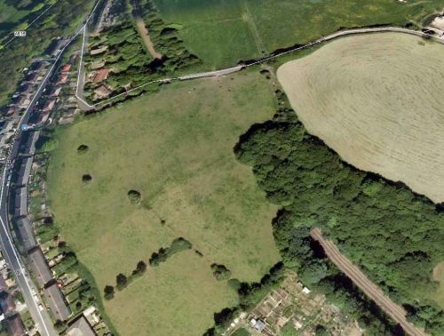
The Huddersfield–Penistone line runs through the Robin Hood Tunnel / Google Earth.
By Henrik Thiil Nielsen, 2013-08-04. Revised by Henrik Thiil Nielsen, 2021-01-06.
A tunnel on the Huddersfield-Penistone railway line is named Robin Hood Tunnel. It is situated near Berry Brow, not far from Robin Hood Hill and Robin Hood House.
Gazetteers
Background
Also see

