Robin Hood Quarries (Thorpe-on-the-Hill): Difference between revisions
From International Robin Hood Bibliography
m (Text replacement - ".</p><div class="no-img">" to ".</p> <div class="no-img">") |
mNo edit summary |
||
| Line 1: | Line 1: | ||
__NOTOC__{{PnItemTop|Lat=53.7366|Lon=-1.5192|AdmDiv=Yorkshire|Vicinity=In Thorpe-on-the-Hill|Type=Establishment|Interest=Robin Hood name|Status=Extant|Demonym=|Riding=West|GreaterLondon=|Year=1894|Aka=|Century=|Cluster1=|Cluster2=|Cluster3=|Image=robin-hood-quarries-thorpe-on-the-hill-google-earth.jpg|Postcards=|ExtraCat1=|ExtraCat2=|ExtraCat3=|ExtraCat4=|ExtraCat5=|GeopointPrefix=|GeopointSuffix=|StatusSuffix=?|DatePrefix=|DateSuffix=}} | __NOTOC__{{PnItemTop|Lat=53.7366|Lon=-1.5192|AdmDiv=Yorkshire|Vicinity=In Thorpe-on-the-Hill|Type=Establishment|Interest=Robin Hood name|Status=Extant|Demonym=|Riding=West|GreaterLondon=|Year=1894|Aka=|Century=|Cluster1=Robin Hood|Cluster2=Wakefield|Cluster3=|Image=robin-hood-quarries-thorpe-on-the-hill-google-earth.jpg|Postcards=|ExtraCat1=|ExtraCat2=|ExtraCat3=|ExtraCat4=|ExtraCat5=|GeopointPrefix=|GeopointSuffix=|StatusSuffix=?|DatePrefix=|DateSuffix=}} | ||
{{#display_map:{{#var:Coords}}|width=34%}}<div class="pnMapLegend">The site of Robin Hood Quarries.</div> | {{#display_map:{{#var:Coords}}|width=34%}}<div class="pnMapLegend">The site of Robin Hood Quarries.</div> | ||
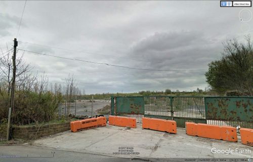
[[File:robin-hood-quarries-thorpe-on-the-hill-google-earth.jpg|thumb|right|500px|The quarry is in there / Google Earth Street View.]] | [[File:robin-hood-quarries-thorpe-on-the-hill-google-earth.jpg|thumb|right|500px|The quarry is in there / Google Earth Street View.]] | ||
| Line 15: | Line 15: | ||
* [http://maps.nls.uk/view/100947680#zoom=5&lat=3265&lon=7816&layers=BT 6" O.S. map ''Yorkshire'' CCXXXIII.NE (1950; rev. 1948).] | * [http://maps.nls.uk/view/100947680#zoom=5&lat=3265&lon=7816&layers=BT 6" O.S. map ''Yorkshire'' CCXXXIII.NE (1950; rev. 1948).] | ||
{{PnItemAlsoSee}} | |||
Revision as of 13:19, 21 December 2017
The site of Robin Hood Quarries.
By Henrik Thiil Nielsen, 2016-12-31. Revised by Henrik Thiil Nielsen, 2017-12-21.
Robin Hood Quarries in Thorpe-on-the-Hill was established sometime after 1851 but before 1892. It is indicated on all subsequent revisions of the map during the first half of the 20th century (see 6" O.S. maps of the area listed below in the Maps section).
Maps
- 6" O.S. map Yorkshire 233 (1854; rev. 1848-51)
- 6" O.S. map Yorkshire CCXXXIII.NW (1894; surveyed 1890-92)
- 6" O.S. map Yorkshire CCXXXIII.NW (1908; rev. 1905)
- 6" O.S. map Yorkshire CCXXXIII.NW (1908; rev. 1905) (georeferenced)
- 6" O.S. map Yorkshire CCXXXIII.NW (1931; rev. 1931-32 [''sic''])
- 6" O.S. map Yorkshire CCXXXIII.NW (1945; rev. 1938)
- 6" O.S. map Yorkshire CCXXXIII.NE (1950; rev. 1948).

