
Robin Hood Holiday Park (Bassenthwaite): Difference between revisions
m (Text replacement - "|service=leaflet}}" to "|service=leaflet|enablefullscreen=yes}}") |
m (→Maps) |
||
| Line 16: | Line 16: | ||
* [http://maps.nls.uk/view/101091685#zoom=5&lat=2716&lon=7526&layers=BT 6" O.S. map ''Cumberland'' XLVI.SE (1900; rev. 1898)] | * [http://maps.nls.uk/view/101091685#zoom=5&lat=2716&lon=7526&layers=BT 6" O.S. map ''Cumberland'' XLVI.SE (1900; rev. 1898)] | ||
* [http://maps.nls.uk/geo/explore/#zoom=17&lat=54.6854&lon=-3.2002&layers=171&b=1 6" O.S. map ''Cumberland'' XLVI.SE (1900; rev. 1898)] (georeferenced) | * [http://maps.nls.uk/geo/explore/#zoom=17&lat=54.6854&lon=-3.2002&layers=171&b=1 6" O.S. map ''Cumberland'' XLVI.SE (1900; rev. 1898)] (georeferenced) | ||
* [http://maps.nls.uk/view/101091682#zoom=5&lat=2945&lon=7627&layers=BT 6" O.S. map ''Cumberland'' XLVI.SE (19230; rev. 1926)] | * [http://maps.nls.uk/view/101091682#zoom=5&lat=2945&lon=7627&layers=BT 6" O.S. map ''Cumberland'' XLVI.SE (19230; rev. 1926).] | ||
== Background == | == Background == | ||
Revision as of 14:21, 30 May 2019

By Henrik Thiil Nielsen, 2017-08-29. Revised by Henrik Thiil Nielsen, 2019-05-30.
Robin Hood Holiday Park immediately NW of Robin Hood (Bassenthwaite), c. 2 km NE of Bassenthwaite Lake and c. 0.6 km NNW of Bassenthwaite village, is a cluster of recently constructed, individually owned holiday lodges.[1] Also known simply as Robin Hood Park, Robin Hood Holiday Park was previously known as 'Robin Hood Caravan Park'.[2] Template:PnItemQry
Gazetteers
- Not included in Dobson, R. B., ed.; Taylor, J., ed. Rymes of Robyn Hood: an Introduction to the English Outlaw (London, 1976), pp. 293-311.
Maps
Robin Hood (Bassenthwaite) vicinity labelled and indicated.
- 25" O.S. map Cumberland XLVI.16 (1900; rev. 1898)
- 25" O.S. map Cumberland XLVI.16 (1925; rev. 1923)
- 6" O.S. map Cumberland XLVI (1867; surveyed 1864-65)
- 6" O.S. map Cumberland XLVI.SE (1900; rev. 1898)
- 6" O.S. map Cumberland XLVI.SE (1900; rev. 1898) (georeferenced)
- 6" O.S. map Cumberland XLVI.SE (19230; rev. 1926).
Background
Notes
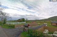
Robin Hood Holiday Park / Google Earth Street View.]
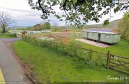
Robin Hood Holiday Park. Someone liked the colour of absinthe! / Google Earth Street View.]
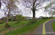
Robin Hood Holiday Park / Google Earth Street View.]
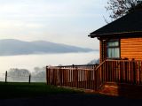
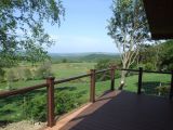
View from the holiday park / Robin Hood Holiday Park
View from cottage at the holiday park / Robin Hood Holiday Park
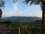
View from cottage at the holiday park / Robin Hood Holiday Park
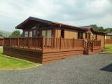
Cottage at the holiday park / Robin Hood Holiday Park

View from the holiday park / Robin Hood Holiday Park


