Robin Hood Gardens (Poplar): Difference between revisions
m (Text replacement - "|service=leaflet}}" to "|service=leaflet|enablefullscreen=yes}}") |
mNo edit summary |
||
| Line 7: | Line 7: | ||
<div class="no-img"> | <div class="no-img"> | ||
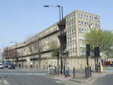
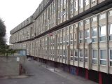
Robin Hood Gardens is a council housing estate designed 1966-67 by Alison and Peter Smithson, built 1968-72, on a site bounded to the north by Woolmore Street, [[Robin Hood Lane (Poplar)| Robin Hood Lane]] to the east, Poplar High Street and the A1261 to the south, and to the west Cotton Street. From its inception this project has remained highly controversial, and after a decade-long struggle over its fate, its two large concrete blocks are now being torn down, work of demolition having just started in December of 2017 on the western block along Cotton Street. | Robin Hood Gardens is a council housing estate designed 1966-67 by Alison and Peter Smithson, built 1968-72, on a site bounded to the north by Woolmore Street, [[Robin Hood Lane (Poplar)| Robin Hood Lane]] to the east, Poplar High Street and the A1261 to the south, and to the west Cotton Street. From its inception this project has remained highly controversial, and after a decade-long struggle over its fate, its two large concrete blocks are now being torn down, work of demolition having just started in December of 2017 on the western block along Cotton Street. | ||
{{PnItemQry}} | |||
== Gazetteers == | |||
* Not included in {{:Dobson, Richard Barrie 1976a}}, pp. 293-311. | |||
== Maps == | == Maps == | ||
| Line 13: | Line 16: | ||
** [http://british-library.georeferencer.com/map/1q1TvydVT7tT7GhHPDuDXd/201311092154-uoGUoh/visualize British Library: Online Gallery]; section, including Robin Hood Lane, as an overlay on Google Maps | ** [http://british-library.georeferencer.com/map/1q1TvydVT7tT7GhHPDuDXd/201311092154-uoGUoh/visualize British Library: Online Gallery]; section, including Robin Hood Lane, as an overlay on Google Maps | ||
** [http://www.crouchrarebooks.com/maps/view/gascoyne-joel-an-actual-survey-of-the-parish-of-st.-dunstan-stepney-alias-s Daniel Crouch Rare Books Eastenders]; entire map (reduced size) | ** [http://www.crouchrarebooks.com/maps/view/gascoyne-joel-an-actual-survey-of-the-parish-of-st.-dunstan-stepney-alias-s Daniel Crouch Rare Books Eastenders]; entire map (reduced size) | ||
* [https://maps.nls.uk/view/103313027#zoom=5&lat=2081&lon=7181&layers=BT 25" O.S. map ''London (1869; surveyed 1867)] | * [https://maps.nls.uk/view/103313027#zoom=5&lat=2081&lon=7181&layers=BT 25" O.S. map ''London'' (1869; surveyed 1867)] | ||
* [https://maps.nls.uk/view/104194818#zoom=4&lat=2049&lon=6744&layers=BT 25" O.S. map ''Essex (1916; rev. 1914)] | * [https://maps.nls.uk/view/104194818#zoom=4&lat=2049&lon=6744&layers=BT 25" O.S. map ''Essex'' (1916; rev. 1914)] | ||
* [http://maps.nls.uk/geo/explore/#zoom=18&lat=51.5102&lon=-0.0075&layers=168&b=1 25" O.S. map ''Essex'' LXXXVI.9 (1916; rev. 1914)] (georeferenced) | * [http://maps.nls.uk/geo/explore/#zoom=18&lat=51.5102&lon=-0.0075&layers=168&b=1 25" O.S. map ''Essex'' LXXXVI.9 (1916; rev. 1914)] (georeferenced) | ||
* [https://maps.nls.uk/view/102342032#zoom=6&lat=9428&lon=6474&layers=BT 6" O.S. map ''Essex'' LXXXI (1870-82; surveyed 1862-73)] | * [https://maps.nls.uk/view/102342032#zoom=6&lat=9428&lon=6474&layers=BT 6" O.S. map ''Essex'' LXXXI (1870-82; surveyed 1862-73)] | ||
| Line 23: | Line 26: | ||
* [https://maps.nls.uk/view/101456111#zoom=5&lat=5071&lon=6364&layers=BT 6" O.S. map ''Essex'' LXXXI.NW (1899; rev. 1893-94)] | * [https://maps.nls.uk/view/101456111#zoom=5&lat=5071&lon=6364&layers=BT 6" O.S. map ''Essex'' LXXXI.NW (1899; rev. 1893-94)] | ||
* [https://maps.nls.uk/view/101427837#zoom=5&lat=4646&lon=5402&layers=BT 6" O.S. map ''Kent'' I.NE (1899; rev. 1893-94)] | * [https://maps.nls.uk/view/101427837#zoom=5&lat=4646&lon=5402&layers=BT 6" O.S. map ''Kent'' I.NE (1899; rev. 1893-94)] | ||
* [http://maps.nls.uk/geo/explore/#zoom=17&lat=51.5105&lon=-0.0075&layers=6&b=1 6" O.S. map 'Kent' I.NE (1899; rev. 1893-94)] (georeferenced) | * [http://maps.nls.uk/geo/explore/#zoom=17&lat=51.5105&lon=-0.0075&layers=6&b=1 6" O.S. map 'Kent' I.NE (1899; rev. 1893-94)] (georeferenced) | ||
* [https://maps.nls.uk/view/102345870#zoom=6&lat=3974&lon=1908&layers=BT 6" O.S. map ''London'' Sheet L (1920; rev. 1913-15)] | * [https://maps.nls.uk/view/102345870#zoom=6&lat=3974&lon=1908&layers=BT 6" O.S. map ''London'' Sheet L (1920; rev. 1913-15)] | ||
* [https://maps.nls.uk/view/102345867#zoom=6&lat=4060&lon=2243&layers=BT 6" O.S. map ''London'' Sheet L (''c.'' 1946; rev. 1938).] | * [https://maps.nls.uk/view/102345867#zoom=6&lat=4060&lon=2243&layers=BT 6" O.S. map ''London'' Sheet L (''c.'' 1946; rev. 1938).] | ||
Revision as of 17:27, 31 May 2019
[[File:|500px|thumb|right|The west block seen from the southwest / MalcMcDonald, 30 Mar. 2012, Creative Commons, via Geograph.]]
By Henrik Thiil Nielsen, 2013-08-07. Revised by Henrik Thiil Nielsen, 2019-05-31.
Robin Hood Gardens is a council housing estate designed 1966-67 by Alison and Peter Smithson, built 1968-72, on a site bounded to the north by Woolmore Street, Robin Hood Lane to the east, Poplar High Street and the A1261 to the south, and to the west Cotton Street. From its inception this project has remained highly controversial, and after a decade-long struggle over its fate, its two large concrete blocks are now being torn down, work of demolition having just started in December of 2017 on the western block along Cotton Street. Template:PnItemQry
Gazetteers
- Not included in Dobson, R. B., ed.; Taylor, J., ed. Rymes of Robyn Hood: an Introduction to the English Outlaw (London, 1976), pp. 293-311.
Maps
- Gascoyne, Joel, cartog.; Harris, John, engr. An Actuall Survey of the Parish of St Dunstan Stepney alias Stebunheath ([London], 1703)
- Gascoyne, Joel, cartog.; Harris, John, engr. An Actuall Survey of the Parish of St. Dunstan Stepney, Alias Stebunheath: Being One of the Ten Paryshes in the County of Middlesex Adjacent to the City of London ([London], [1994?])
- British Library: Online Gallery; section, including Robin Hood Lane, as an overlay on Google Maps
- Daniel Crouch Rare Books Eastenders; entire map (reduced size)
- 25" O.S. map London (1869; surveyed 1867)
- 25" O.S. map Essex (1916; rev. 1914)
- 25" O.S. map Essex LXXXVI.9 (1916; rev. 1914) (georeferenced)
- 6" O.S. map Essex LXXXI (1870-82; surveyed 1862-73)
- 6" O.S. map Middlesex XVIII (1873; surveyed 1867)
- 6" O.S. map Surrey III (1880; surveyed 1868-73)
- 6" O.S. map London VIII.SW (1894-96; rev. 1893-94)
- 6" O.S. map Surrey III.NE (1898; rev. 1893-94)
- 6" O.S. map Essex LXXXI.NW (1899; rev. 1893-94)
- 6" O.S. map Kent I.NE (1899; rev. 1893-94)
- 6" O.S. map 'Kent' I.NE (1899; rev. 1893-94) (georeferenced)
- 6" O.S. map London Sheet L (1920; rev. 1913-15)
- 6" O.S. map London Sheet L (c. 1946; rev. 1938).
Background
- Robin Hood Gardens: Out of Time
- Wikipedia: Poplar
- Wikipedia: Robin Hood Gardens
- YouTube: Deezen: Drone footage captures brutalist Robin Hood Gardens ahead of imminent demolition. Viewable on this page.
- YouTube: The Architectural Review: Robin Hood Gardens: Requiem For A Dream. Viewable on this page.
The west side of the east block / Stephen Richards, Sep. 2009, Creative Commons, via Geograph
The east block from the northeast / Danny P Robinson, 11 Jul. 2009, Creative Commons, via Geograph
The east side of the east block / Stephen Richards, Sep. 2009, Creative Commons, via Geograph
East side of east block from a distance / MalcMcDonald, 30 Mar. 2012, Creative Commons, via Geograph]
West block from the southwest / MalcMcDonald, 30 Mar. 2012, Creative Commons, via Geograph]
Center of west side of west block / Stephen Richards, Sep. 2009, Creative Commons, via Geograph
'A moribund Robin Hood Gardens', west block from the west / Stephen Richards, 18 Sep. 2017
West block from the west / Danny P Robinson, 16 Sep. 2009, Creative Commons, via Geograph
West block from the west / Stephen Richards, Sep. 2009, Creative Commons, via Geograph
West block from the north east / Stephen Richards, 18 Sep. 2017
East side of west block from the southeast / Stephen Richards, Sep. 2009, Creative Commons, via Geograph


