From International Robin Hood Bibliography
The printable version is no longer supported and may have rendering errors. Please update your browser bookmarks and please use the default browser print function instead.
| Locality |
|---|
| Coordinate |
53.672617, -1.529965 |
|---|
| Adm. div. |
West Riding of Yorkshire |
|---|
| Vicinity |
2 km SW of central Wakefield |
|---|
| Type |
Thoroughfare |
|---|
| Interest |
Robin Hood name |
|---|
| Status |
Extant |
|---|
| First Record |
|
|---|
Loading map...
{"minzoom":false,"maxzoom":false,"mappingservice":"leaflet","width":"34%","height":"400px","centre":false,"title":"","label":"","icon":"","lines":[],"polygons":[],"circles":[],"rectangles":[],"copycoords":false,"static":false,"zoom":false,"defzoom":9,"layers":["OpenStreetMap","NLS","Stamen.Terrain"],"image layers":[],"overlays":[],"resizable":false,"fullscreen":true,"scrollwheelzoom":true,"cluster":false,"clustermaxzoom":20,"clusterzoomonclick":true,"clustermaxradius":80,"clusterspiderfy":true,"geojson":"","clicktarget":"","imageLayers":[],"locations":[{"text":"\u003Cdiv class=\"mw-parser-output\"\u003E\u003Cp\u003ELittle John Crescent (Wakefield)\n\u003C/p\u003E\u003C/div\u003E","title":"Little John Crescent (Wakefield)\n","link":"","lat":53.672617,"lon":-1.529965,"icon":""}],"imageoverlays":null}
Robin Hood Crescent.
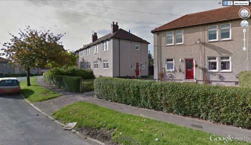
Little John Crescent / Google Earth Street View.
By Henrik Thiil Nielsen, 2014-10-19. Revised by Henrik Thiil Nielsen, 2021-01-06.
Little John Crescent and Robin Hood Crescent are two streets in a residential area c. 2 km SW of central Wakefield which together form an ellipse round Sherwood Grove.
Gazetteers
Also see

