Robin Hood Quarry (Robin Hood, Wakefield)
From International Robin Hood Bibliography
| Locality | |
|---|---|
| Coordinate | 53.7391, -1.5074 |
| Adm. div. | West Riding of Yorkshire |
| Vicinity | Leeds Road, Wakefield |
| Type | Establishment |
| Interest | Robin Hood name |
| Status | Defunct |
| First Record | 1841 |
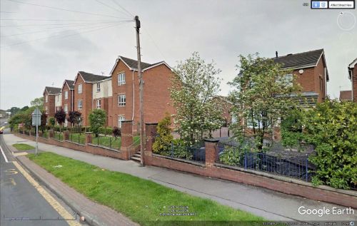
The site of Robin Hood Quarry.
By Henrik Thiil Nielsen, 2013-08-07. Revised by Henrik Thiil Nielsen, 2022-04-22.
Robin Hood Quarry was a sandstone quarry in the village of Robin Hood (Wakefield). The first record of this place-name known to IRHB is the MS tithe map, dated 1841, for the township of Lofthouse in the Parish of Rothwell.[1] It is next found included on the 6" O.S. map of the area published in 1854. The quarry is indicated, but without name, on subsequent revisions of the map published from then until 1931, when the area was used for allotment gardens (see Maps section below).
Maps
- 6" O.S. map Yorkshire 233 (1854; rev. 1848-51)
- 6" O.S. map Yorkshire CCXXXIII.NE (1894; rev. 1892)
- 6" O.S. map Yorkshire CCXXXIII.NE (1908; rev. 1905)
- 6" O.S. map Yorkshire CCXXXIII.NE (1908; rev. 1905) (georeferenced)
- 6" O.S. map Yorkshire CCXXXIII.NE (1931; rev. 1931-32) [sic]
- 6" O.S. map Yorkshire CCXXXIII.NE (1947; rev. 1938)
- 6" O.S. map Yorkshire CCXXXIII.NE (1949; rev. 1948).
MS sources
- 1841 tithe map for the township of Lofthouse in the Parish of Rothwell, online at the Genealogist.co.uk, Piece 43, sub-piece 268, Image 207 (£).
Also see
- Robin Hood (Wakefield) place-name cluster
- Wakefield place-name cluster
- Places named Robin Hood's Quarry.
Notes
- ↑ 1841 tithe map for the township of Lofthouse in the Parish of Rothwell, online at the Genealogist.co.uk, Piece 43, sub-piece 268, Image 207 (£).

