From International Robin Hood Bibliography
| Locality |
|---|
| Coordinate |
50.948373, 0.910342 |
|---|
| Adm. div. |
Kent |
|---|
| Vicinity |
Connecting Romney and Tourney roads |
|---|
| Type |
Thoroughfare |
|---|
| Interest |
Robin Hood name |
|---|
| Status |
Extant |
|---|
| First Record |
|
|---|
Loading map...
{"minzoom":false,"maxzoom":false,"mappingservice":"leaflet","width":"34%","height":"400px","centre":false,"title":"","label":"","icon":"","lines":[],"polygons":[],"circles":[],"rectangles":[],"copycoords":false,"static":false,"zoom":false,"defzoom":9,"layers":["OpenStreetMap","NLS","Stamen.Terrain"],"image layers":[],"overlays":[],"resizable":false,"fullscreen":true,"scrollwheelzoom":true,"cluster":false,"clustermaxzoom":20,"clusterzoomonclick":true,"clustermaxradius":80,"clusterspiderfy":true,"geojson":"","clicktarget":"","imageLayers":[],"locations":[{"text":"\u003Cdiv class=\"mw-parser-output\"\u003E\u003Cp\u003ERobin Hood Lane (Lydd)\n\u003C/p\u003E\u003C/div\u003E","title":"Robin Hood Lane (Lydd)\n","link":"","lat":50.948373,"lon":0.910342,"icon":""}],"imageoverlays":null}
Robin Hood Lane (Lydd).
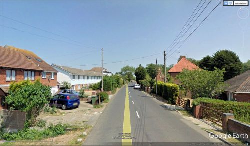
Robin Hood Lane in Lydd, Kent / Google Earth Street View.
By Henrik Thiil Nielsen, 2018-01-10. Revised by Henrik Thiil Nielsen, 2021-01-06.
Robin Hood Lane in Lydd, Kent, is a residential street connecting Romney and Tourney Roads.
Gazetteers

