Sherwood Street (Reading): Difference between revisions
From International Robin Hood Bibliography
m (Text replacement - "{{#ask:[[Category:Records ({{#ifeq:{{#pos:{{PAGENAME}}|(|}}||{{PAGENAME}}|{{#sub:{{PAGENAME}}|0| {{#expr:{{#pos:{{PAGENAME}}|(|}}-1}} }},{{#sub:{{PAGENAME}}|{{#expr:{{#pos:{{PAGENAME}}|(|}}-1}}|1}}{{#sub:{{PAGENAME}}|{{#expr:{{#pos:...) |
m (Text replacement - "{{#display_map:{{#var:Coords}}~{{#replace:{{PAGENAME}}|'|'}}|width=34%}}<div class="pnMapLegend">" to "{{#display_map:{{#var:Coords}}~{{#replace:{{PAGENAME}}|'|'}}|width=34%|service=leaflet}}<div class="pnMapLegend">") |
||
| Line 1: | Line 1: | ||
__NOTOC__{{PnItemTop|Lat=51.459293|Lon=-1.002943|AdmDiv=Berkshire|Vicinity=''c.'' 80 m N of and parallel with Oxford Street in Reading|Type=Thoroughfare|Interest=Miscellaneous|Status=Extant|Demonym=|Riding=|GreaterLondon=|Year=1900|Aka=|Century=|Cluster1=Reading|Cluster2=|Cluster3=|Image=sherwood-street-reading-google-earth-street-view.jpg|Postcards=|ExtraCat1=Places named after Sherwood Forest|ExtraCat2=|ExtraCat3=|ExtraCat4=|ExtraCat5=|ExtraLink1=|ExtraLink2=|ExtraLink3=|ExtraLink4=|ExtraLink5=|ExtraLinkName1=|ExtraLinkName2=|ExtraLinkName3=|ExtraLinkName4=|ExtraLinkName5=|GeopointPrefix=|GeopointSuffix=|StatusSuffix=|DatePrefix=|DateSuffix=}} | __NOTOC__{{PnItemTop|Lat=51.459293|Lon=-1.002943|AdmDiv=Berkshire|Vicinity=''c.'' 80 m N of and parallel with Oxford Street in Reading|Type=Thoroughfare|Interest=Miscellaneous|Status=Extant|Demonym=|Riding=|GreaterLondon=|Year=1900|Aka=|Century=|Cluster1=Reading|Cluster2=|Cluster3=|Image=sherwood-street-reading-google-earth-street-view.jpg|Postcards=|ExtraCat1=Places named after Sherwood Forest|ExtraCat2=|ExtraCat3=|ExtraCat4=|ExtraCat5=|ExtraLink1=|ExtraLink2=|ExtraLink3=|ExtraLink4=|ExtraLink5=|ExtraLinkName1=|ExtraLinkName2=|ExtraLinkName3=|ExtraLinkName4=|ExtraLinkName5=|GeopointPrefix=|GeopointSuffix=|StatusSuffix=|DatePrefix=|DateSuffix=}} | ||
{{#display_map:{{#var:Coords}}~{{#replace:{{PAGENAME}}|'|'}}|width=34%}}<div class="pnMapLegend">The northern part of the now bi-, tri or more-sected Little John's Lane in Reading.</div> | {{#display_map:{{#var:Coords}}~{{#replace:{{PAGENAME}}|'|'}}|width=34%|service=leaflet}}<div class="pnMapLegend">The northern part of the now bi-, tri or more-sected Little John's Lane in Reading.</div> | ||
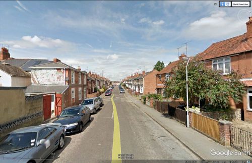
[[File:sherwood-street-reading-google-earth-street-view.jpg|thumb|right|500px|Looking west on Sherwood Street / Google Earth Street View.]] | [[File:sherwood-street-reading-google-earth-street-view.jpg|thumb|right|500px|Looking west on Sherwood Street / Google Earth Street View.]] | ||
<p id="byline">By Henrik Thiil Nielsen, 2017-11-17. Revised by {{#realname:{{REVISIONUSER}}}}, {{REVISIONYEAR}}-{{REVISIONMONTH}}-{{REVISIONDAY2}}.</p> | <p id="byline">By Henrik Thiil Nielsen, 2017-11-17. Revised by {{#realname:{{REVISIONUSER}}}}, {{REVISIONYEAR}}-{{REVISIONMONTH}}-{{REVISIONDAY2}}.</p> | ||
Revision as of 09:01, 5 April 2019
The northern part of the now bi-, tri or more-sected Little John's Lane in Reading.
By Henrik Thiil Nielsen, 2017-11-17. Revised by Henrik Thiil Nielsen, 2019-04-05.
Sherwood Street in Reading most likely owes its name to the presence in the neighbourhood of several localities named after Little John. The map evidence (see Maps section below) indicates that the street came into being probably after 1883 and certainly after 1877. Template:PnItemQry
Gazetteers
- Not included in Dobson, R. B., ed.; Taylor, J., ed. Rymes of Robyn Hood: an Introduction to the English Outlaw (London, 1976), pp. 293-311.
Maps
- 25" O.S. map Berkshire XXXVII.2 (1911; rev. 1910) (street labelled)
- 25" O.S. map Berkshire XXXVII.2 (1934; rev. 1932) (street labelled)
- 25" O.S. map Berkshire XXXVII.2 (1911; rev. 1910) (street labelled)
- 25" O.S. map Berkshire XXXVII.2 (1934; rev. 1932) (street labelled)
- 6" O.S. map Berkshire XXXVII (1883; surveyed 1872-77) (street not on map)
- 6" O.S. map Berkshire XXXVII.NW (1900; rev. 1898) (street labelled)
- 6" O.S. map Berkshire XXXVII.NW (1900; rev. 1898) (georeferenced) (street labelled)
- 6" O.S. map Berkshire XXXVII.NW (1914; rev. 1910) (street labelled)
- 6" O.S. map Berkshire XXXVII.NW (c. 1935; rev. 1932) (street labelled)
- 6" O.S. map Berkshire XXXVII.NW (c. 1944; rev. 1938) (street labelled).
Background

