
Sherwood Place (Wolston Close, Solihull): Difference between revisions
From International Robin Hood Bibliography
m (Text replacement - "{{#var:Coords}}~{{PAGENAME}}" to "{{#var:Coords}}~{{#replace:{{PAGENAME}}|'|'}}") |
m (Text replacement - "ImgGalleryIntro" to "ImageGalleryIntroduction") |
||
| (30 intermediate revisions by 2 users not shown) | |||
| Line 1: | Line 1: | ||
__NOTOC__{{ | __NOTOC__{{PlaceNamesItemTop|Lat=52.418548|Lon=-1.828084|AdministrativeDivision=Warwickshire|Vicinity=NW of Olton Road|Type=Area|Interest=Miscellaneous|Status=Extant|Demonym=English|Riding=|GreaterLondon=|Year=2013|Aka=|Century=|Cluster1=Kineton Green|Cluster2=|Cluster3=|Image=sherwood-place-wolston-close-solihull-google-earth-street-view.jpg|Postcards=|ExtraCat1=Places named after Sherwood Forest|ExtraCat2=|ExtraCat3=|ExtraCat4=|ExtraCat5=|ExtraLink1=|ExtraLink2=|ExtraLink3=|ExtraLink4=|ExtraLink5=|ExtraLinkName1=|ExtraLinkName2=|ExtraLinkName3=|ExtraLinkName4=|ExtraLinkName5=|GeopointPrefix=|GeopointSuffix=|StatusSuffix=|DatePrefix=''c. ''|DateSuffix=}} | ||
{{#display_map:{{#var:Coords}}~{{#replace:{{PAGENAME}}|'|'}}|width=34%}}<div class="pnMapLegend">Sherwood Place</div> | {{#display_map:{{#var:Coords}}~{{#replace:{{PAGENAME}}|'|'}}|width=34%|enablefullscreen=yes}}<div class="pnMapLegend">Sherwood Place</div> | ||
[[File:{{#var: | [[File:{{#var:Image}}|thumb|right|500px|Sherwood Place / Google Earth Street View.]]<div class="no-img"> | ||
<p id="byline">By Henrik Thiil Nielsen, 2018-05-25. Revised by {{#realname:{{REVISIONUSER}}}}, {{REVISIONYEAR}}-{{REVISIONMONTH}}-{{REVISIONDAY2}}.</p | <p id="byline">By Henrik Thiil Nielsen, 2018-05-25. Revised by {{#realname:{{REVISIONUSER}}}}, {{REVISIONYEAR}}-{{REVISIONMONTH}}-{{REVISIONDAY2}}.</p> | ||
A housing complex on Pailton Road/Wolston Close, Solihull, built ''c.'' 2013, is named Sherwood Place, a name perhaps inspired by the presence of several localities with Robin Hood-related names in the area. It seems to have been built ''c.'' 2013.<ref>The flats had sold out by 16 Jul. 2014, see [http://www.geograph.org.uk/photo/4075159 Geograph: SP1180 : Sherwood Place, development.]</ref>{{ | A housing complex on Pailton Road/Wolston Close, Solihull, built ''c.'' 2013, is named Sherwood Place, a name perhaps inspired by the presence of several localities with Robin Hood-related names in the area. It seems to have been built ''c.'' 2013.<ref>The flats had sold out by 16 Jul. 2014, see [http://www.geograph.org.uk/photo/4075159 Geograph: SP1180 : Sherwood Place, development.]</ref> | ||
<!-- | {{PlaceNamesItemAllusionsAndRecords}} | ||
== Gazetteers == | |||
* Not included in {{:Dobson, Richard Barrie 1976a}}, pp. 293-311.<!-- | |||
== Sources ==--> | |||
== Maps == | |||
* [https://maps.nls.uk/view/115633969#zoom=3&lat=3463&lon=6333&layers=BT 25" O.S. map ''Warwickshire'' XIX.7 (1888; surveyed 1886)] | * [https://maps.nls.uk/view/115633969#zoom=3&lat=3463&lon=6333&layers=BT 25" O.S. map ''Warwickshire'' XIX.7 (1888; surveyed 1886)] | ||
* [https://maps.nls.uk/view/115633972#zoom=3&lat=3838&lon=6915&layers=BT 25" O.S. map ''Warwickshire'' XIX.7 (1904; rev. 1903)] | * [https://maps.nls.uk/view/115633972#zoom=3&lat=3838&lon=6915&layers=BT 25" O.S. map ''Warwickshire'' XIX.7 (1904; rev. 1903)] | ||
| Line 17: | Line 20: | ||
* [https://maps.nls.uk/view/101584864#zoom=4&lat=2004&lon=2598&layers=BT 6" O.S. map ''Warwickshire'' XIX.NE (1920; rev. 1913-14)] | * [https://maps.nls.uk/view/101584864#zoom=4&lat=2004&lon=2598&layers=BT 6" O.S. map ''Warwickshire'' XIX.NE (1920; rev. 1913-14)] | ||
* [https://maps.nls.uk/view/101584861#zoom=4&lat=1860&lon=2846&layers=BT 6" O.S. map ''Warwickshire'' XIX.NE (''c.'' 1946; rev. 1938).] | * [https://maps.nls.uk/view/101584861#zoom=4&lat=1860&lon=2846&layers=BT 6" O.S. map ''Warwickshire'' XIX.NE (''c.'' 1946; rev. 1938).] | ||
<!-- | <!--== Discussion ==--> | ||
== Background == | |||
* [http://www.geograph.org.uk/photo/4075159 Geograph: SP1180 : Sherwood Place, development.]<!-- | * [http://www.geograph.org.uk/photo/4075159 Geograph: SP1180 : Sherwood Place, development.]<!-- | ||
== Brief mention ==--> | |||
{{ | {{PlaceNamesItemAlsoSee}} | ||
== Notes == | |||
<references/> | <references/> | ||
</div> | |||
< | <div id="gallery"> | ||
{{ | {{ImageGalleryIntroduction}} | ||
<gallery widths="195px"> | <gallery widths="195px"> | ||
File:sherwood-place-wolston-close-solihull-google-earth-street-view.jpg|Sherwood Place / Google Earth Street View. | File:sherwood-place-wolston-close-solihull-google-earth-street-view.jpg|Sherwood Place / Google Earth Street View. | ||
File:geograph-4075159-by-Alex-McGregor.jpg|Sherwood Place / [geograph-4075159-by-Alex-McGregor Alex McGregor, 16 Jul. 2014, Creative Commons, via Geograph.] | File:geograph-4075159-by-Alex-McGregor.jpg|Sherwood Place / [geograph-4075159-by-Alex-McGregor Alex McGregor, 16 Jul. 2014, Creative Commons, via Geograph.] | ||
</gallery> | </gallery> | ||
</div> | |||
{{PlaceNamesItemNavigation}} | |||
{{ | |||
Latest revision as of 13:54, 7 January 2021
| Locality | |
|---|---|
| Coordinate | 52.418548, -1.828084 |
| Adm. div. | Warwickshire |
| Vicinity | NW of Olton Road |
| Type | Area |
| Interest | Miscellaneous |
| Status | Extant |
| First Record | c. 2013 |
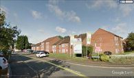
Sherwood Place

By Henrik Thiil Nielsen, 2018-05-25. Revised by Henrik Thiil Nielsen, 2021-01-07.
A housing complex on Pailton Road/Wolston Close, Solihull, built c. 2013, is named Sherwood Place, a name perhaps inspired by the presence of several localities with Robin Hood-related names in the area. It seems to have been built c. 2013.[1]
Gazetteers
- Not included in Dobson, R. B., ed.; Taylor, J., ed. Rymes of Robyn Hood: an Introduction to the English Outlaw (London, 1976), pp. 293-311.
Maps
- 25" O.S. map Warwickshire XIX.7 (1888; surveyed 1886)
- 25" O.S. map Warwickshire XIX.7 (1904; rev. 1903)
- 25" O.S. map Warwickshire XIX.7 (1904; rev. 1903) (georeferenced)
- 25" O.S. map Warwickshire XIX.7 (1917; rev. 1913-14)
- 25" O.S. map Warwickshire XIX.7 (1939; rev. 1937)
- 6" O.S. map Warwickshire XIX.NE (1886; surveyed 1886)
- 6" O.S. map Warwickshire XIX.NE (1905; rev. 1902-1903)
- 6" O.S. map Warwickshire XIX.NE (1905; rev. 1902-1903) (georeferenced)
- 6" O.S. map Warwickshire XIX.NE (1920; rev. 1913-14)
- 6" O.S. map Warwickshire XIX.NE (c. 1946; rev. 1938).
Background
Also see
Notes
- ↑ The flats had sold out by 16 Jul. 2014, see Geograph: SP1180 : Sherwood Place, development.
Image gallery
Click any image to display it in the lightbox, where you can navigate between images by clicking in the right or left side of the current image.
Sherwood Place / Google Earth Street View.

Sherwood Place / [geograph-4075159-by-Alex-McGregor Alex McGregor, 16 Jul. 2014, Creative Commons, via Geograph.]
