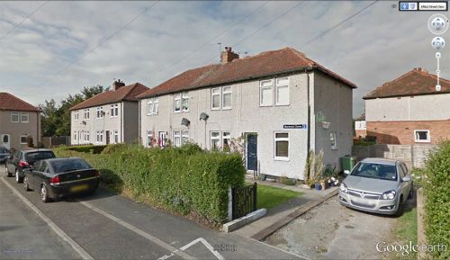
Sherwood Grove (Wakefield)
From International Robin Hood Bibliography
| Locality | |
|---|---|
| Coordinates | 53.67234, -1.531894 |
| Adm. div. | West Riding of Yorkshire |
| Vicinity | 2 km SW of central Wakefield |
| Type | Thoroughfare |
| Interest | Miscellaneous |
| Status | Extant |
| First Record | ? |
Approximate location of Sherwood Grove.
By Henrik Thiil Nielsen, 2014-10-19. Revised by Henrik Thiil Nielsen, 2017-06-09.
Sherwood Grove is encircled by Little John Crescent, to the west, and Robin Hood Crescent to the right. The three little streets are situated in a residential area c. 2 km SW of central Wakefield.
Gazetteers
- Not included in Dobson, R. B., ed.; Taylor, J., ed. Rymes of Robyn Hood: an Introduction to the English Outlaw (London, 1976), pp. 293-311.
Also see
Template:BeforeNavTemplate:NavTemplate:PreviousWest Riding of Yorkshire place-namesTemplate:BeforeNavTemplate:NavTemplate:Next
Template:BeforeNavTemplate:NavTemplate:PreviousYorkshire place-namesTemplate:BeforeNavTemplate:NavTemplate:Next
Template:BeforeNavTemplate:NavTemplate:PreviousPlace-namesTemplate:BeforeNavTemplate:NavTemplate:Next"th" can not be assigned to a declared number type with value 20.

