Sherwood Close (Campsall): Difference between revisions
From International Robin Hood Bibliography
m (Text replacement - "PnItemTop" to "PlaceNamesItemTop") |
m (Text replacement - "PnItemQry" to "PlaceNamesItemQuery") |
||
| Line 5: | Line 5: | ||
<p id="byline">By Henrik Thiil Nielsen, 2020-06-18. Revised by {{#realname:{{REVISIONUSER}}}}, {{REVISIONYEAR}}-{{REVISIONMONTH}}-{{REVISIONDAY2}}.</p><div class="no-img"> | <p id="byline">By Henrik Thiil Nielsen, 2020-06-18. Revised by {{#realname:{{REVISIONUSER}}}}, {{REVISIONYEAR}}-{{REVISIONMONTH}}-{{REVISIONDAY2}}.</p><div class="no-img"> | ||
Given its location on the southern outskirts of Barnsdale, it seems likely that the name of the short residential cul de sac Sherwood Close was inspired by that other stamping ground of Robin Hood's. The houses on Sherwood Close are all of fairly recent date, so a 20th (or 21st?) century date seems likely. Sherwood Close is a side street of [[Loxley Mount (Campsall)|Loxley Mount.]] | Given its location on the southern outskirts of Barnsdale, it seems likely that the name of the short residential cul de sac Sherwood Close was inspired by that other stamping ground of Robin Hood's. The houses on Sherwood Close are all of fairly recent date, so a 20th (or 21st?) century date seems likely. Sherwood Close is a side street of [[Loxley Mount (Campsall)|Loxley Mount.]] | ||
{{ | {{PlaceNamesItemQuery}} | ||
== Gazetteers == | == Gazetteers == | ||
* Not included in {{:Dobson, Richard Barrie 1976a}}, pp. 293-311. | * Not included in {{:Dobson, Richard Barrie 1976a}}, pp. 293-311. | ||
Revision as of 00:15, 6 January 2021
| Locality | |
|---|---|
| Coordinate | 53.619725, -1.181852 |
| Adm. div. | West Riding of Yorkshire |
| Vicinity | Just N of High Street, Campsall |
| Type | Thoroughfare |
| Interest | Miscellaneous |
| Status | Extant |
| First Record | |
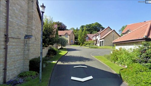
Sherwood Close, Campsall.
By Henrik Thiil Nielsen, 2020-06-18. Revised by Henrik Thiil Nielsen, 2021-01-06.
Given its location on the southern outskirts of Barnsdale, it seems likely that the name of the short residential cul de sac Sherwood Close was inspired by that other stamping ground of Robin Hood's. The houses on Sherwood Close are all of fairly recent date, so a 20th (or 21st?) century date seems likely. Sherwood Close is a side street of Loxley Mount. Template:PlaceNamesItemQuery
Gazetteers
- Not included in Dobson, R. B., ed.; Taylor, J., ed. Rymes of Robyn Hood: an Introduction to the English Outlaw (London, 1976), pp. 293-311.
Maps
- 25" O.S. map Yorkshire CCLXIV.8 (1893; surveyed 1891)
- 25" O.S. map Yorkshire CCLXIV.8 (1906; rev. 1904) (georeferenced)
- 25" O.S. map Yorkshire CCLXIV.8 (1906; rev. 1904)
- 25" O.S. map Yorkshire CCLXIV.8 (1932; rev. 1930)
- 6" O.S. map Yorkshire 264 (1854; surveyed 1849)
- 6" O.S. map Yorkshire CCLXIV.NE (1894; surveyed 1891)
- 6" O.S. map Yorkshire CCLXIV.NE (1907; rev. 1904) (georeferenced)
- 6" O.S. map Yorkshire CCLXIV.NE (1907; rev. 1904)
- 6" O.S. map Yorkshire CCLXIV.NE (1930; rev. 1930)
- 6" O.S. map Yorkshire CCLXIV.NE (1950; rev. 1948).

