Sherwood Avenue (Boston): Difference between revisions
From International Robin Hood Bibliography
m (Text replacement - "{{#ask:[[Category:Records ({{#ifeq:{{#pos:{{PAGENAME}}|(|}}||{{PAGENAME}}|{{#sub:{{PAGENAME}}|0| {{#expr:{{#pos:{{PAGENAME}}|(|}}-1}} }},{{#sub:{{PAGENAME}}|{{#expr:{{#pos:{{PAGENAME}}|(|}}-1}}|1}}{{#sub:{{PAGENAME}}|{{#expr:{{#pos:...) |
mNo edit summary |
||
| Line 1: | Line 1: | ||
__NOTOC__{{PnItemTop|Lat=52.986405|Lon=-0.032402|AdmDiv=Lincolnshire|Vicinity=Boston|Type=Thoroughfare|Interest=Miscellaneous|Status=Extant|Demonym=|Riding=|GreaterLondon=|Year=|Aka=|Century=|Cluster1=Robin Hood's Walk|Cluster2=|Cluster3=|Image=marian-road-boston-google-earth-street-view.jpg|Postcards=|ExtraCat1=Places named after Sherwood Forest|ExtraCat2=|ExtraCat3=|ExtraCat4=|ExtraCat5=|ExtraLink1=|ExtraLink2=|ExtraLink3=|ExtraLink4=|ExtraLink5=|ExtraLinkName1=|ExtraLinkName2=|ExtraLinkName3=|ExtraLinkName4=|ExtraLinkName5=|GeopointPrefix=|GeopointSuffix=|StatusSuffix=|DatePrefix=|DateSuffix=}} | __NOTOC__{{PnItemTop|Lat=52.986405|Lon=-0.032402|AdmDiv=Lincolnshire|Vicinity=Boston|Type=Thoroughfare|Interest=Miscellaneous|Status=Extant|Demonym=|Riding=|GreaterLondon=|Year=|Aka=|Century=|Cluster1=Robin Hood's Walk|Cluster2=Boston|Cluster3=|Image=marian-road-boston-google-earth-street-view.jpg|Postcards=|ExtraCat1=Places named after Sherwood Forest|ExtraCat2=|ExtraCat3=|ExtraCat4=|ExtraCat5=|ExtraLink1=|ExtraLink2=|ExtraLink3=|ExtraLink4=|ExtraLink5=|ExtraLinkName1=|ExtraLinkName2=|ExtraLinkName3=|ExtraLinkName4=|ExtraLinkName5=|GeopointPrefix=|GeopointSuffix=|StatusSuffix=|DatePrefix=|DateSuffix=}} | ||
{{#display_map:{{#var:Coords}}~{{#replace:{{PAGENAME}}|'|'}}|width=34%}}<div class="pnMapLegend">Sherwood Avenue.</div> | {{#display_map:{{#var:Coords}}~{{#replace:{{PAGENAME}}|'|'}}|width=34%}}<div class="pnMapLegend">Sherwood Avenue.</div> | ||
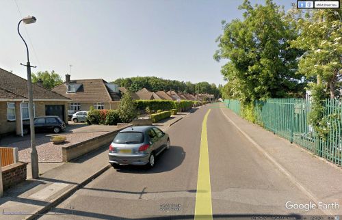
[[File:marian-road-boston-google-earth-street-view.jpg|thumb|right|500px|Looking northwest on Marian Road / Google Earth Street View.]] | [[File:marian-road-boston-google-earth-street-view.jpg|thumb|right|500px|Looking northwest on Marian Road / Google Earth Street View.]] | ||
Revision as of 20:00, 21 October 2018
Sherwood Avenue.
By Henrik Thiil Nielsen, 2013-07-09. Revised by Henrik Thiil Nielsen, 2018-10-21.
Friar Way, Greenwood Drive, Locksley Close, Marian Road, Sheriff Way and Sherwood Avenue were all obviously inspired by the presence in this immediate are of a residential street named Robin Hood's Walk, which itself goes at least as far back as 1640.Template:PnItemQry
Gazetteers
- Not included in Dobson, R. B., ed.; Taylor, J., ed. Rymes of Robyn Hood: an Introduction to the English Outlaw (London, 1976), pp. 293-311.

