
Robin Hood Wood (Bassenthwaite): Difference between revisions
mNo edit summary |
mNo edit summary |
||
| Line 57: | Line 57: | ||
File:robin-hhod-wood-david-brown-geograph.jpg|Path in Robin Hood Wood / [http://www.geograph.org.uk/photo/4293756 David Brown; Geograph; Creative Commons.] | File:robin-hhod-wood-david-brown-geograph.jpg|Path in Robin Hood Wood / [http://www.geograph.org.uk/photo/4293756 David Brown; Geograph; Creative Commons.] | ||
File:robin-hood-wood-bassenthwaite-google-earth-street-view.jpg|Robin Hood Wood seen from the southwest / Google Earth Street View. | File:robin-hood-wood-bassenthwaite-google-earth-street-view.jpg|Robin Hood Wood seen from the southwest / Google Earth Street View. | ||
File:robin-hood-wood-bassenthwaite-adrian-taylor-geograph.jpg|Bridleway | File:robin-hood-wood-bassenthwaite-adrian-taylor-geograph.jpg|Bridleway in Robin Hood Wood / [http://www.geograph.org.uk/photo/2322412 Adrian Taylor; Geograph; Creative Commons.] | ||
File:robin-hood-wood-bassenthwaite-christine-johnstone-geograph.jpg|On the bridleway in Robin Hood Wood / [http://www.geograph.org.uk/photo/3950822 Christine Johnstone; Geograph; Creative Commons.] | |||
</gallery> | </gallery> | ||
<div id="dplcatlinks" class="subcategory"><div id="dplcatarea"> | <div id="dplcatlinks" class="subcategory"><div id="dplcatarea"> | ||
Revision as of 10:50, 30 August 2017
| Locality | |
|---|---|
| Coordinates | 54.6825, -3.1958 |
| Adm. div. | Cumberland |
| Vicinity | Immediately N of Bassenthwaite |
| Type | Natural feature |
| Interest | Robin Hood name |
| Status | Extant |
| First Record | 1867 |

By Henrik Thiil Nielsen, 2017-08-30. Revised by Henrik Thiil Nielsen, 2017-08-30.
Robin Hood Wood is situated immediately north of Bassenthwaite. About 200 m NNW are Robin Hood farm and Robin Hood Cottage. Robin Hood Holiday Park is located c. 300 m northwest. Robin Hood Wood is included on the 6" O.S. map of the area published in 1867 as well as subsequent revisions (see Maps section below).
Gazetteers
- Not included in Dobson, R. B., ed.; Taylor, J., ed. Rymes of Robyn Hood: an Introduction to the English Outlaw (London, 1976), pp. 293-311.
Maps
- 6" O.S. map Cumberland XLVI (1867; surveyed 1864-65)
- 6" O.S. map Cumberland XLVI.SE (1900; rev. 1898)
- 6" O.S. map Cumberland XLVI.SE (1900; rev. 1898) (georeferenced)
- 6" O.S. map Cumberland XLVI.SE (19230; rev. 1926)
Background
Also see
Notes
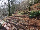
Path in Robin Hood Wood / David Brown; Geograph; Creative Commons.
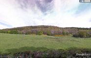
Robin Hood Wood seen from the southwest / Google Earth Street View.
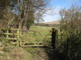
Bridleway in Robin Hood Wood / Adrian Taylor; Geograph; Creative Commons.
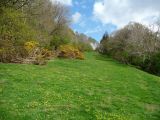
On the bridleway in Robin Hood Wood / Christine Johnstone; Geograph; Creative Commons.


"th" can not be assigned to a declared number type with value 19.