
Robin Hood Way (Kingston-upon-Thames) (2)
From International Robin Hood Bibliography
| Locality | |
|---|---|
| Coordinate | 51.430831, -0.256965 |
| Adm. div. | Surrey, now Greater London |
| Vicinity | Kingston Vale |
| Type | Thoroughfare |
| Interest | Robin Hood name |
| Status | Extant |
| First Record | |
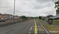
Robin Hood Way.

Robin Hood Way / Alex McGregor, 7 June 2011, Creative Commons, via Geograph.
By Henrik Thiil Nielsen, 2013-08-07. Revised by Henrik Thiil Nielsen, 2021-01-06.
'Robin Hood Way' is the name of a stretch of the A3 between Wimbledon and Kingston Vale. A residential street in the vicinity was apparently also named Robin Hood Way during the years c. 1944-46. See Robin Hood Way (Kingston-upon-Thames) (1).
Gazetteers
- Not included in Dobson, R. B., ed.; Taylor, J., ed. Rymes of Robyn Hood: an Introduction to the English Outlaw (London, 1976), pp. 293-311.
Also see

Robin Hood Way / Alex McGregor, 7 June 2011, Creative Commons, via Geograph.
Robin Hood Way / Google Earth Street View.
