
Robin Hood Way (Kingston-upon-Thames) (2): Difference between revisions
From International Robin Hood Bibliography
m (Text replacement - "{{#display_map:{{#var:Coords}}|" to "{{#display_map:{{#var:Coords}}~{{PAGENAME}}|") |
m (Text replacement - "ImgGalleryIntro" to "ImageGalleryIntroduction") |
||
| (23 intermediate revisions by 2 users not shown) | |||
| Line 1: | Line 1: | ||
__NOTOC__{{ | __NOTOC__{{PlaceNamesItemTop|Lat=51.430831|Lon=-0.256965|AdministrativeDivision=Surrey|Vicinity=Kingston Vale|Type=Thoroughfare|Interest=Robin Hood name|Status=Extant|Demonym=English|Riding=|GreaterLondon=Yes|Year=|Aka=|Century=|Cluster1=Kingston Vale|Cluster2=|Cluster3=|Image=geograph-2479227-by-Alex-McGregor.jpg|Postcards=|ExtraCat1=|ExtraCat2=|ExtraCat3=|ExtraCat4=|ExtraCat5=|ExtraLink1=Robin Hood Way (Kingston-upon-Thames) (1)|ExtraLink2=|ExtraLink3=|ExtraLink4=|ExtraLink5=|ExtraLinkName1=|ExtraLinkName2=|ExtraLinkName3=|ExtraLinkName4=|ExtraLinkName5=|GeopointPrefix=|GeopointSuffix=|StatusSuffix=|DatePrefix=|DateSuffix=}} | ||
{{#display_map:{{#var:Coords}}~{{PAGENAME}}|width=34%}}<div class="pnMapLegend">Robin Hood Way.</div> | {{#display_map:{{#var:Coords}}~{{#replace:{{PAGENAME}}|'|'}}|width=34%|enablefullscreen=yes}}<div class="pnMapLegend">Robin Hood Way.</div> | ||
[[File:{{#var: | [[File:{{#var:Image}}|thumb|right|500px|Robin Hood Way / [https://www.geograph.org.uk/photo/2479227 Alex McGregor, 7 June 2011, Creative Commons, via Geograph.]]]<div class="no-img"> | ||
<p id="byline">By Henrik Thiil Nielsen, 2013-08-07. Revised by {{#realname:{{REVISIONUSER}}}}, {{REVISIONYEAR}}-{{REVISIONMONTH}}-{{REVISIONDAY2}}.</p> | <p id="byline">By Henrik Thiil Nielsen, 2013-08-07. Revised by {{#realname:{{REVISIONUSER}}}}, {{REVISIONYEAR}}-{{REVISIONMONTH}}-{{REVISIONDAY2}}.</p> | ||
'Robin Hood Way' is the name of a stretch of the A3 between Wimbledon and Kingston Vale. A residential street in the vicinity was apparently also named Robin Hood Way during the years ''c.'' 1944-46. See [[Robin Hood Way (Kingston-upon-Thames) (1)]]. | |||
'Robin Hood Way' is the name of a stretch of the A3 between Wimbledon and Kingston Vale. | {{PlaceNamesItemAllusionsAndRecords}} | ||
A residential street in the vicinity was apparently also named Robin Hood Way during the years ''c.'' 1944-46. See [[Robin Hood Way (Kingston-upon-Thames) (1)]]. | == Gazetteers == | ||
* Not included in {{:Dobson, Richard Barrie 1976a}}, pp. 293-311. | |||
{{ | {{PlaceNamesItemAlsoSee}} | ||
</div> | </div> | ||
{{ | <div id="gallery"> | ||
{{ImageGalleryIntroduction}} | |||
<gallery widths="195px"> | |||
File:geograph-2479227-by-Alex-McGregor.jpg|Robin Hood Way / [https://www.geograph.org.uk/photo/2479227 Alex McGregor, 7 June 2011, Creative Commons, via Geograph.] | |||
File:robin-hood-way-kingston-vale-google-earth-street-view.jpg|Robin Hood Way / Google Earth Street View. | |||
</gallery> | |||
</div> | |||
{{PlaceNamesItemNavigation}} | |||
Latest revision as of 13:54, 7 January 2021
| Locality | |
|---|---|
| Coordinate | 51.430831, -0.256965 |
| Adm. div. | Surrey, now Greater London |
| Vicinity | Kingston Vale |
| Type | Thoroughfare |
| Interest | Robin Hood name |
| Status | Extant |
| First Record | |
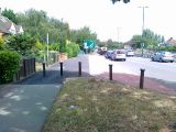
Robin Hood Way.

Robin Hood Way / Alex McGregor, 7 June 2011, Creative Commons, via Geograph.
By Henrik Thiil Nielsen, 2013-08-07. Revised by Henrik Thiil Nielsen, 2021-01-07.
'Robin Hood Way' is the name of a stretch of the A3 between Wimbledon and Kingston Vale. A residential street in the vicinity was apparently also named Robin Hood Way during the years c. 1944-46. See Robin Hood Way (Kingston-upon-Thames) (1).
Gazetteers
- Not included in Dobson, R. B., ed.; Taylor, J., ed. Rymes of Robyn Hood: an Introduction to the English Outlaw (London, 1976), pp. 293-311.
Also see
Image gallery
Click any image to display it in the lightbox, where you can navigate between images by clicking in the right or left side of the current image.
Robin Hood Way / Alex McGregor, 7 June 2011, Creative Commons, via Geograph.
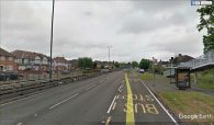
Robin Hood Way / Google Earth Street View.
