
Robin Hood Roundabout (Newbury)
[[File:|thumb|right|500px|Robin Hood Roundabout / Colin Pyle, Creative Commons via Geograph.]]
By Henrik Thiil Nielsen, 2020-04-30. Revised by Henrik Thiil Nielsen, 2020-05-02.
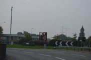
The Robin Hood Roundabout at the intersection of the A339 (formerly A34), London Road, the A4, and Shaw Road, in Newbury, was built in 1966.[1]
The roundabout was altered in 1977, but apparently further alterations were required already in the 1980s.[2] No doubt the roundabout was named after its neighbour, the Robin Hood.Template:PnItemQry
Gazetteers
- Not included in Dobson, R. B., ed.; Taylor, J., ed. Rymes of Robyn Hood: an Introduction to the English Outlaw (London, 1976), pp. 293-311.
Sources
Maps
Maps of the area, all older than the roundabout.
- 25" O.S. map Berkshire XXXV.13 (c. 1880, surveyed 1878). No Copy in NLS
- 25" O.S. map Berkshire XXXV.13 (1900, rev. 1898) (georeferenced)
- 25" O.S. map Berkshire XXXV.13 (1900; rev. 1898)
- 25" O.S. map Berkshire XXXV.13 (1911; rev. 1910)
- 25" O.S. map Berkshire XXXV.13 (1933; rev. 1932)
- 6" O.S. map Berkshire XXXV (1883; surveyed 1877-1878)
- 6" O.S. map Berkshire XXXV.SW (1900, rev. 1898) (georeferenced)
- 6" O.S. map Berkshire XXXV.SW (1900; rev. 1898)
- 6" O.S. map Berkshire XXXV.SW (1913; rev. 1910)
- 6" O.S. map Berkshire XXXV.SW (c. 1933; rev. 1932)
- 6" O.S. map Berkshire XXXV.SW (c. 1944; rev. 1938).
Notes
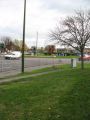
Robin Hood Roundabout / Julian Tubb, 7 Nov. 2007; Creative Commons via Geograph.
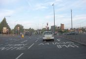
The notorious Robin Hood Roundabout / Stuart Logan, 23 Sep. 2011; Creative Commons via Geograph.
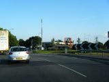
Robin Hood Roundabout / Colin Pyle, 10 Aug. 2012; Creative Commons via Geograph.
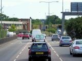
Robin Hood Roundabout / David Dixon, 17 July 2014; Creative Commons via Geograph.
Robin Hood Roundabout / David Dixon, 21 July 2014; Creative Commons via Geograph.
Robin Hood Roundabout / N. Chadwick, 1 Oct. 2015; Creative Commons via Geograph.
Robin Hood Roundabout / David Howard, 24 Apr. 2016; Creative Commons via Geograph.


