Robin Hood Road (Brentwood): Difference between revisions
From International Robin Hood Bibliography
m (Text replacement - ".</p><div class="no-img">" to ".</p> <div class="no-img">") |
mNo edit summary |
||
| Line 1: | Line 1: | ||
__NOTOC__{{PnItemTop|Lat=51.6282|Lon=0.2953|AdmDiv=Essex|Vicinity=Connecting Ongar Road, to the north, and Doddinghurst Road, to the south|Type=Thoroughfare|Interest=Robin Hood name|Status=Extant|Demonym=|Riding=|GreaterLondon=|Year=|Aka=|Century=|Cluster1=Brentwood|Cluster2=|Cluster3=|Image=Robin hood road brentwood essex google earth.jpg|Postcards=|ExtraCat1=|ExtraCat2=|ExtraCat3=|ExtraCat4=|ExtraCat5=|ExtraLink1=|ExtraLink2=|ExtraLink3=|ExtraLink4=|ExtraLink5=|ExtraLinkName1=|ExtraLinkName2=|ExtraLinkName3=|ExtraLinkName4=|ExtraLinkName5=|GeopointPrefix=|GeopointSuffix=|StatusSuffix=|DatePrefix=|DateSuffix= | __NOTOC__{{PnItemTop|Lat=51.6282|Lon=0.2953|AdmDiv=Essex|Vicinity=Connecting Ongar Road, to the north, and Doddinghurst Road, to the south|Type=Thoroughfare|Interest=Robin Hood name|Status=Extant|Demonym=|Riding=|GreaterLondon=|Year=|Aka=|Century=|Cluster1=Brentwood|Cluster2=|Cluster3=|Image=Robin hood road brentwood essex google earth.jpg|Postcards=|ExtraCat1=|ExtraCat2=|ExtraCat3=|ExtraCat4=|ExtraCat5=|ExtraLink1=|ExtraLink2=|ExtraLink3=|ExtraLink4=|ExtraLink5=|ExtraLinkName1=|ExtraLinkName2=|ExtraLinkName3=|ExtraLinkName4=|ExtraLinkName5=|GeopointPrefix=|GeopointSuffix=|StatusSuffix=|DatePrefix=|DateSuffix=}} | ||
{{#display_map:{{#var:Coords}}|controls=type,streetview|typestyle=dropdown|width=34%}}<div class="pnMapLegend">Robin Hood Road, north of Brentwood in Essex.</div> | {{#display_map:{{#var:Coords}}|controls=type,streetview|typestyle=dropdown|width=34%}}<div class="pnMapLegend">Robin Hood Road, north of Brentwood in Essex.</div> | ||
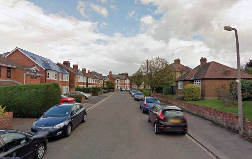
[[File:Robin hood road brentwood essex google earth.jpg|thumb|right|500px|Robin Hood Road is presumably named after the Robin Hood public house, which is now the Robin / Google Earth Street View.]] | [[File:Robin hood road brentwood essex google earth.jpg|thumb|right|500px|Robin Hood Road is presumably named after the Robin Hood public house, which is now the Robin / Google Earth Street View.]] | ||
| Line 5: | Line 5: | ||
<div class="no-img"> | <div class="no-img"> | ||
Very likely Robin Hood Road just north of Brentwood, Essex, takes its name from the [[Robin Hood (Brentwood)|Robin Hood]] pub which was located at its northern end. The pub is still there but has been renamed the Robin. Robin Hood Road, about 200 m long and roughly the shape of an ice hockey stick, connects Ongar Road and Doddinghurst Road. It is not found on any of the [http://maps.nls.uk/os/6inch-england-and-wales/counties.html 6" O.S. maps of the area available online at NLS]; no doubt it was constructed sometime in the 20th century. | Very likely Robin Hood Road just north of Brentwood, Essex, takes its name from the [[Robin Hood (Brentwood)|Robin Hood]] pub which was located at its northern end. The pub is still there but has been renamed the Robin. Robin Hood Road, about 200 m long and roughly the shape of an ice hockey stick, connects Ongar Road and Doddinghurst Road. It is not found on any of the [http://maps.nls.uk/os/6inch-england-and-wales/counties.html 6" O.S. maps of the area available online at NLS]; no doubt it was constructed sometime in the 20th century. | ||
The coordinates cited above are for the NW end of the road, those for the SE being something like 51.6276, 0.2989. | The coordinates cited above are for the NW end of the road, those for the SE being something like 51.6276, 0.2989.{{#ask:[[Category:Records ({{#ifeq:{{#pos:{{PAGENAME}}|(|}}||{{PAGENAME}}|{{#sub:{{PAGENAME}}|0| {{#expr:{{#pos:{{PAGENAME}}|(|}}-1}} }},{{#sub:{{PAGENAME}}|{{#expr:{{#pos:{{PAGENAME}}|(|}}-1}}|1}}{{#sub:{{PAGENAME}}|{{#expr:{{#pos:{{PAGENAME}}|(|}}+1}}}}}}]]| format=embedded|embedformat=h4|columns=1|limit=1000|sort=Utitle|intro=<h3>Records</h3>}}{{#ask:[[Category:Allusions ({{#ifeq:{{#pos:{{PAGENAME}}|(|}}||{{PAGENAME}}|{{#sub:{{PAGENAME}}|0| {{#expr:{{#pos:{{PAGENAME}}|(|}}-1}} }},{{#sub:{{PAGENAME}}|{{#expr:{{#pos:{{PAGENAME}}|(|}}-1}}|1}}{{#sub:{{PAGENAME}}|{{#expr:{{#pos:{{PAGENAME}}|(|}}+1}}}}}}]]| format=embedded|embedformat=h4|columns=1|limit=1000|sort=Utitle|intro=<h3>Allusions</h3>}} | ||
=== Gazetteers === | === Gazetteers === | ||
* Not included in {{:Dobson, Richard Barrie 1976a}}, pp. 293-311. | * Not included in {{:Dobson, Richard Barrie 1976a}}, pp. 293-311. | ||
{{PnItemAlsoSee}}<!-- | |||
=== Notes === | |||
<references/>--> | |||
</div> | </div> | ||
{{PnItemNav}} | {{PnItemNav}} | ||
Revision as of 04:07, 25 May 2018
Robin Hood Road, north of Brentwood in Essex.
By Henrik Thiil Nielsen, 2016-06-26. Revised by Henrik Thiil Nielsen, 2018-05-25.
Very likely Robin Hood Road just north of Brentwood, Essex, takes its name from the Robin Hood pub which was located at its northern end. The pub is still there but has been renamed the Robin. Robin Hood Road, about 200 m long and roughly the shape of an ice hockey stick, connects Ongar Road and Doddinghurst Road. It is not found on any of the 6" O.S. maps of the area available online at NLS; no doubt it was constructed sometime in the 20th century. The coordinates cited above are for the NW end of the road, those for the SE being something like 51.6276, 0.2989.
Gazetteers
- Not included in Dobson, R. B., ed.; Taylor, J., ed. Rymes of Robyn Hood: an Introduction to the English Outlaw (London, 1976), pp. 293-311.

