Robin Hood Moss (Howden Moors, Bradfield)
| Locality | |
|---|---|
| Coordinate | 53.439545, -1.710628 |
| Adm. div. | West Riding of Yorkshire |
| Vicinity | Howden Moors, in Bradfield parish, c. 2.7 km due E of N end of Howden Reservoir |
| Type | Natural feature |
| Interest | Robin Hood name |
| Status | Extant? |
| First Record | 1855 |

By Henrik Thiil Nielsen, 2016-08-28. Revised by Henrik Thiil Nielsen, 2021-03-21.
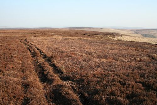
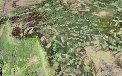
Robin Hood Moss is or was the name of an area of moorland overlooking the Derwent Dams, and now Howden Reservoir, in the High Peak. Dobson & Taylor,[1] whose entry on this locality is based on that in Mitchell's Haunts of Robin Hood,[2] put this locality in Derbyshire and refer to it as "Robin Hood's Moss". It appears on all the 6" O.S. maps at NLS (see Maps section below) as 'Robin Hood Moss'. Located east of Howden Reservoir, which forms a boundary between West Yorkshire and Derbyshire,[3] the Moss is at present in South Yorkshire, and unless Derbyshire extended east of the Derwent in the area now covered by the reservoir, it must have been formerly in the West Riding of Yorkshire, not in Derbyshire.
Close to Robin Hood Moss is or was a Robin Hood Spring. Some 12 km ESE of Robin Hood Moss is another Robin Hood's Moss.
Gazetteers
- Dobson, R. B., ed.; Taylor, J., ed. Rymes of Robyn Hood: an Introduction to the English Outlaw (London, 1976), p. 296. s.n. 'Robin Hood's Moss'.
- Mitchell, W.R. The Haunts of Robin Hood (Clapham via Lancaster, 1970), p. 68, s.n. 'Moss'.
Maps
- 6" O.S. map Yorkshire 287 (1855; surveyed 1850-51)
- 6" O.S. map Yorkshire CCLXXXVII.NW (1894; surveyed 1891)
- 6" O.S. map Yorkshire CCLXXXVII.NW (1903; rev. 1901)
- 6" O.S. map Derbyshire IV (1924; rev. 1919-20)
Background
Also see
Notes
- ↑ Dobson, R. B., ed.; Taylor, J., ed. Rymes of Robyn Hood: an Introduction to the English Outlaw (London, 1976), p. 296. s.n. 'Robin Hood's Moss'.
- ↑ Mitchell, W.R. The Haunts of Robin Hood (Clapham via Lancaster, 1970), p. 68, s.n. 'Moss'.
- ↑ Wikipedia: Bradfield, South Yorkshire; Wikipedia: Howden_Reservoir.

