
Robin Hood Lane (Warnham): Difference between revisions
m (Text replacement - "ImgGalleryIntro" to "ImageGalleryIntroduction") |
m (Text replacement - "* 25" map" to "* 25" O.S. map") |
||
| (3 intermediate revisions by the same user not shown) | |||
| Line 1: | Line 1: | ||
__NOTOC__{{PlaceNamesItemTop|Lat=51.078655|Lon=-0.348434|AdministrativeDivision=Sussex|Vicinity=Between the A24 and Broadbridge Heath Road, southern perimeter of Rookwood Golf Course|Type=Thoroughfare|Interest=Robin Hood name| | __NOTOC__{{PlaceNamesItemTop|Lat=51.078655|Lon=-0.348434|AdministrativeDivision=Sussex|Vicinity=Between the A24 and Broadbridge Heath Road, southern perimeter of Rookwood Golf Course|Type=Thoroughfare|Interest=Robin Hood name| | ||
Status=Extant|Demonym=English|Riding=|GreaterLondon=|Year=|Aka=|Century=|Cluster1=|Cluster2=|Cluster3=|Image= | Status=Extant|Demonym=English|Riding=|GreaterLondon=|Year=1874|Aka=|Century=|Cluster1=|Cluster2=|Cluster3=|Image=geograph-2472447-by-N-Chadwick.jpg|Postcards=|ExtraCat1=|ExtraCat2=|ExtraCat3=|ExtraCat4=|ExtraCat5=|ExtraLink1=|ExtraLink2=|ExtraLink3=|ExtraLink4=|ExtraLink5=|ExtraLinkName1=|ExtraLinkName2=|ExtraLinkName3=|ExtraLinkName4=|ExtraLinkName5=|GeopointPrefix=|GeopointSuffix=|VicinitySuffix=|StatusSuffix=|DatePrefix=|DateSuffix=}} | ||
{{#display_map:{{#var:Coords}}~{{#replace:{{PAGENAME}}|'|'}}|width=34%|enablefullscreen=yes}}<div class="pnMapLegend">{{PAGENAME}}.</div> | {{#display_map:{{#var:Coords}}~{{#replace:{{PAGENAME}}|'|'}}|width=34%|enablefullscreen=yes}}<div class="pnMapLegend">{{PAGENAME}}.</div> | ||
[[File:{{#var:Image}}|thumb|right|500px|Robin Hood Lane / | [[File:{{#var:Image}}|thumb|right|500px|Robin Hood Lane / [https://m.geograph.org.uk/photo/2472447 N. Chadwick, 3 Apr. 2011; Creative Commons, via Geograph.]]]<div class="no-img"> | ||
<p id="byline">By Henrik Thiil Nielsen, 2018-01-12. Revised by {{#realname:{{REVISIONUSER}}}}, {{REVISIONYEAR}}-{{REVISIONMONTH}}-{{REVISIONDAY2}}.</p> | <p id="byline">By Henrik Thiil Nielsen, 2018-01-12. Revised by {{#realname:{{REVISIONUSER}}}}, {{REVISIONYEAR}}-{{REVISIONMONTH}}-{{REVISIONDAY2}}.</p> | ||
Robin Hood Lane in Warnham, Horsham, runs between the A24 and Broadbridge Heath Road, forming the southern perimeter of Rookwood Golf Course.{{PlaceNamesItemAllusionsAndRecords}} | Robin Hood Lane in Warnham, Horsham, runs between the A24 and Broadbridge Heath Road, forming the southern perimeter of Rookwood Golf Course. | ||
The earliest reference known to IRHB is a 6" O.S. map of the area published in 1874 (see Maps below).{{PlaceNamesItemAllusionsAndRecords}} | |||
== Gazetteers == | == Gazetteers == | ||
* Not included in {{:Dobson, Richard Barrie 1976a}}, pp. 293-311. | * Not included in {{:Dobson, Richard Barrie 1976a}}, pp. 293-311. | ||
<!--== Sources == | <!--== Sources == | ||
* --> | * --> | ||
== Maps == | |||
* -- | * 25" O.S. map ''Sussex'' XIII.7 (''c.'' 1876; surveyed ''c.'' 1874). No copy in NLS | ||
* 25" O.S. map ''Sussex'' XIII.7 (''c.'' 1897; rev. ''c.'' 1895). No copy in NLS | |||
* [https://maps.nls.uk/geo/explore/#zoom=16&lat=51.09401&lon=-0.37113&layers=168&b=5 25" O.S. map ''Sussex'' XIII.3 (1912; rev. 1909)] (georeferenced) | |||
* [https://maps.nls.uk/view/103667995#zoom=4&lat=9976&lon=12201&layers=BT 25" O.S. map ''Sussex'' XIII.7 (1912; rev. 1909)] | |||
* [https://maps.nls.uk/view/103667992#zoom=5&lat=9858&lon=12245&layers=BT 25" O.S. map ''Sussex'' XIII.7 (1934; rev. 1932)] | |||
* [https://maps.nls.uk/view/102347544#zoom=6&lat=3794&lon=8789&layers=BT 6" O.S. map ''Surrey'' XLVII (1874; surveyed 1870–71)] | |||
* [https://maps.nls.uk/geo/explore/#zoom=16&lat=51.09402&lon=-0.36770&layers=6&b=5 6" O.S. map ''Sussex'' XIII.NE (1898; rev. 1895–96)] (georeferenced) | |||
* [https://maps.nls.uk/view/101437759#zoom=4&lat=1984&lon=6451&layers=BT 6" O.S. map ''Surrey'' XLVII.NW (1898; rev. 1895–96)] | |||
* [https://maps.nls.uk/view/101437756#zoom=4&lat=1993&lon=6660&layers=BT 6" O.S. map ''Surrey'' XLVII.NW (1920; rev. 1913).] | |||
<!--== Discussion == | <!--== Discussion == | ||
* --> | * --> | ||
| Line 23: | Line 33: | ||
</div> | </div><div id="gallery"> | ||
{{ImageGalleryIntroduction}} | {{ImageGalleryIntroduction}} | ||
<gallery widths="195px"> | <gallery widths="195px"> | ||
robin-hood-lane-warnham-google-earth-street-view.jpg|Robin Hood Lane / Google Earth Street View. | |||
geograph-2472447-by-N-Chadwick.jpg|Robin Hood Lane / [https://m.geograph.org.uk/photo/2472447 N. Chadwick, 3 Apr. 2011; Creative Commons, via Geograph.] | |||
geograph-2472443-by-N-Chadwick.jpg|Robin Hood Lane / [https://m.geograph.org.uk/photo/2472443 N. Chadwick, 3 Apr. 2011; Creative Commons, via Geograph.] | |||
geograph-2472437-by-N-Chadwick.jpg|Robin Hood Lane / [https://m.geograph.org.uk/photo/2472437 N. Chadwick, 3 Apr. 2011; Creative Commons, via Geograph.] | |||
geograph-2472433-by-N-Chadwick.jpg|West Sussex Literary Trail arrives at Robin Hood Lane / [https://m.geograph.org.uk/photo/2472433 N. Chadwick, 3 Apr. 2011; Creative Commons, via Geograph.] | |||
geograph-2475483-by-N-Chadwick.jpg|Roberts Cottages, Robin Hood Lane / [https://m.geograph.org.uk/photo/2475483 N. Chadwick, 3 Apr. 2011; Creative Commons, via Geograph.] | |||
geograph-4805933-by-Shazz.jpg|Bend on Robin Hood Lane with barn / [https://m.geograph.org.uk/photo/4805933 Shazz, 26 Jan. 2016; Creative Commons, via Geograph.] | |||
geograph-4805936-by-Shazz.jpg|Bends on Robin Hood Lane with house / [https://m.geograph.org.uk/photo/4805936 Shazz, 26 Jan. 2016; Creative Commons, via Geograph.] | |||
</gallery> | </gallery> | ||
</div | </div> | ||
{{PlaceNamesItemNavigation}} | {{PlaceNamesItemNavigation}} | ||
Latest revision as of 16:44, 8 May 2022
| Locality | |
|---|---|
| Coordinate | 51.078655, -0.348434 |
| Adm. div. | Sussex |
| Vicinity | Between the A24 and Broadbridge Heath Road, southern perimeter of Rookwood Golf Course |
| Type | Thoroughfare |
| Interest | Robin Hood name |
| Status | Extant |
| First Record | 1874 |

By Henrik Thiil Nielsen, 2018-01-12. Revised by Henrik Thiil Nielsen, 2022-05-08.
Robin Hood Lane in Warnham, Horsham, runs between the A24 and Broadbridge Heath Road, forming the southern perimeter of Rookwood Golf Course.
The earliest reference known to IRHB is a 6" O.S. map of the area published in 1874 (see Maps below).
Gazetteers
- Not included in Dobson, R. B., ed.; Taylor, J., ed. Rymes of Robyn Hood: an Introduction to the English Outlaw (London, 1976), pp. 293-311.
Maps
- 25" O.S. map Sussex XIII.7 (c. 1876; surveyed c. 1874). No copy in NLS
- 25" O.S. map Sussex XIII.7 (c. 1897; rev. c. 1895). No copy in NLS
- 25" O.S. map Sussex XIII.3 (1912; rev. 1909) (georeferenced)
- 25" O.S. map Sussex XIII.7 (1912; rev. 1909)
- 25" O.S. map Sussex XIII.7 (1934; rev. 1932)
- 6" O.S. map Surrey XLVII (1874; surveyed 1870–71)
- 6" O.S. map Sussex XIII.NE (1898; rev. 1895–96) (georeferenced)
- 6" O.S. map Surrey XLVII.NW (1898; rev. 1895–96)
- 6" O.S. map Surrey XLVII.NW (1920; rev. 1913).
Image gallery
Click any image to display it in the lightbox, where you can navigate between images by clicking in the right or left side of the current image.
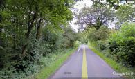
Robin Hood Lane / Google Earth Street View.
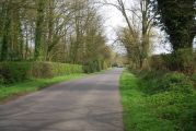
Robin Hood Lane / N. Chadwick, 3 Apr. 2011; Creative Commons, via Geograph.
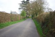
Robin Hood Lane / N. Chadwick, 3 Apr. 2011; Creative Commons, via Geograph.
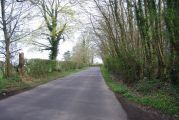
Robin Hood Lane / N. Chadwick, 3 Apr. 2011; Creative Commons, via Geograph.
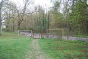
West Sussex Literary Trail arrives at Robin Hood Lane / N. Chadwick, 3 Apr. 2011; Creative Commons, via Geograph.
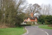
Roberts Cottages, Robin Hood Lane / N. Chadwick, 3 Apr. 2011; Creative Commons, via Geograph.
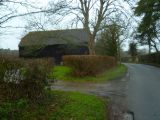
Bend on Robin Hood Lane with barn / Shazz, 26 Jan. 2016; Creative Commons, via Geograph.
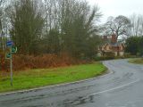
Bends on Robin Hood Lane with house / Shazz, 26 Jan. 2016; Creative Commons, via Geograph.


