
Robin Hood Lane (Sutton): Difference between revisions
From International Robin Hood Bibliography
mNo edit summary |
mNo edit summary |
||
| Line 19: | Line 19: | ||
[[File:robin-hood-lane-sutton-google-earth-street-view-1.jpg|500px|thumb|right|Robin Hood Lane, Sutton / Google Earth Street View.]] | [[File:robin-hood-lane-sutton-google-earth-street-view-1.jpg|500px|thumb|right|Robin Hood Lane, Sutton / Google Earth Street View.]] | ||
<p id="byline">By Henrik Thiil Nielsen, 2013-08-07. Revised by {{#realname:{{REVISIONUSER}}}}, {{REVISIONYEAR}}-{{REVISIONMONTH}}-{{REVISIONDAY2}}.</p><div class="no-img"> | <p id="byline">By Henrik Thiil Nielsen, 2013-08-07. Revised by {{#realname:{{REVISIONUSER}}}}, {{REVISIONYEAR}}-{{REVISIONMONTH}}-{{REVISIONDAY2}}.</p><div class="no-img"> | ||
Robin Hood Lane is a street in Sutton, Surrey. | |||
=== Also see === | === Also see === | ||
Revision as of 05:05, 18 November 2017
| Locality | |
|---|---|
| Coordinates | 51.363053, -0.196891 |
| Adm. div. | Surrey |
| Vicinity | Connecting St James's Road and Collingwood Road |
| Type | Thoroughfare |
| Interest | Robin Hood name |
| Status | Extant |
| First Record | ? |
Robin Hood Lane, Sutton.

By Henrik Thiil Nielsen, 2013-08-07. Revised by Henrik Thiil Nielsen, 2017-11-18.
Robin Hood Lane is a street in Sutton, Surrey.
Also see

Robin Hood Lane, Sutton / Google Earth Street View.
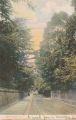
Woolstone Bros. Robin Hood Lane (The Milton "Artlette" Series) (London, [s.d.]). Hand-tinted picture postcard. 139 x 89 mm.. Postcard from private collection.

"?" is not a number.