
Robin Hood Lane (Hall Green): Difference between revisions
From International Robin Hood Bibliography
m (Text replacement - "/ Private collection" to "/ HTN collection") |
m (Text replacement - "width=34%|service=leaflet|" to "service=leaflet|width=34%|") |
||
| Line 1: | Line 1: | ||
__NOTOC__{{PnItemTop|Lat=52.426535|Lon=-1.850741|AdmDiv=Worcestershire|Vicinity=Between Cole Valley Road/Sarehold Road and Stratford Road|Type=Thoroughfare|Interest=Robin Hood name| | __NOTOC__{{PnItemTop|Lat=52.426535|Lon=-1.850741|AdmDiv=Worcestershire|Vicinity=Between Cole Valley Road/Sarehold Road and Stratford Road|Type=Thoroughfare|Interest=Robin Hood name| | ||
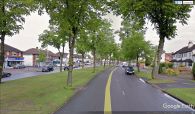
Status=Extant|Demonym=English|Riding=|GreaterLondon=|Year=|Aka=|Century=|Cluster1=Hall Green|Cluster2=|Cluster3=|Image=robin-hood-lane-hall-green-google-earth-street-view.jpg|Postcards=Yes|ExtraCat1=|ExtraCat2=|ExtraCat3=|ExtraCat4=|ExtraCat5=|ExtraLink1=|ExtraLink2=|ExtraLink3=|ExtraLink4=|ExtraLink5=|ExtraLinkName1=|ExtraLinkName2=|ExtraLinkName3=|ExtraLinkName4=|ExtraLinkName5=|GeopointPrefix=|GeopointSuffix=|VicinitySuffix=|StatusSuffix=|DatePrefix=|DateSuffix=}} | Status=Extant|Demonym=English|Riding=|GreaterLondon=|Year=|Aka=|Century=|Cluster1=Hall Green|Cluster2=|Cluster3=|Image=robin-hood-lane-hall-green-google-earth-street-view.jpg|Postcards=Yes|ExtraCat1=|ExtraCat2=|ExtraCat3=|ExtraCat4=|ExtraCat5=|ExtraLink1=|ExtraLink2=|ExtraLink3=|ExtraLink4=|ExtraLink5=|ExtraLinkName1=|ExtraLinkName2=|ExtraLinkName3=|ExtraLinkName4=|ExtraLinkName5=|GeopointPrefix=|GeopointSuffix=|VicinitySuffix=|StatusSuffix=|DatePrefix=|DateSuffix=}} | ||
{{#display_map:{{#var:Coords}}~{{#replace:{{PAGENAME}}|'|'}}|width=34% | {{#display_map:{{#var:Coords}}~{{#replace:{{PAGENAME}}|'|'}}|service=leaflet|width=34%|enablefullscreen=yes}}<div class="pnMapLegend">{{PAGENAME}}.</div> | ||
[[File:{{#var:Pnimage}}|thumb|right|500px|Robin Hood Lane, Hall Green / Google Earth Street View.]]<div class="no-img"> | [[File:{{#var:Pnimage}}|thumb|right|500px|Robin Hood Lane, Hall Green / Google Earth Street View.]]<div class="no-img"> | ||
<p id="byline">By Henrik Thiil Nielsen, 2018-01-12. Revised by {{#realname:{{REVISIONUSER}}}}, {{REVISIONYEAR}}-{{REVISIONMONTH}}-{{REVISIONDAY2}}.</p> | <p id="byline">By Henrik Thiil Nielsen, 2018-01-12. Revised by {{#realname:{{REVISIONUSER}}}}, {{REVISIONYEAR}}-{{REVISIONMONTH}}-{{REVISIONDAY2}}.</p> | ||
Revision as of 12:47, 22 December 2020
Robin Hood Lane (Hall Green).
[[File:|thumb|right|500px|Robin Hood Lane, Hall Green / Google Earth Street View.]]
By Henrik Thiil Nielsen, 2018-01-12. Revised by Henrik Thiil Nielsen, 2020-12-22.
Robin Hood Lane is a major street in Hall Green, connecting Cole Valley Road/Sarehold Road and Stratford Road.Template:PnItemQry
Gazetteers
- Not included in Dobson, R. B., ed.; Taylor, J., ed. Rymes of Robyn Hood: an Introduction to the English Outlaw (London, 1976), pp. 293-311.
Robin Hood Lane, Hall Green / Google Earth Street View.

